Nowcast - Winds bowing from the north, ramped into the 20-30 mph range right around dinnertime last night and continue in that spirit near the high peaks early this morning as high pressure firmly homesteads over the Uinta region. Meanwhile, nothin' but clear skies overhead allows temperatures to dip into the teens and low 20's °F.
Forecast - A gorgeous day is on tap with mostly sunny skies and high temperatures climbing into the low and mid 40's °F. Winds blowing from the northwest are slightly obnoxious this morning, but taper off as the day progresses.
Futurecast - Rinse and repeat through the weekend, but then things get interesting with a hint of pattern change for more active weather slated to kickoff the workweek. Too early to tell timing and strength for storminess. The encouraging news is winter is returning from its tropical hiatus. Man, I hope it's well rested and ready to party!
Travel Conditions - This winter looks underwhelming from first sight, but the Uinta's are performing closer to average this season than meets the eye. Snow depths vary from 1-3' across the range above 9,000' with a mostly right-side up snowpack. In general, protected polars continue to weaken but are riding well thanks to our Christmas Eve rain crust keeping us off the ground. Flip the compass script to slopes exposed to the elements for the past couple weeks, and they display a combo of wind-press, jack and whack, whilst lacking any attractive riding quality.
Andy and Bo were near Notch Mountain Monday and report... "Beauty of a day up in the high country..."

And continue with... "Travel is thin down low, and the price of admission is high, but with a little patience and some knowin' where you're goin', it's a great time to be out in the mountains."
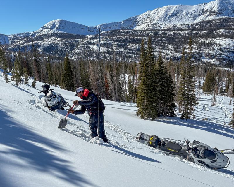
Yesterday, Ted and I staged out of Smith-Moorehouse to gain access to the North Slope.... all the deets on our travels are found HERE.
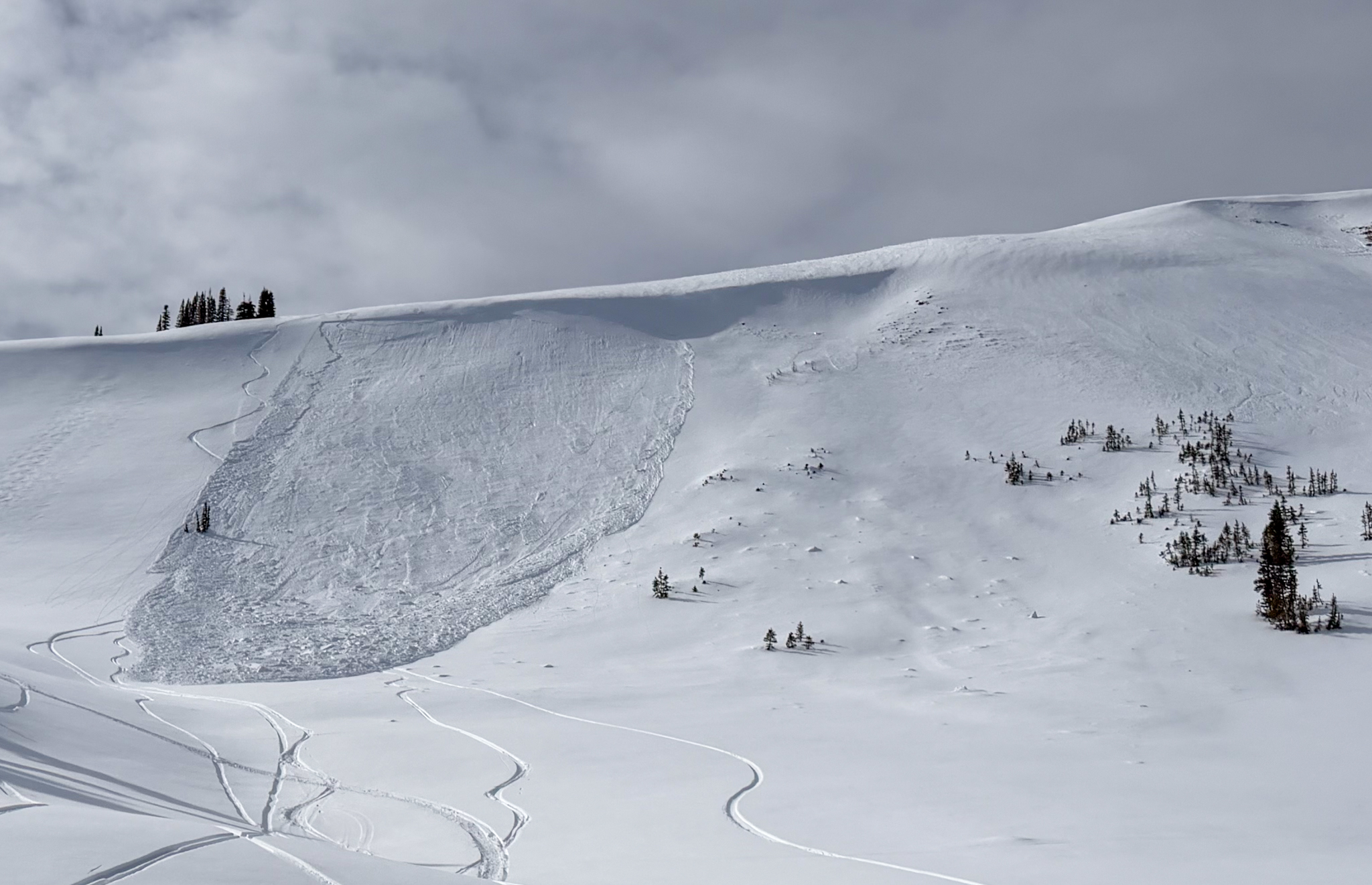
On Sunday, Summit County SAR Member and Avalanche Educator, Alan "Big Al" Richards and his riding crew rolled on scene after a group of sled-skiers triggered this persistent slab avalanche on their third or fourth lap, failing into faceted snow and breaking nearly 200' wide. Check out more on this slide, here.
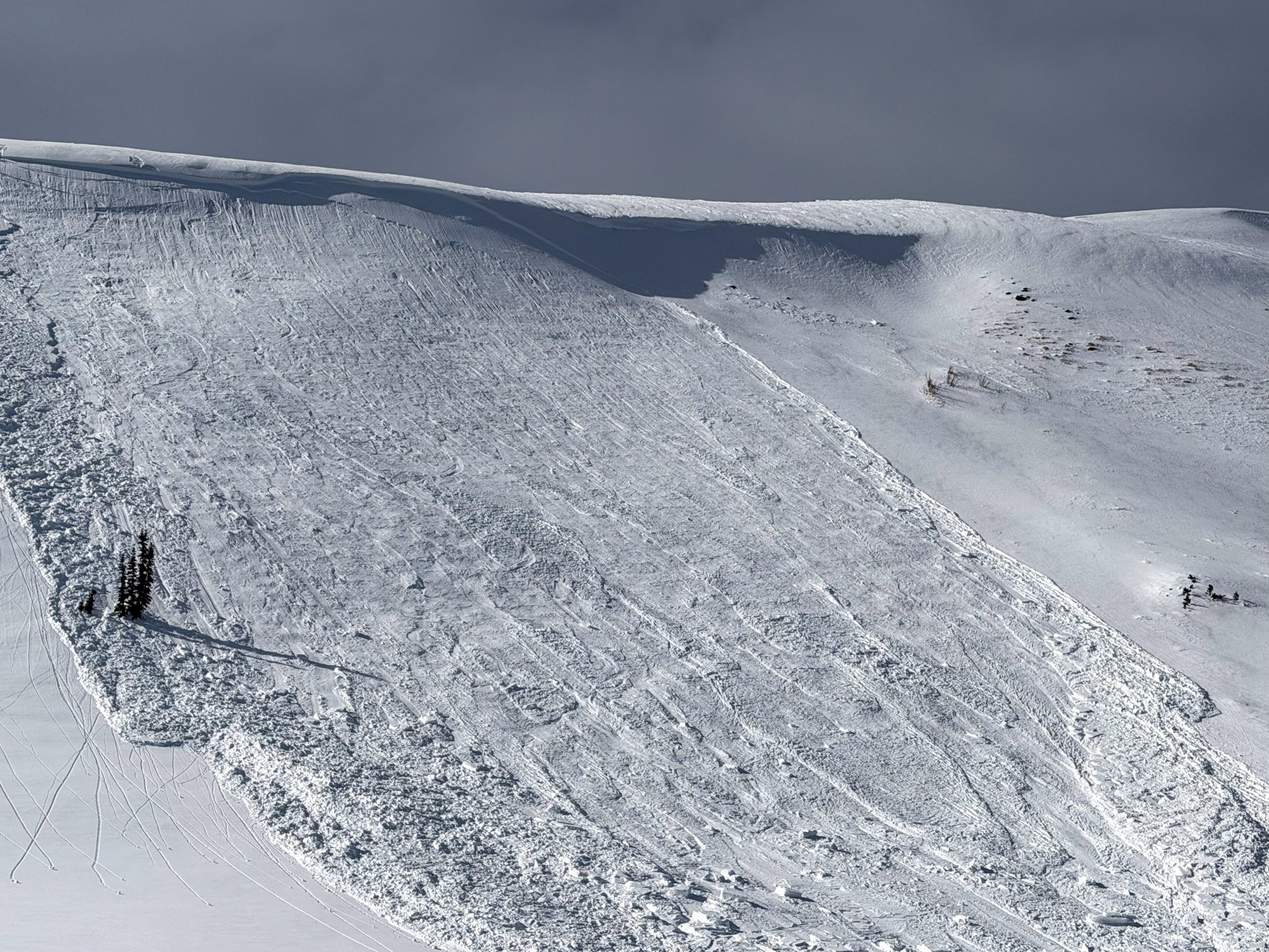
This avalanche was triggered on a east facing slope at 10,300 feet failing on the old, faceted snow surface that formed during middle of January during our extended stint of high pressure (via A.Richards).