Forecast for the Uintas Area Mountains

Craig Gordon
Issued by Craig Gordon on
Tuesday morning, February 3, 2026

While making up a small portion of the terrain available to ride today, in upper elevation, polar terrain above treeline you'll find MODERATE avalanche danger. Human-triggered avalanches breaking up to a foot deep and failing into faceted snow just beneath the snow surface are POSSIBLE,

You're on the hunt for recycled powder in upper elevations... me too! And as I step into bigger terrain, I'm continually gathering information, while avoiding slopes and terrain features in the windzone that look rounded, pillowed, or sound hollow like a drum.

Low
Moderate
Considerable
High
Extreme
Learn how to read the forecast here
Weather and Snow

Nowcast - With clear skies overhead, I suggest to a waning Snow Moon... we need a little less moon and a little more snow! It was a one-sided convo, but hey, we take what we can and roll with the punches. On the bright side, the air is clean in the mountains and temperatures begin the day in the low 20's °F as winds near the high peaks blow 20-25 mph from the northwest.

Forecast - Look for mostly sunny skies with high temperatures climbing into the upper 30's °F. Winds blowing into the 30 mph range from the northwest will become obnoxiously strong this morning, but taper off as the day progresses.

Futurecast - Above average temperatures and sunny skies are a safe bet to wrap up the workweek. There's a hint, a notion, a suggestion of a pattern change late in the weekend.... we'll keep ya posted.

Travel Conditions - This winter looks grim from first sight, but the Uinta's are performing closer to average this season than one may like to admit. Snow depths vary from 1-3' across the range above 9,000' with mostly right-side up snowpack. In general, protected polars continue to weaken but are riding well thanks to our Christmas Eve rain crust. Flip the compass script to slopes exposed to the elements for the past week, and they display a combo of wind-press, jack and whack and lack any attractive riding quality.

Andy and Bo were near Notch Mountain yesterday and report... "Beauty of a day up in the high country..."

And continue with... "Travel is thin down low, and the price of admission is high, but with a little patience and some knowin' where you're goin', it's a great time to be out in the mountains."

Recent Avalanches

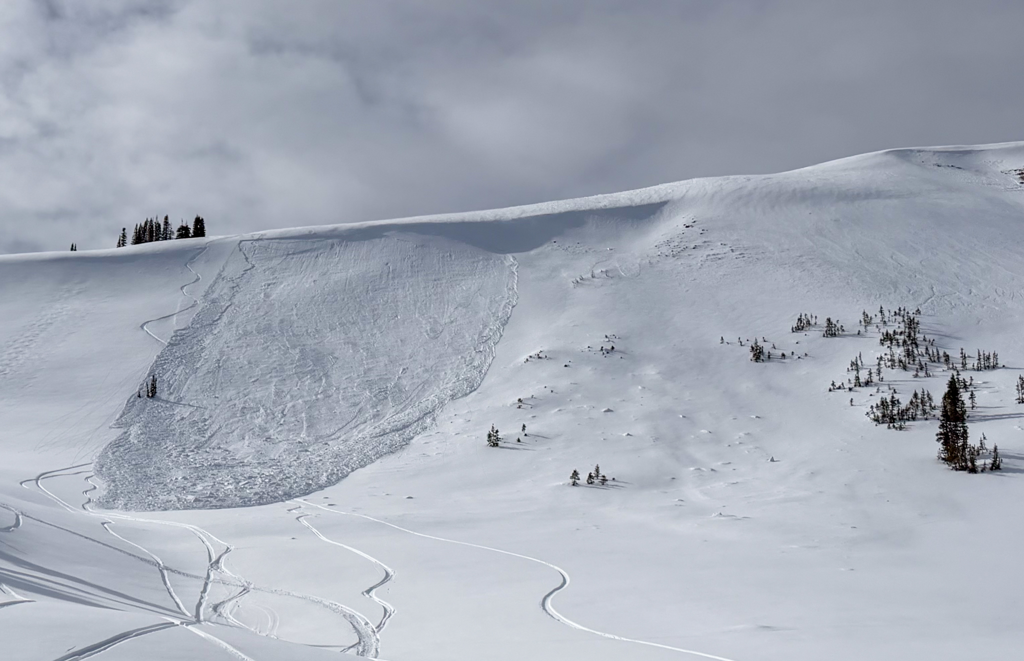
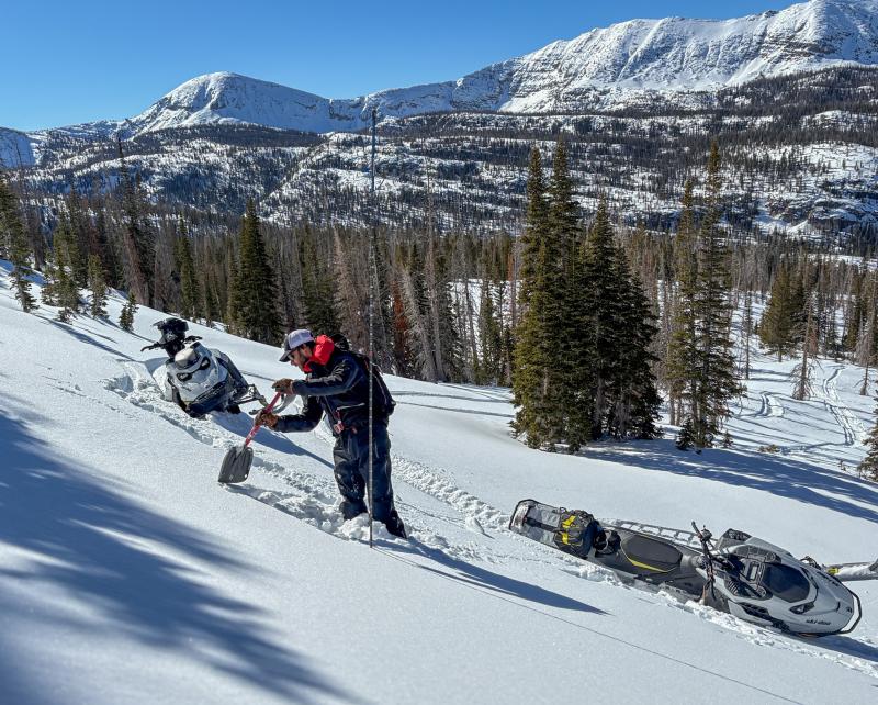
On Sunday, Summit County SAR Member and Avalanche Educator, Alan "Big Al" Richards and his riding crew rolled on scene after a group of sled-skiers triggered this persistent slab avalanche on their third or fourth lap, failing into faceted snow and breaking nearly 200' wide. Check out more on this slide, here.

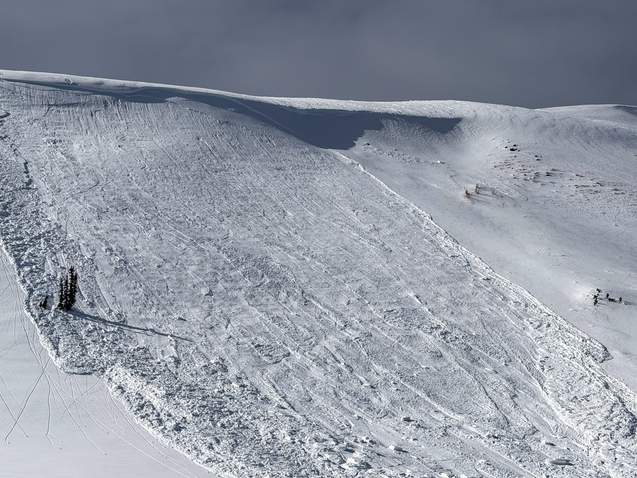
This avalanche was triggered on a east facing slope at 10,300 feet failing on the old, faceted snow surface that formed during middle of January during our extended stint of high pressure (via A.Richards).

Avalanche Problem #1
Persistent Weak Layer
Type
Location
Likelihood
Size
Description

There is a lot going on in this photo but yesterdays avalanche illustrates pockety, persistent slab avalanches are in fact a player and reactive to our additional weight (via A. Richards).

Consistent, yet variable winds have welded stiff, hard slabs in place and that'll feel solid under our ride, but the problem is... this setup rests above a sugary layer of faceted snow that formed during the recent stretch of high pressure. We forget about weak layers, but the snowpack has a great memory. (Learn more about it here, and why it's important to pay attention to surface conditions.)

Above treeline, on steep, wind-loaded slopes, specifically those with with an easterly component, hardened slabs living above faceted snow are reacting to our additional weight well after they formed. This is why we've transitioned our wind-drifted snow problem to a persistent weak layer. While the chances of triggering this avalanche problem are decreasing, if you're getting after it on sustained, steep terrain in the alpine, remember even a small slide in consequential terrain could turn nasty if it strains us through trees, rocks, or over cliffs.

Fortunately, we can avoid this problem by seeking wind sheltered terrain out of the alpine where we're greeted with more straight-forward avalanche danger and protected, cold, recycled powder.

General Announcements

We have some upcoming classes and events that we'd be stoked to see you at -- Please reach out with any questions and check out below for more details!

We are always looking for snow and avalanche observations or just general riding conditions. Reach out to us with questions, concerns, or if you see anything in your travels! Contact us directly through the info below:

This forecast is from the U.S.D.A. Forest Service, which is solely responsible for its content. This forecast describes general avalanche conditions, and local variations always occur. This forecast was issued on Tuesday, February 3rd at 0400 AM and expires 24 hours after it was issued. We'll update this information by 07:00 AM tomorrow