Forecast for the Uintas Area Mountains

Andrew Nassetta
Issued by Andrew Nassetta on
Monday morning, January 12, 2026

Today's avalanche danger is MODERATE on mid and upper elevation slopes facing northwest through southeast, where human-triggered avalanches are POSSIBLE, breaking up to 4' deep and failing into persistent weak layers near the ground. Once triggered, even a small loose snow avalanche or drift can step down and trigger a larger slide than we might have expected.

Today I am heading for cold powder on polar slopes where the sun and wind have yet to affect the riding quality. In doing so, I am managing my terrain and slope angles to avoid avalanches and am steering clear of suspect, northerly facing slopes greater than 30°.

Low
Moderate
Considerable
High
Extreme
Learn how to read the forecast here
Weather and Snow

Nowcast - As of 0500 AM, inversion continues, and 11k' temperatures report in the high 20°F's while low elevation trailheads and hollows hover in the teens. Wind were calm overnight and trend the same this morning, averaging 10 MPH from the northwest with gusts into the teens.

Forecast - If you thought yesterday felt like spring, then today could feel like summer! Valley temperatures and trailheads reach 45°F by the heat of the day, and 30°F up high, paired with light winds from the northwest, averaging 10 MPH and keeping calm.

Futurecast - More sunshine and warm temps continue through the week. While things look pretty bleak regarding incoming storms in the long run, we are hopeful for a pattern change later this month.

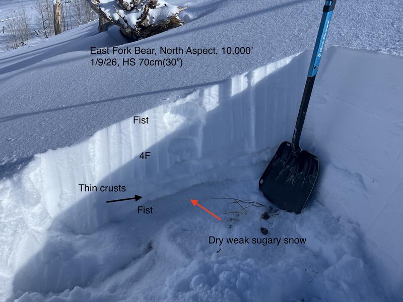
Travel Conditions - Riding and skiing across the range has been 5-star lately with a supportable, go anywhere base. It's still thin at lower elevations, about 1-2', but the Christmas Eve raincrust keeps us off the ground at mid and upper elevations where depths are 3-5'. Yesterday, solar aspects and low elevations took on some serious sun and warmth, and will be crusted over today. Fortunately, north-facing terrain holds deep, cold, dry powder that provides quality turning and travel.

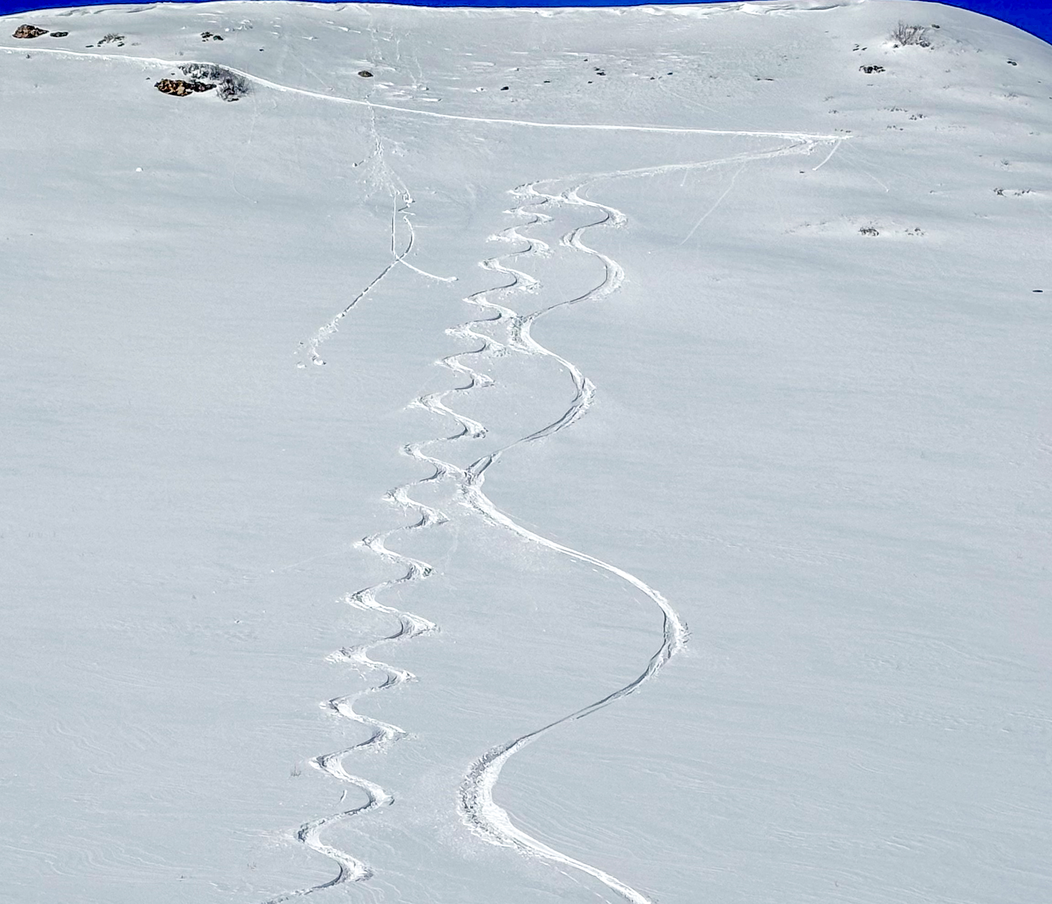
Soft, spongy, sunny turns at 10,500' until 1100 AM when things really took on heat and snow quality deteriorated -- At that point it was time to head for shady, cold snow on polar aspects.

Recent Avalanches

A few older avalanches and some wet loose activity were reported yesterday, but no major slides were observed across the range.

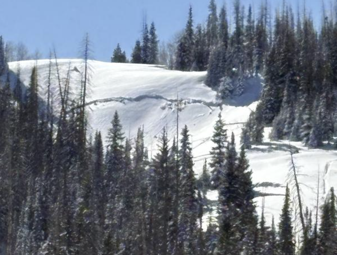
Ranger Nelson and his team were out on Duchesne Ridge and watched a few sled-skiers trigger this pocket of wind-drifted snow on a east facing slope around 10,000'. See more information from the full observation, here.

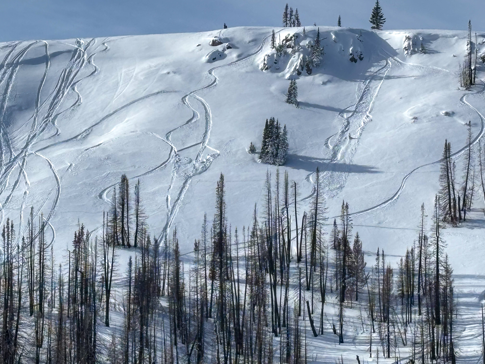
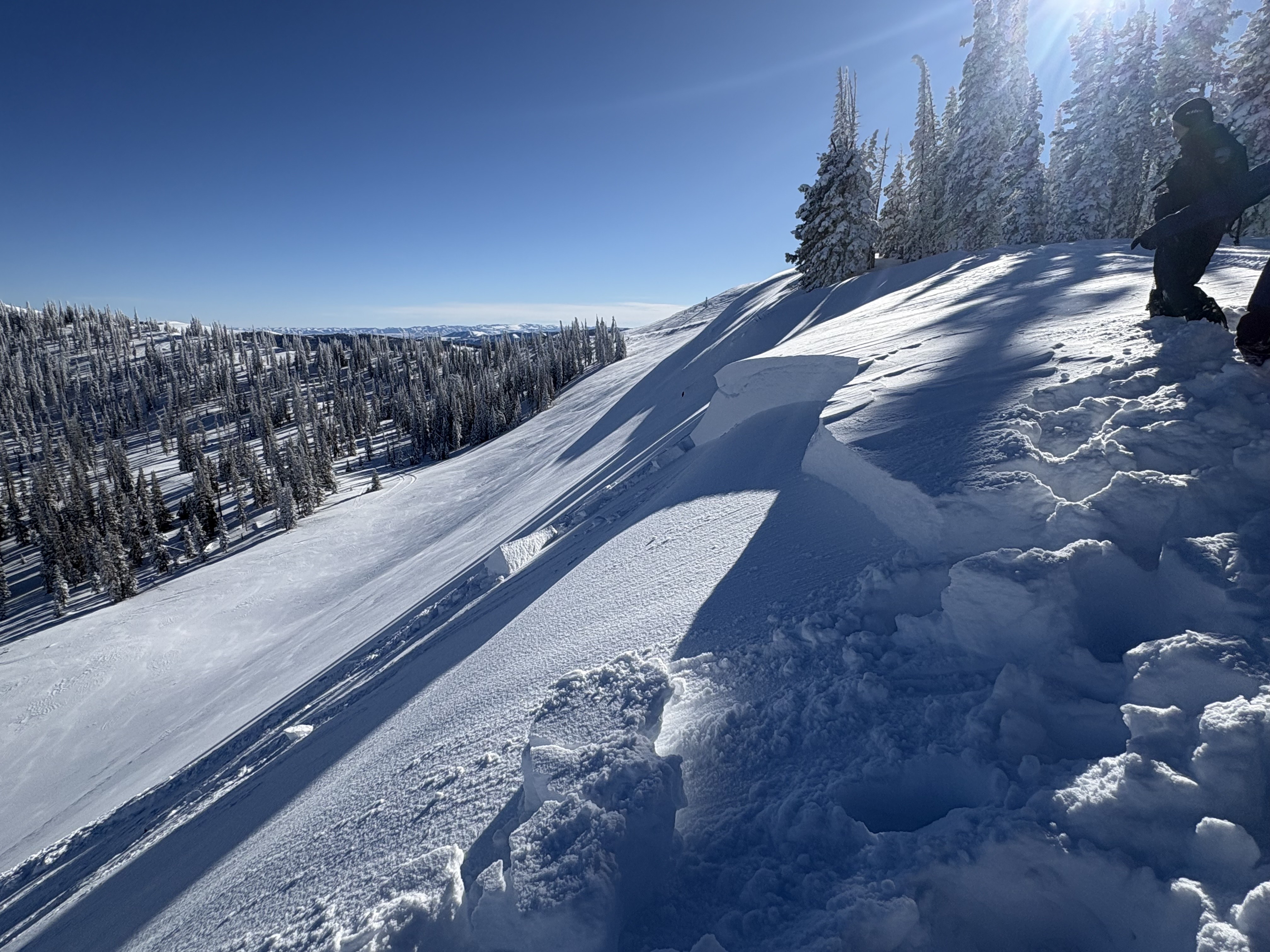
On Saturday, near Wolf Creek Pass, around 10,000', a sledder triggered a windslab on the left, and a skier triggered a loose snow avalanche on the right.

Avalanche Problem #1
Persistent Weak Layer
Type
Location
Likelihood
Size
Description

An old, sled-triggered persistent slab avalanche from earlier in the weekend that broke on a shallow, shrubby, steep slope near Heber Mountain at 9,800' -- Thanks for sharing Nate. Check out more from his travels here.

The likelihood of triggering a persistent slab avalanche continues to go down, but as a rider, it is still possible to trigger a slide breaking 2-5' deep and hundreds of feet wide that takes out the entire season's snowpack. Recent avalanches failing deep and breaking wide have required big triggers like a cornice, snowmobile, or even smaller avalanches to step-down. Suspect terrain is steep, rocky, wind-affected slopes facing northwest through east that have a shallower snowpack (<3').

It is a bit like Minesweeper out there -- Although the likelihood of us triggering a large avalanche has gone down, if we play the game enough and keep putting tracks in terrain where this avalanche problem exists, we are bound to hit the mine eventually. How do we lose the game? All we need to do is find a thin portion of the snowpack around a rock or bush, collapse the weak layer (whumpf), and now we're staring down the barrel of a dangerous avalanche. Remember, today's avalanches are tricky, unmanageable slides. Instead of trying to outsmart the avalanche, avoidance is the go-to tool, and I am steering clear of this problem until it goes away or is buried deep enough and not a concern.

Ted was taking a look at things around 10,000' near the East Fork where he found a shallow, weak snowpack less than 3' that has a similar structure to that of deeper parts of the range.

General Announcements

We have some upcoming classes and events that we'd be stoked to see you at -- Please reach out with any questions and check out below for more details!

We are always looking for snow and avalanche observations or just general riding conditions. Reach out to us with questions, concerns, or if you see anything in your travels! Contact us directly through the info below:

This forecast is from the U.S.D.A. Forest Service, which is solely responsible for its content. This forecast describes general avalanche conditions, and local variations always occur. This forecast was issued on Monday, January 12th at 0500 AM and expires 24 hours after it was issued. We'll update this information by 07:00 AM tomorrow.