Forecast for the Uintas Area Mountains

Craig Gordon
Issued by Craig Gordon on
Tuesday morning, January 13, 2026

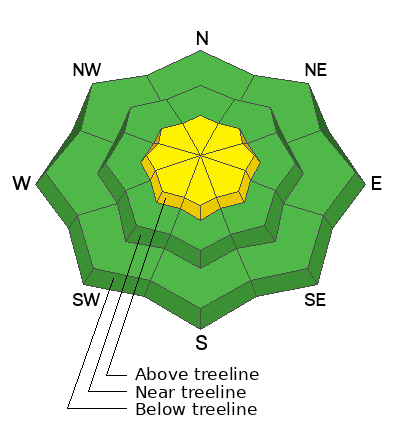
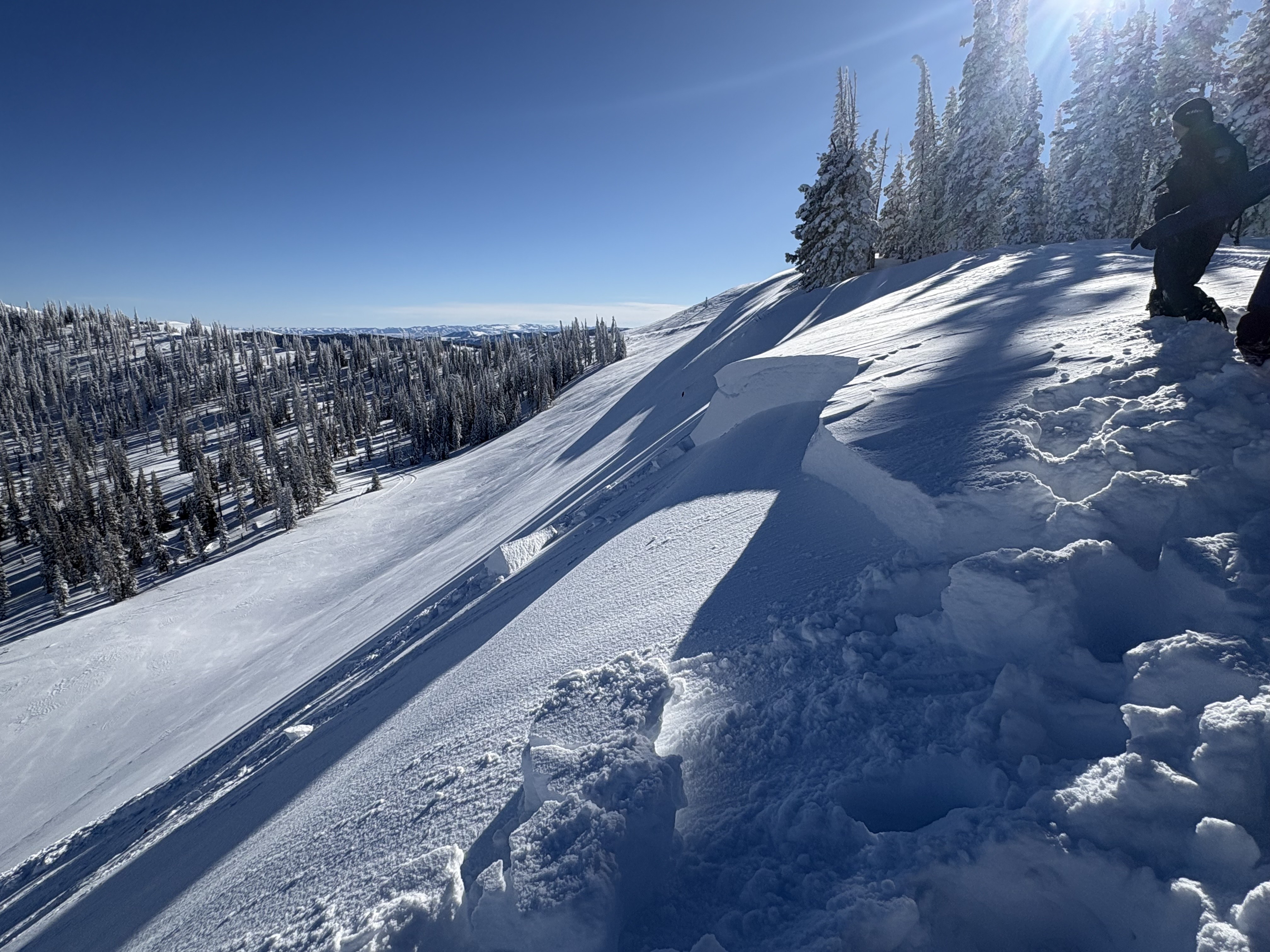
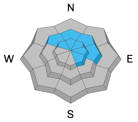
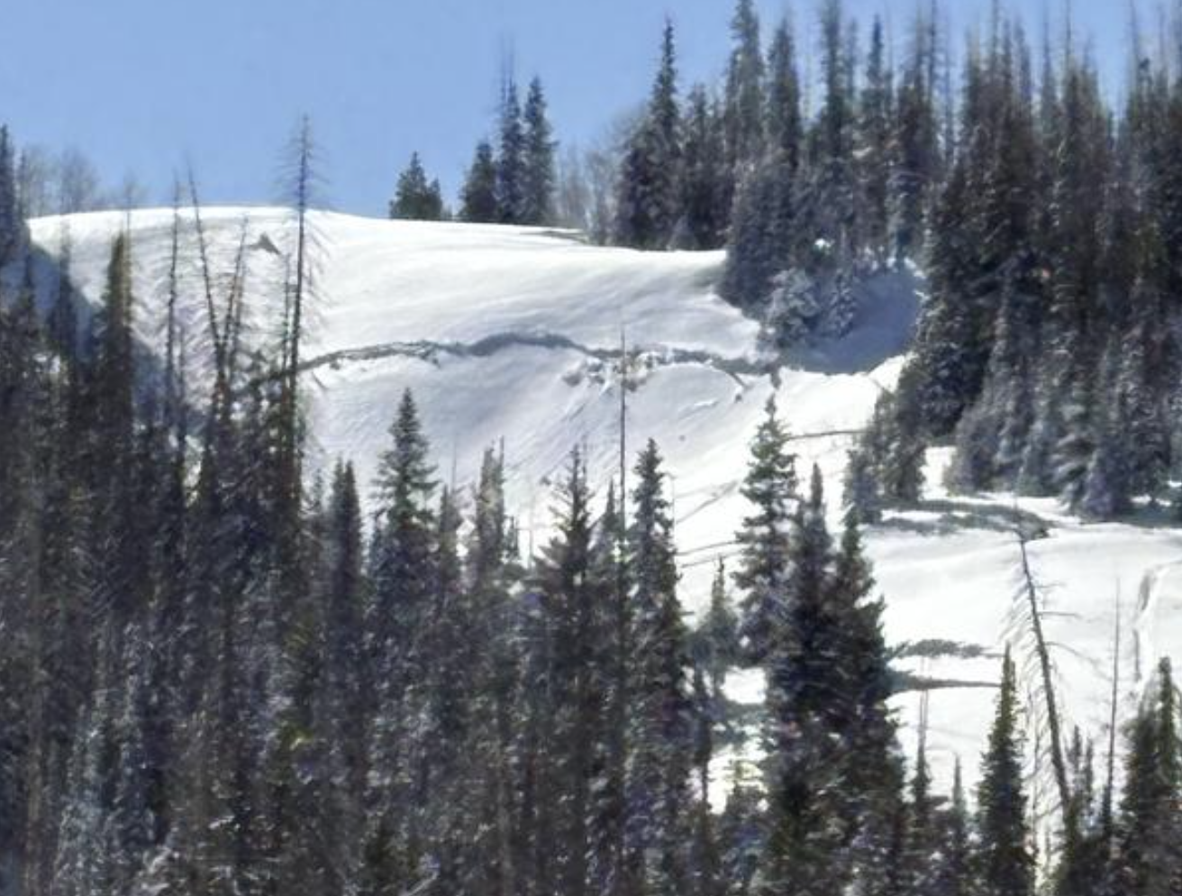
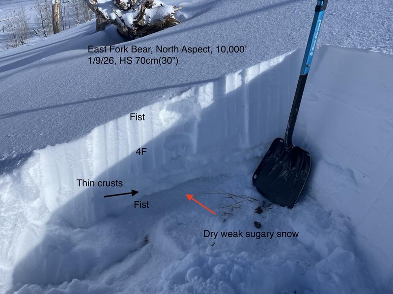
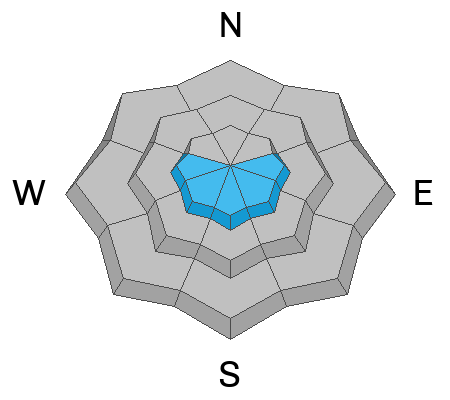
In the wind zone at and above treeline, expect MODERATE avalanche danger and human triggered avalanches are POSSIBLE, but for two distinctly different avalanche dragons. First and straight-forward... fresh drifts formed overnight on upper elevation leeward slopes, especially those facing the south half of the compass and they'll be reactive to our additional weight. Second and a bit more elusive... avalanches breaking up to 4' deep and failing into persistent weak layers near the ground are still POSSIBLE. You know this program and you're familiar with usual suspects... steep, rocky terrain, with a shallow weak snowpack is guilty until proven otherwise.

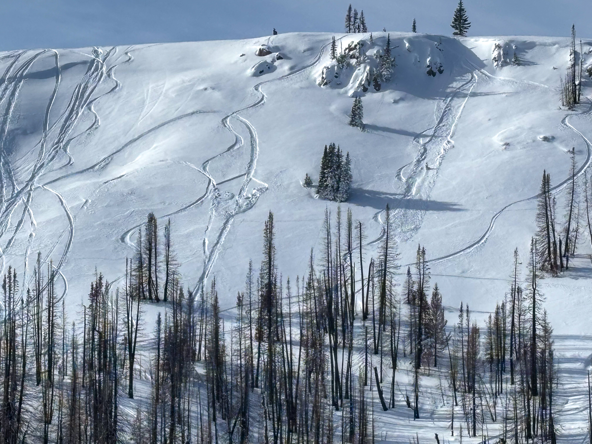
The inside line to scoring a solid day is wind sheltered, polar terrain with no overhead hazard.

Low
Moderate
Considerable
High
Extreme
Learn how to read the forecast here
Weather and Snow

Nowcast - Above the valley funk, gunk, and junk the air is clean and livin' is easy. At o'dark thirty, a band of thin clouds drifts through the region and temperatures are mild, registering in the mid 20's °F across the board. Late last night, winds blowing from the north and northwest bumped into the 20-30 mph range, gusting into the 50's on the south half of the Uinta zone, near Currant Creek and Strawberry.

Forecast - High pressure homesteads over the area through the workweek, delivering mostly sunny skies with temperatures climbing into the upper 30's°F. Overnight lows generally dip into the mid 20's°F.

Futurecast - While it's looking rather underwhelming for storminess, fingers, eyes, and toes are crossed for a pattern change later this month.

Travel Conditions - Riding and skiing across the range is 5-star on a supportable, go anywhere base. It's still thin at lower elevations, just about 1'-2' of total snow depth, but the Christmas Eve raincrust keeps us off the ground at mid and upper elevations where depths average 3'-5'. Strong sunshine and warm temps have had their way with solar aspects and low elevations. But don't let your heart be troubled... north-facing terrain offers deep, cold, dry powder, delivering top shelf conditions.

Recent Avalanches

A few older avalanches and some wet loose activity were reported Sunday, but nothing too alarming in recent days.

Ranger Nelson and his team were out on Duchesne Ridge and watched a few brap-boarders trigger this wind-drifted pocket on an east facing slope around 10,000'. See more information from the full observation, here.

On Saturday, near Wolf Creek Pass, around 10,000', a sledder triggered a windslab on the left, and a skier triggered a loose snow avalanche on the right.

Avalanche Problem #1
Persistent Weak Layer
Type
Location
Likelihood
Size
Description

An old, sled-triggered persistent slab avalanche from earlier in the weekend that broke on a shallow, shrubby, steep slope near Heber Mountain at 9,800' -- Thanks for sharing Nate. Check out more from his travels here.

The snowpack is getting comfortable in its own skin and the likelihood of triggering a deep, dangerous avalanche is decreasing... and that's good news. But I gotta remind myself, the pack is in it's teenage years and still a bit unpredictable. Put together the right elements like steep, rocky terrain with a shallow, thin snowpack, tease it a little bit and now what seemed relatively predictable, is coming unglued.

It not like rolling craps in Vegas, maybe a bit more like Minesweeper, play it long enough and eventually we're bound to stumble onto the booby trap. Remember, all we need to do is find a thin portion of the snowpack, like around a rock or bush, collapse the weak layer (whumpf), and now we're staring down the barrel of a dangerous avalanche. Don't forget, today's persistent slab avalanches are tricky, unmanageable slides. Instead of trying to outsmart the avalanche, avoidance is the go-to tool. So, I'm steering clear of the problem until it no longer exists or is buried deep enough and on the road to healing.

Ted's been looking at structure around 10,000' near the East Fork where he's noted a shallow, weak snowpack with less than three feet of total snow depth.

Avalanche Problem #2
Wind Drifted Snow
Type
Location
Likelihood
Size
Description

24 hour data dump from Currant Creek Peak (10,547') illustrating an overnight bump in northerly winds.

You might encounter a fresh drift or two especially on the south half of the range where north and northwest winds were busy at work overnight. Easy to detect by their fat rounded appearance, they're even easier to avoid by losing a little elevation and steering towards wind sheltered slopes.

General Announcements

We have some upcoming classes and events that we'd be stoked to see you at -- Please reach out with any questions and check out below for more details!

We are always looking for snow and avalanche observations or just general riding conditions. Reach out to us with questions, concerns, or if you see anything in your travels! Contact us directly through the info below:

This forecast is from the U.S.D.A. Forest Service, which is solely responsible for its content. This forecast describes general avalanche conditions, and local variations always occur. This forecast was issued on Tuesday, January 13th at 0400 AM and expires 24 hours after it was issued. We'll update this information by 07:00 AM tomorrow.