Forecast for the Salt Lake Area Mountains

Bo Torrey
Issued by Bo Torrey on
Tuesday morning, April 7, 2026

The avalanche danger is MODERATE. As daytime temperatures rise and the surface snow softens, you can trigger wet snow avalanches. Avoid travel on sunny slopes where the surface snow is wet and slushy.

On upper elevation NW-N-NE facing slopes, it remains possible to trigger a shallow soft slab within the recent snow. A sensitive layer produced significant avalanche activity late last week, and while avalanche activity has decreased, it remains reactive.

Low
Moderate
Considerable
High
Extreme
Learn how to read the forecast here
Special Announcements

Human Factor Research: Researchers Ian McCammon and Sara Boilen are developing new tools for managing human factors for backcountry skiers and boarders. This survey asks about personal experiences with human factors and will take 7-8 minutes to complete. Link is HERE

We have published February 2026: Four Avalanche Fatalities in Five Days: a community review with most of the UAC Salt Lake office. This 38-minute video is worth sitting down and digesting. A huge thanks to UAC Education Manager & Forecaster McKinley Talty for his hard work putting this together behind the scenes.

Weather and Snow

Overnight, skies were partly cloudy before clearing around 3 AM. Temperatures dropped into the 30s °F. Upper elevation winds blowing from the northwest were light, 10-15 mph with gusts into the 20s.

Today, expect mostly sunny skies with daytime temperatures rising into the 50s °F. Upper-elevation winds will be light early in the day, blowing from the NW at 10 to 15 mph before backing to the west and increasing to 20 to 30 mph this afternoon.

Looking ahead, weather models show another storm impacting the Wasatch starting Saturday night into the early part of next week. Current SWE numbers range from 0.5" to 2.0" for the Upper Cottonwoods.

Recent Avalanches

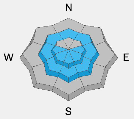
Yesterday, natural wet-loose avalanches were observed on east, south, and west-facing slopes as daytime temperatures warmed the snow. Ski area avalanche teams triggered slab avalanches that failed on a sensitive interface within the recent storm snow about a foot deep.

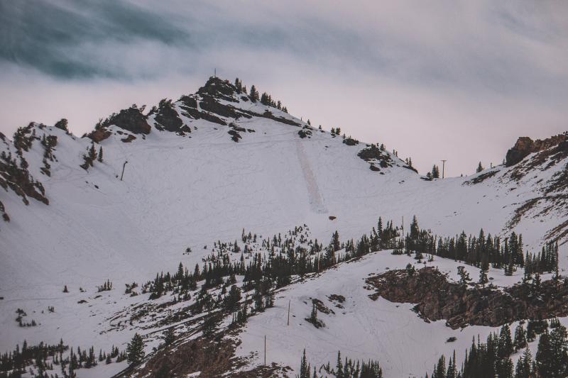
Wet loose avalanche on an east-facing slope near 10,000 feet.

Avalanche Problem #1
Wet Snow
Type
Location
Likelihood
Size
Description

Clear skies and warming temperatures will increase the risk of wet snow avalanches today. These avalanches often start as small point releases before widening, gathering more snow, and gaining speed.

If the snow is slushy and you are sinking past your boots, avoid steep slopes where even a small avalanche could have real consequences.

Avalanche Problem #2
Wind Drifted Snow
Type
Location
Likelihood
Size
Description

Last week’s storm snow was very reactive on Friday, resulting in at least 18 human-triggered avalanches with 10 riders caught and carried. While the snowpack is starting to settle, recent slides and failing snowpack tests show that riders can still trigger an avalanche on this layer.

General Announcements

This information does not apply to developed ski areas or highways where avalanche control is normally done. This forecast is from the U.S.D.A. Forest Service, which is solely responsible for its content. This forecast describes general avalanche conditions and local variations always occur.