New UAC Podcast Episode: Longtime local professionals Jenna Malone and Chris Brown sat down with us to discuss Utah's Backcountry Culture and Etiquette—especially relevant this weekend. Give it a listen on your ride upcanyon, and maybe take a look at Jenna's timeless Ascent Backcountry Snow Journal piece "Mountain Manners (and why they matter)"
Human Factor Research: Researchers Ian McCammon and Sara Boilen are developing new tools for managing human factors for backcountry skiers and boarders. This survey asks about personal experiences with human factors and will take 7-8 minutes to complete. Link is HERE
This Morning: Skies are clear and temperatures range through the 30's °F. Winds are from the west/southwest and light, averaging in the teens with gusts in the low 20's mph along exposed ridges at the mid and upper elevations.
Today: Skies will be mostly sunny, with temperatures rising into the 40's and low 50's °F. Winds will be from the west/southwest and remain light, with the strongest gusts in the 20's mph at the upper elevations.
This Week: Mostly sunny with daytime temperatures rising into the low 50's and light winds. We may see more active weather returning late this week.
We have published February 2026: Four Avalanche Fatalities in Five Days: a community review with most of the UAC Salt Lake office. This 38-minute video is worth sitting down and digesting. A huge thanks to UAC Education Manager & Forecaster McKinley Talty for his hard work putting this together behind the scenes.
Despite plenty of sunshine this weekend, freshening winds and moderate temperatures kept the snow surface cool, resulting in minor, wet-loose avalanche activity. Two small, rider-triggered avalanches involving wind-loaded, dry snow were reported on Sunday:
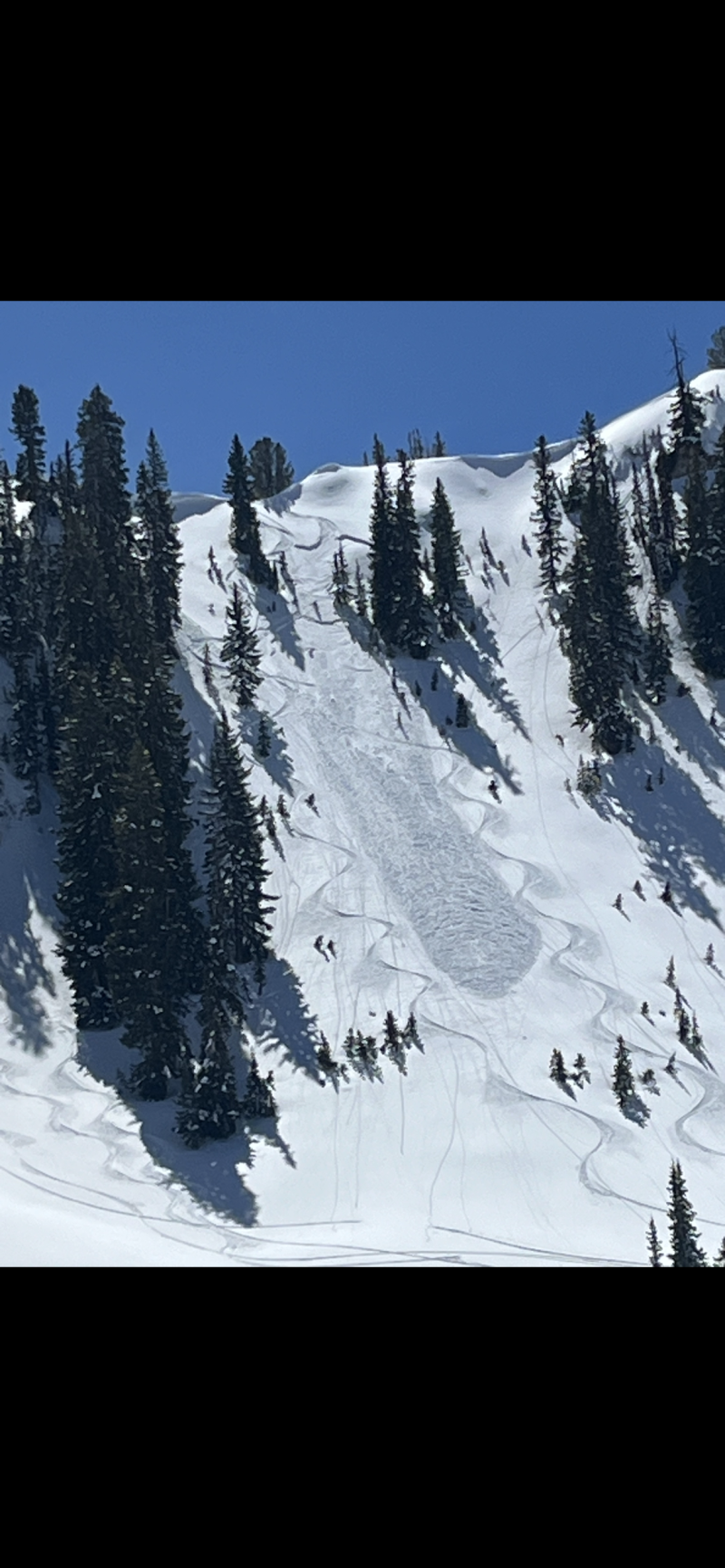
- Silver Fork Headwall - North-facing at 9,800 feet. 10 inches deep and 40 feet wide (photo below)
- Scotties Bowl - North-facing at 9,300 feet. 8 inches deep and 30-40 feet wide.
On Saturday, an experienced party triggered an avalanche on Box Elder Peak involving wind-drifted snow. Although the avalanche was not that large (18 inches deep and 50 feet wide), two riders were caught and carried in consequential terrain.
Friday brought 18 reported skier-triggered avalanches in the backcountry, with at least 10 catch and carries, and one helicopter evacuation due to traumatic injuries secondary to avalanche involvement. There were numerous other close calls.