A new version the UAC's mobile app has been released with many new features and performance improvements. Download our app today, available on iPhone and Android. Learn more HERE.
Skies are partly cloudy. Overnight lows are in the mid to upper 40s, with a few stations in the low 50s. It's difficult to believe to write that...but this winter is unbelievable in and of itself. Winds are blowing 15-20mph from the west.
For today, we'll see partly cloudy skies with temps again rising to the 50s and 60s. Winds will be blowing in the moderate range from the west. A sharp, but dry cold front arrives Thursday, but temps rebound over the weekend. There are some hints of a more active pattern for next week, but I won't hold my breath.
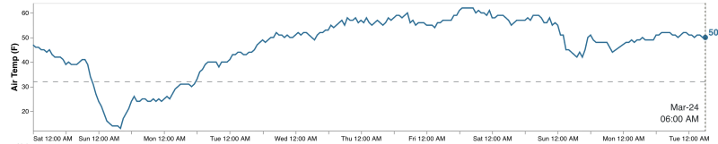
We'll call it mid-March madness, but look at the temps from the Ben Lomond weather station (7700') below. You can clearly see the cold front arriving Saturday March 14th, but the temperatures since then have been more akin to late May and early June.
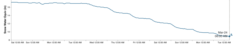
Similarly, look at the SWE (snow-water-equivalent) for the Ben Lomond site. It held steady at 17", but the bottom fell out and it now holds just 9" of water.
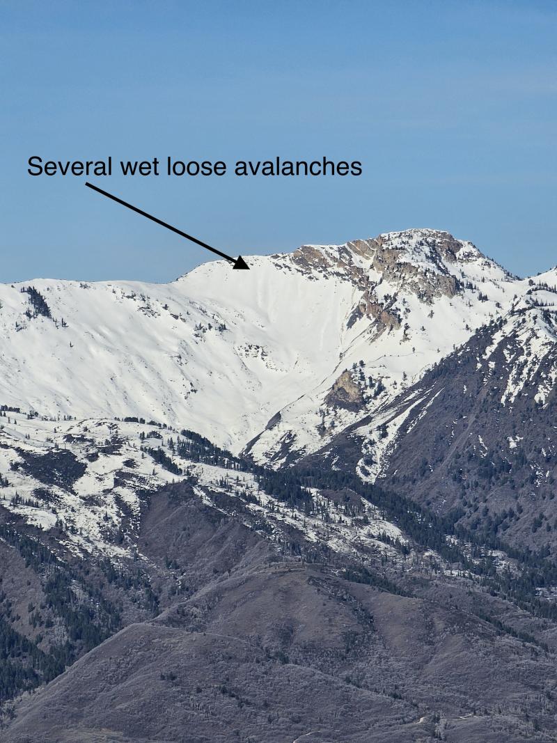
The only avalanche activity reported over the weekend was long-running wet-loose avalanches, including several along the Willard Headwall noted by Keenan Grady.