Forecast for the Ogden Area Mountains

Greg Gagne
Issued by Greg Gagne on
Monday morning, March 23, 2026

The avalanche danger is MODERATE for both wet-loose and large, destructive wet slab avalanches. Avoid being on or underneath steep slopes once the snow surface becomes loose and unconsolidated.

(Gray on the danger rose indicates little to no snow.)

Low
Moderate
Considerable
High
Extreme
Learn how to read the forecast here
Special Announcements

After a difficult week in February that included four avalanche fatalities, UAC forecasters will host a community debrief to discuss the conditions surrounding these accidents. We will review the weather and snowpack patterns, share observations from the field, and discuss lessons learned. This event will not be live but will include time for questions and discussion, with the goal of learning together as a community. Please use the form below to submit questions for review. Submit your questions HERE.

A new version the UAC's mobile app has been released with many new features and performance improvements. Download our app today, available on iPhone and Android. Learn more HERE.

Join Caroline Miller, UAC Executive Director, in exploring a life-altering accident in the mountains. Broken Neck, Broken Systems is a deeper dive into decision-making in the mountains. Learn more HERE.

Weather and Snow

This Morning: Skies are partly to mostly cloudy and temperatures are in the 40's °F, a few degrees warmer than yesterday morning. Winds are from the west, with gusts of 15-25 mph along the highest reaches of the Ogden Skyline.

Today: Skies will be partly to mostly cloudy with temperatures rising into the upper 50's °F. Winds will be from the west and won't change much throughout the day, with gusts near 25 mph along exposed ridges and peaks above 9,000 feet.

With cloudy skies and no overnight refreeze, the snow surface is unlikely to be supportable this morning.

This Week: Warming temperatures through mid week, with (yet another) dry cold front around Thursday which will lower temperatures, but still remaining well above average.

Recent Avalanches

The only avalanche activity reported over the weekend was long-running wet-loose avalanches, including several along the Willard Headwall noted by Keenan Grady.

Avalanche Problem #1
Wet Snow
Type
Location
Likelihood
Size
Description

There are two concerns for wet snow avalanches:

1. Wet Loose - This will be the most common concern, with the possibility for natural and human-triggered avalanches involving wet snow near the surface. These may be long-running and gouge down into the snow pack. These avalanches are especially dangerous in steep terrain or above terrain traps such as steep-sided gullies where escaping the flow is difficult.

2. Wet Slabs - As meltwater moves deeper into the snowpack, it can pool on buried crusts or weak layers, weakening the structure and allowing avalanches to break deeper and wider. These are larger and more destructive avalanches and may occur naturally, possibly failing down around crusts that formed over the holidays in late December.

Although not a common concern in the Ogden mountains, glide avalanches occur when the entire snowpack slowly slides on the ground, typically over smooth rock slabs or grassy slopes. The terrain around the Chilly Peak Slabs is the most common area for glide avalanches.

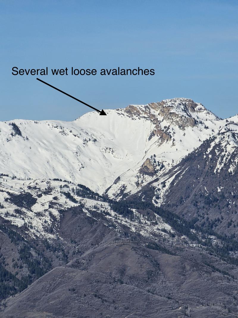
Wet-loose avalanches along the Willard Peak headwall (photo Keenan Grady)

General Announcements

This information does not apply to developed ski areas or highways where avalanche control is normally done. This forecast is from the U.S.D.A. Forest Service, which is solely responsible for its content. This forecast describes general avalanche conditions and local variations always occur.