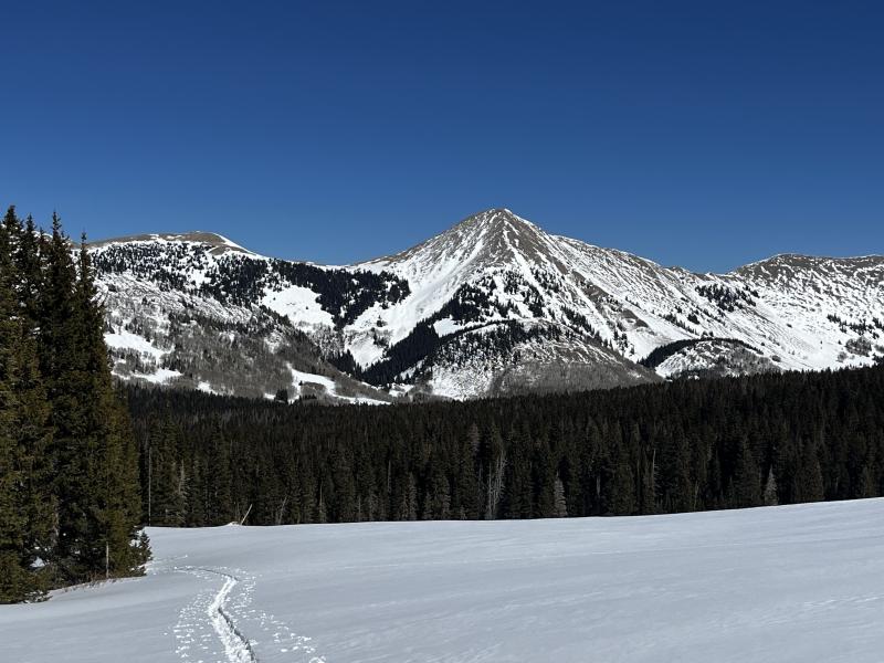
Forecast for the Moab Area Mountains

Eric Trenbeath
Issued by Eric Trenbeath on
Saturday morning, February 28, 2026

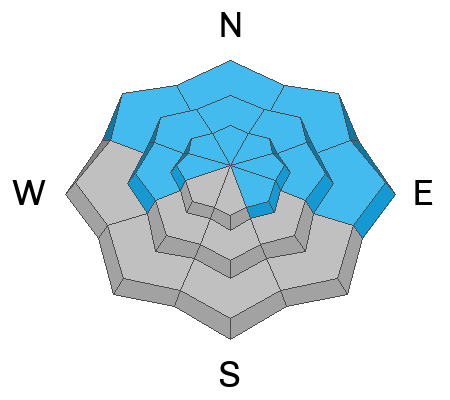
The avalanche danger is CONSIDERABLE on steep slopes near treeline and above that face NW-N-NE-E. Human-triggered, hard slab avalanches 2 to 4 feet deep, failing on a buried persistent weak layer remain likely. These avalanches could step down and release the entire season’s snowpack. Avoid slopes steeper than 30 degrees in these areas.

A MODERATE danger exists on west facing slopes near and above treeline, and on low elevation, northerly aspects. In these areas, human triggered avalanches, failing on a persistent weak layer are possible.

Low
Moderate
Considerable
High
Extreme
Learn how to read the forecast here
Special Announcements

Geyser Pass Road Conditions: The road is plowed and scraped down to the dirt in most areas.

Grooming: Conditions are pretty rough.

Mountain Film on Tour returns to Star Hall in Moab on Saturday, March 14. Tickets are available online and all proceeds benefit UAC Moab. Look forward to seeing you all there!

Weather and Snow

24 Hour Snow: 0" 72 Hour Snow: 0" Season Total Snow: 71" Depth at Gold Basin: 33"

Winds on Pre-Laurel Peak: NW 10-15 Temp: 25°F

Weather

The biggest news is that overnight lows were again well below freezing. Nevertheless, the warming trend continues today with high temperatures again soaring into the low to mid 40's at 10,000 feet. Look for increasing clouds today and light westerly winds ahead of a brief pulse of moisture clipping by to the north. Sunday will be mostly cloudy and warm. A continued warm but unsettled pattern begins on Monday, but nothing significant is likely to come out of it.

General Conditions

It feels like April out there but with half the snowpack. Sun exposed slopes will be crusted over this morning and this includes west and east aspects at lower to mid elevations. You may find a brief window of supportability and corn-like conditions in these areas. Many south aspects are back down to the rocks. Low elevation northerlies are mashed potatoes, with dense dry snow found above about 10,800 - 11,000'. Winds have blasted exposed slopes up high.

Last week's storm cycle has settled into a dense, 4f slab 8"-12" thick on top of the Feb 11, faceted weak layer. The slab is damp at low and mid elevations. It provides for supportable travel, but it's quite disconcerting to step out of the skis and punch through the underlying facets. Most facet layers remain dry. For more details, see my observation from Thursday.

Thin cover on south aspects.

See all Moab observations here.

Snowpack and Weather Data

Wind Station on Pre-Laurel Peak (11,400')
NWS forecast for the La Sal Mountains.
Recent Avalanches
The avalanche database has been updated to include all observed avalanches since last Friday's storm. These are all great examples of the type of avalanche you are still likely to trigger.
Avalanche Problem #1
Persistent Weak Layer
Type
Location
Likelihood
Size
Description

Last week's storm cycle has settled into a dense, slab 8"-12" thick on top of the Feb 11, faceted weak layer. On west facing slopes near and above treeline, and on low elevation, northerly aspects, human triggered, avalanches failing on this weak layer are possible. The danger is much more acute on steep, northerly aspects, near and above treeline, where hard slabs 2 to 4 feet thick now rest above this weak, faceted layer. Human-triggered avalanches failing on the 2/11 layer remain likely, and once triggered, may step down deeper into the snowpack resulting in much more destructive and deadly avalanches.

It's been a week since the last storm and natural avalanche cycle, and obvious red flag signs of instability such as collapsing and cracking are no longer evident. But make no mistake, many steep slopes that did not avalanche during Friday’s storm remain primed for release. The safest strategy is to continue to avoid slopes steeper than 30 degrees.

Additional Information
General Announcements
This forecast is from the U.S.D.A. Forest Service, which is solely responsible for its content. This forecast describes general avalanche conditions and local variations always occur.