Forecast for the Moab Area Mountains

Dave Garcia
Issued by Dave Garcia on
Thursday morning, February 19, 2026

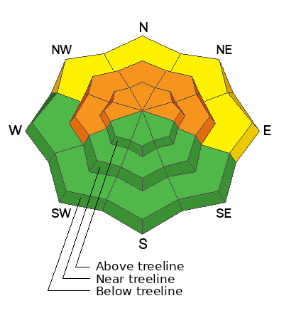
The avalanche danger is CONSIDERABLE. Weak, unstable snowpack structure is widespread, and human-triggered avalanches are likely on slopes near treeline and above that face west to north to east. These slopes harbor a persistent weak layer buried beneath recently formed hard slabs of wind-drifted snow. Wind-loaded north to east aspects are the bullseye for dangerous avalanche conditions today.

On northerly slopes below treeline, there is a MODERATE danger for shallow soft slab avalanches failing on a persistent weak layer.

Solar aspects are largely scoured off by recent strong winds and offer LOW danger.

Remember that CONSIDERABLE danger means natural avalanches are possible and human-triggered avalanches are likely. Cautious route-finding and conservative decision-making are essential for backcountry travel today.

Low
Moderate
Considerable
High
Extreme
Learn how to read the forecast here
Special Announcements

Geyser Pass Road Conditions: The road is not plowed. Expect drifts up to a foot deep up high. AWD recommended.

Grooming: Trails are covered in fresh snow.

We have rescheduled our Moab Backcountry 101 Class to February 20, 21. Click here for information and registration. Moab and Monticello locals can use the discount code MOAB-LOCAL for a 10% discount.

Weather and Snow

24 Hour Snow: 4" 72 Hour Snow: 8" Season Total Snow: 57" Depth at Gold Basin: 35"

Winds on Pre-Laurel Peak: WNW MOD Temp: 6°F

Weather

Under broken skies, it is a chilly 6°F in Gold Basin this morning. Winds on Abajo Peak are blowing out of the west-northwest in the moderate range, with occasional strong gusts. For today, the winds are forecast to back off slightly and blow from the west-southwest at 10 to 15 MPH with gusts up to 30 MPH. Skies will be mostly sunny, and we will reach a high temperature of 18°F at 10,000 feet. The calm sunny weather is short-lived. Tonight, flow aloft shifts southwesterly and taps into yet another weak atmospheric river. The National Weather Service is forecasting big numbers in the 9 to 17 inch range. That's enough to get excited about, but I'm going to place my bet on the low end, which is 4 to 6 inches, hopefully I'm wrong.

General Conditions

Another four inches of snow fell yesterday, along with very strong winds, and snow totals since 2-17 are now 8 inches of snow at 0.86" snow water equivalent (SWE). Skiing conditions on Wednesday were improved from Tuesday's very upside-down-feeling snow. There are now a few inches of nice, light powder on the surface. Solar aspects are starting to take shape and offer fun dust on crust conditions and a lower avalanche hazard.

A widespread layer of near-surface facets was buried on Wednesday night, 2/11, creating a fragile snowpack structure. Recent snowfall and sustained strong southerly winds have created dangerous avalanche conditions. Wind-loaded slopes near treeline and above are the bullseye for serious avalanche problems today. Widespread hard slabs of drifted snow have recently formed on top of weak faceted snow. These slopes are primed for avalanches and are just waiting for a trigger; don't let it be you. For fun turns today, I'll look to northerly slopes below treeline that are not wind-loaded, or I'll head to the south half of the compass and enjoy dust on crust and low danger.

Click here to see my fieldwork from yesterday.

See all recent observations here.

Snowpack and Weather Data

SNOTEL site near Geyser Pass Winter Trailhead (9600')
Wind Station on Pre-Laurel Peak (11,400')
NWS forecast for the La Sal Mountains.
Recent Avalanches
On Tuesday, I spotted this natural avalanche on the steep north face of Exxon's Folly. Details are sparse because of poor visibility, but judging by the debris pile, this is easily a D2 avalanche. Today, you are likely to trigger avalanches similar to this.
See all La Sal avalanches here.
Avalanche Problem #1
Persistent Weak Layer
Type
Location
Likelihood
Size
Description

The entire snowpack is faceted through on shady aspects, providing a variety of weak layers. The immediate layer of concern is the old snow surface from before the storm on the night of February 11. This is the most sensitive of our many weak layers, and the easiest to trigger. Out of the wind zone, the weak layer does seem to be adjusting to the new load. However, it remains possible to trigger a soft slab avalanche that will initially be about ten inches deep. On steep, continuous slopes, these relatively shallow avalanches can entrain enough snow to step down into more deeply buried weak layers, causing a deeper, more dangerous avalanche.

On slopes that have seen recent drifting, the most prominent weak layer of concern is buried two to three feet below the surface. On these slopes, you are likely to trigger avalanches that will initially be up to three feet deep and will almost certainly step down (possibly to the ground), causing very large and destructive avalanches. Keep it simple and avoid slopes steeper than 30 degrees.

Avalanche Problem #2
Wind Drifted Snow
Type
Location
Likelihood
Size
Description

Southerly winds were relentless on Wednesday, blowing and drifting the new snow onto leeward slopes near treeline and above. I observed intense snow transport all day. Recent hard slabs are growing in size. What stood out to me the most was that I could see slopes being loaded very far down off the ridges. This is exactly the type of slab that allows you to ski a good distance out onto it before it breaks well above you. This is a dangerous situation, and all recently wind-loaded slopes should be avoided.

Wind-drifted snow will appear fat, round, and pillowy. Fresh drifts will sound hollow like a drum under your skis or board. Drifted snow is stiffer and more cohesive than non-drifted snow.

Additional Information
General Announcements
This forecast is from the U.S.D.A. Forest Service, which is solely responsible for its content. This forecast describes general avalanche conditions and local variations always occur.