Join the UAC for the first "Stay and Play Avalanche Course" at Bear River Lodge in the Uintas, March 19th-22nd. This course is designed for snowmobilers by snowmobilers, where you will learn avalanche rescue, riding skills, and how to survive in the backcountry. Come enjoy all the luxury offerings at Bear River Lodge and improve your skills along the way.
In a new video, Paige explains how different types of weak snow that develop during periods of benign weather can become persistent weak layers when buried by future snows. We expect dangerous avalanche conditions to develop as persistent weak layers are overloaded by heavy snow next week.
----------------------------------------------------------------------------------
Conditions are rough for mid-February, with surfaces a mixed bag of crusts, old angular snow, and you name it. Last week's 1-4 inches of snow was, at best, a superficial "touchup." The next storm looks like the real deal, though, with colder temperatures, strong winds, and heavy snowfall stacking up feet of snow by the end of the week. Great news for backcountry fun hogs and hydrologists alike!
BUT ... as mentioned in the video above (blog here), we are set up for dangerous avalanche conditions. Widespread weak snow developed during the recent lengthy dry spell across many aspects and elevations, and once buried, it'll be difficult to tell exactly where it'll be most problematic. With a classic Utah snow storm on the way, it's time to get excited and also shift our mindset to a more conservative one - you'll want to plan your backcountry travels to stay out of avalanche terrain.
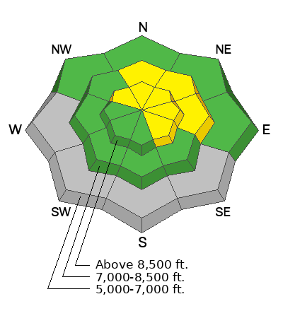
Today, moderate winds from the southwest may elevate avalanche danger on drifted slopes facing northwest through southeast that are steeper than 30 degrees. You may find shallow slabs of wind-drifted snow sensitive to your weight in lee areas of exposed ridgelines and terrain features like gullies and rock bands. Terrain below about 7000 feet has only very shallow snow cover, with muddy trails and sunny slopes facing southeast through west completely bare of snow.
Currently, winds on Logan Peak are blowing from the south-southwest at 35mph, with a 51 mph gust early this morning. It's 23°F on Paris Peak at 9500 feet, and the wind sensor is reading 20 mph from the south-southwest with gusts around 30 mph. At 8700 feet, the UAC Card Canyon station reports 29°F, and there's 43 inches of total snow. The Tony Grove Snotel, located at 8400 feet, reports 32°F, and there's 54 inches of total snow.
Expect partly sunny skies in the mountains today, with high temperatures at 8500' around 36°F and winds from the southwest blowing in the teens mph, with gusts in the 30s mph. Tomorrow will be a repeat with slightly stronger winds ahead of the storm set to arrive Monday night.
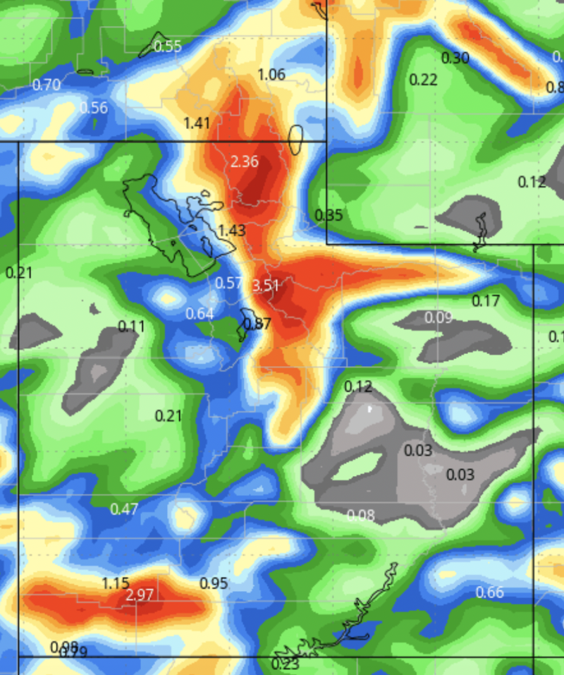
The GFS model run for precipitation through the work week suggests heavy mountain snow across the northern half of Utah and the mountains near SW Utah.
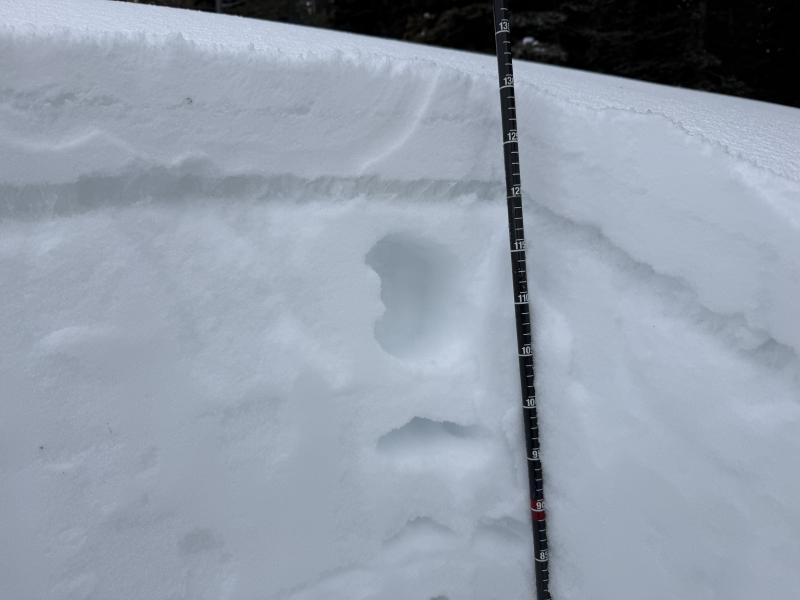
An observer texted us a report of several small soft slab avalanches triggered by skiers in Bloomington Canyon on Thursday between 7500 feet and 8500 feet in elevation. At higher elevations, the party found more stable snow. Friday, an observer in Providence Canyon noted collapsing, cracking, and a few recent wet avalanches. Otherwise, no other avalanche activity was reported recently.
For all observations and avalanche activity in the Logan zone, go HERE