Join the UAC for the first "Stay and Play Avalanche Course" at Bear River Lodge in the Uintas, March 19th-22nd. This course is designed for snowmobilers by snowmobilers, where you will learn avalanche rescue, riding skills, and how to survive in the backcountry. Come enjoy all the luxury offerings at Bear River Lodge and improve your skills along the way.
In a new video, Paige explains how different types of weak snow that develop during periods of benign weather can become persistent weak layers when buried by future snows. We expect dangerous avalanche conditions to develop as persistent weak layers are overloaded by heavy snow next week.
----------------------------------------------------------------------------------
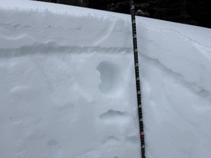
Well, we were all hoping for a bit more snow this past week, but at least we got a few inches to brighten things up. Travel has felt more like late April than mid-season, with mostly firm surfaces minus very shady terrain where soft snow still exists. What was a shallow, damp coating on Thursday turned into crunchy "snow" on Friday. Faceted snow sill abounds, but it is now capped by a variable-thickness/strength crust, which will only make avalanche conditions more complex when we do get snow. Of interest, riders have noted more obvious red flags in shallower areas (Logan Peak and south) than in the northern part of the zone.
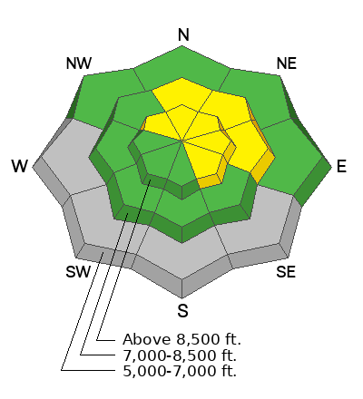
For today, elevated avalanche conditions are found in drifted terrain and on slopes facing northwest through southeast that are steeper than 30 degrees. In the heat of the day, keep a watchful eye out for weakening, saturated snow on very steep sunny slopes where wet loose avalanches will be possible. Terrain below about 7000 feet has only very shallow snow cover, with muddy trails and sunny slopes facing southeast through west completely bare of snow.
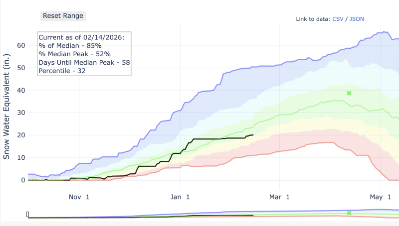
From the valley, it is hard to imagine that Tony Grove sits at 85% of normal SWE.
Winds were fairly benign yesterday, and the clouds hung around a bit longer than expected, keeping the snow surface slightly refrozen. Currently, winds on Logan Peak are blowing from the west in the teens mph with gusts in the 20s mph. It's 18°F on Paris Peak at 9500 feet, and the wind sensor is rimed (encased in frost). At 8700 feet, the UAC Card Canyon reports 18°F, and there's 44 inches of total snow. The Tony Grove Snotel, located at 8400 feet, reports 22°F, and there's 55 inches of total snow.
Expect mostly sunny skies in the mountains today, with high temperatures at 8500' around 35°F and light winds from the southwest. Tomorrow, we'll see increasing clouds, with a high around 38°F and moderate, sometimes gusty, winds from the southwest.
An observer texted us a report of several small soft slab avalanches triggered by skiers in Bloomington Canyon on Thursday between 7500 feet and 8500 feet in elevation. At higher elevations, the party found more stable snow. Friday, an observer in Providence Canyon noted collapsing, cracking, and a few recent wet avalanches. Otherwise, no other avalanche activity was reported recently.
For all observations and avalanche activity in the Logan zone, go HERE