Researchers Ian McCammon and Sara Boilen are developing new tools for managing human factors for backcountry skiers and boarders. This survey asks about personal experiences with human factors and will take 7 - 8 minutes to fill out. Link is HERE.
Nowcast - What a storm! Since Tuesday, we have received roughly 15-20" of right-side up snow across the range with just under 2" of SWE. It came in like a lamb, quiet and calm, but unfortunately roared out like a lion with westerly winds averaging 30 MPH gusting into the 60's. The cold front ripped through at about 1300 yesterday and temperatures dropped significantly. Right now, 10,000' stations are reporting single digit temps (°F).
Forecast - A chilly, beautiful winter-like day is on tap for the range with a little sunshine to boot. We start off with overcast skies and a few lingering flurries this morning as the storm exists the region. 10k' temperatures look to hit a high of 25°F on the day, while a nice breeze from the northwest continues and keeps things chilly, blowing 15-25 MPH gusting into the 30's up high.
Futurecast - The storm tapers off today and we stay sunny and cool into the weekend. That being said, temperatures return to 10-15°F above average by early next week and we are back in the ring with high-pressure.
Travel Conditions - Since Tuesday, we stacked up 15-20" of medium-density snow providing a quick refresh and brief return of winter! Each day the storm snow has settled more into place and the riding continues to improve. On solar and low elevation slopes, things were patchy and bare prior to this storm, but they now have enough snow to travel and slide around on. The best riding exists out of the windzone in mid to upper elevation polar terrain where smooth, moderate slope angles are the ticket.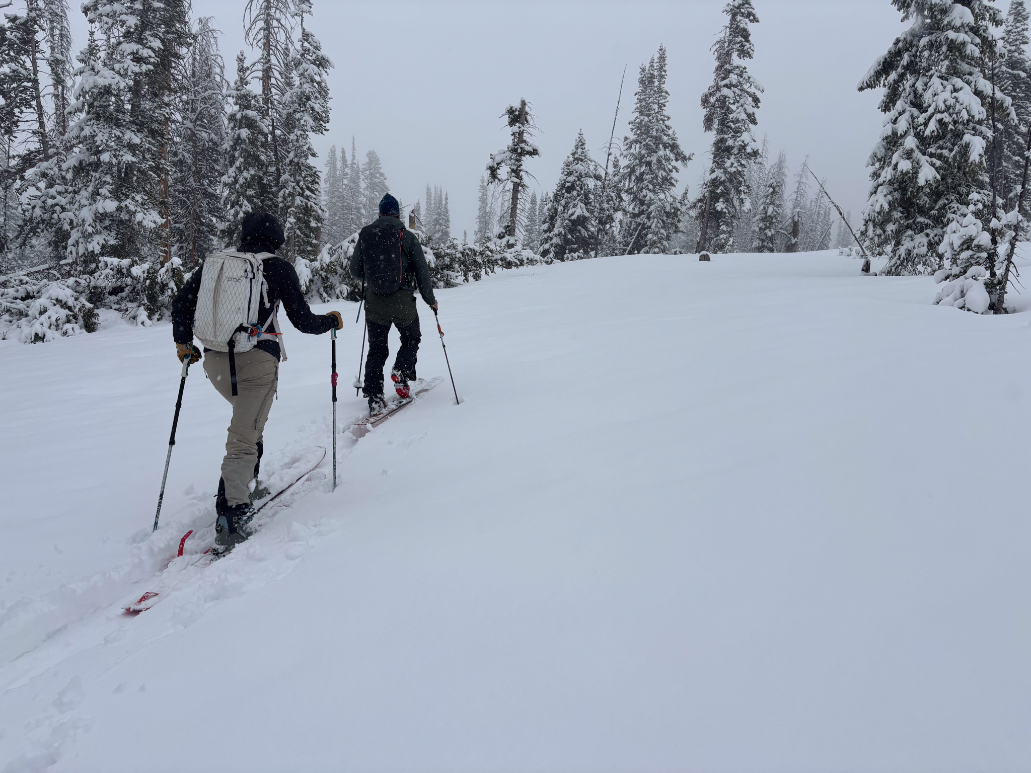 The dynamic Uinta duo of Trevor K and Fran A out and about taking advantage of the improving travel conditions. It doesn't matter if your on a rig, skis, your board or ripping a snow angel, the riding quality has seriously improved over the past few days!
No new avalanche activity has been reported from across the range in the past 24 hours.


 For over 24 hours strong winds blowing between 30-40 MPH, gusting into the 50's and 60's loaded leeward slopes facing northwest through southeast. Sitting atop new snow in many places, today's wind-drifts can fail remotely from a distance and break up to 3' deep. Yesterday, small drifts were reactive underfoot to ski cuts and while stomping around on test slopes, a sure sign that bigger drifts in larger terrain are equally, if not more sensitive to our additional weight.
 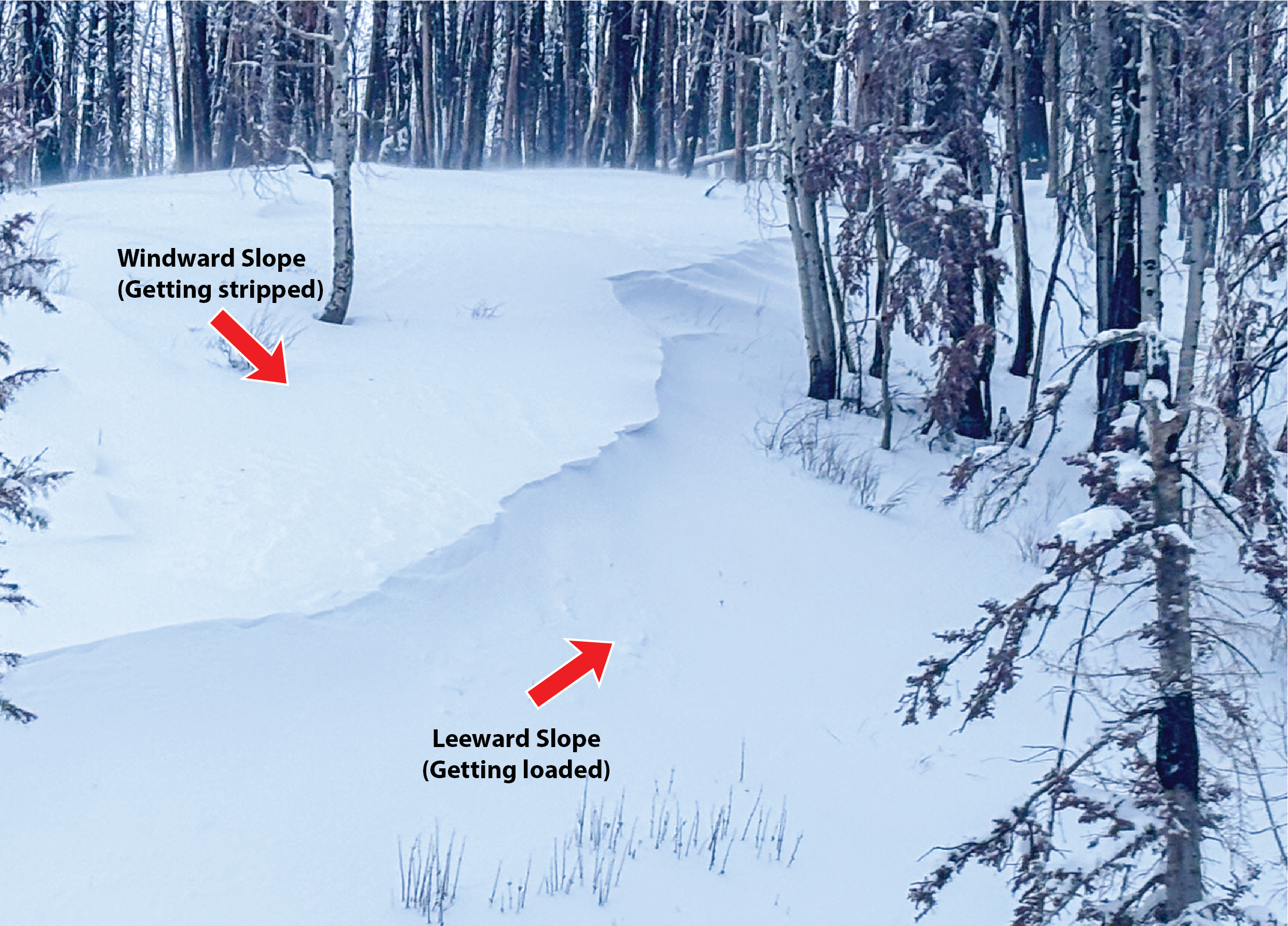 Above is a micro, wind-loaded slope that was fun to play around on and use as a test slope to evaluate the reactivity of our drifting. Even in wind-resistant terrain strong winds were moving and loading snow throughout the day yesterday.