Nowcast - A beautiful, clear and starry morning is brought to life by whistling winds at the trailheads, and winds at upper elevations cranking steady in the 30 and 40's with gusts ranging between 50 and 80 MPH, check out the Windy Peak wind run, here! Temperatures cooled off as the cold front rolled through yesterday afternoon and we currently are just under 20°F at 7,000' and in the single digits °F closer to 11,000'.
Forecast - It will feel winter-like out there today with temps near normal, and a high of 25°F around 9,000'. Winds dwindle this morning into the afternoon, and should back off into the light to moderate category by days end, with a few gusts mixed in between. Sky cover looks good today, and sunny skies should help to bring a bit of warmth to the picture.
Futurecast - A few more days of normal temperatures, then we warm right back up heading into the weekend, 10-15°F above average temperatures. There is nothing in the storm queue worth mentioning.
Travel Conditions - We heard the north side of the HWY150 opened its gates, a sure sign that it is quickly beginning to look like spring out. Fortunately, a bit of settled snow on protected, upper elevation polars from last weeks storm that is still riding well keeps us rocking. Solar aspects and windward terrain are cooked and wind scoured leaving behind a mixed back of textured surfaces, crusts, wind-board and wind-pack in exposed areas. Get out of the mud, and gain some elevation where you will find decent coverage all around for travel with the best riding in cold, sheltered terrain on the north side of the compass.
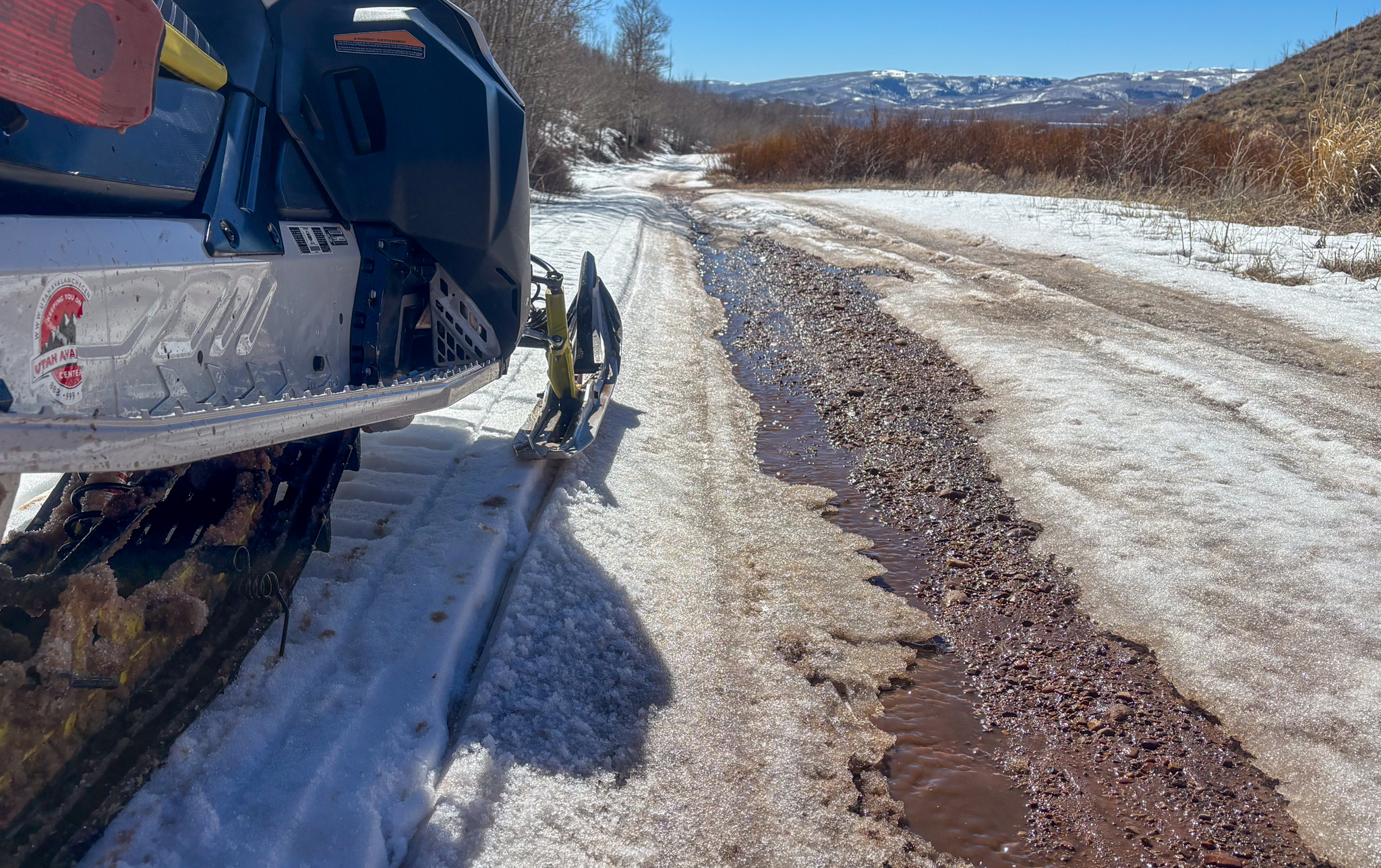
A cool down can't save us now and access has become challenging from many of our trailheads and I think we are getting close to the end of it, for tracked vehicles that is.
No new avalanche activity has been reported or observed in the past 24 hours. But there is still stellar intel waiting for you on our observations page, and you can check out recent avalanches and travel observations from across the range below.


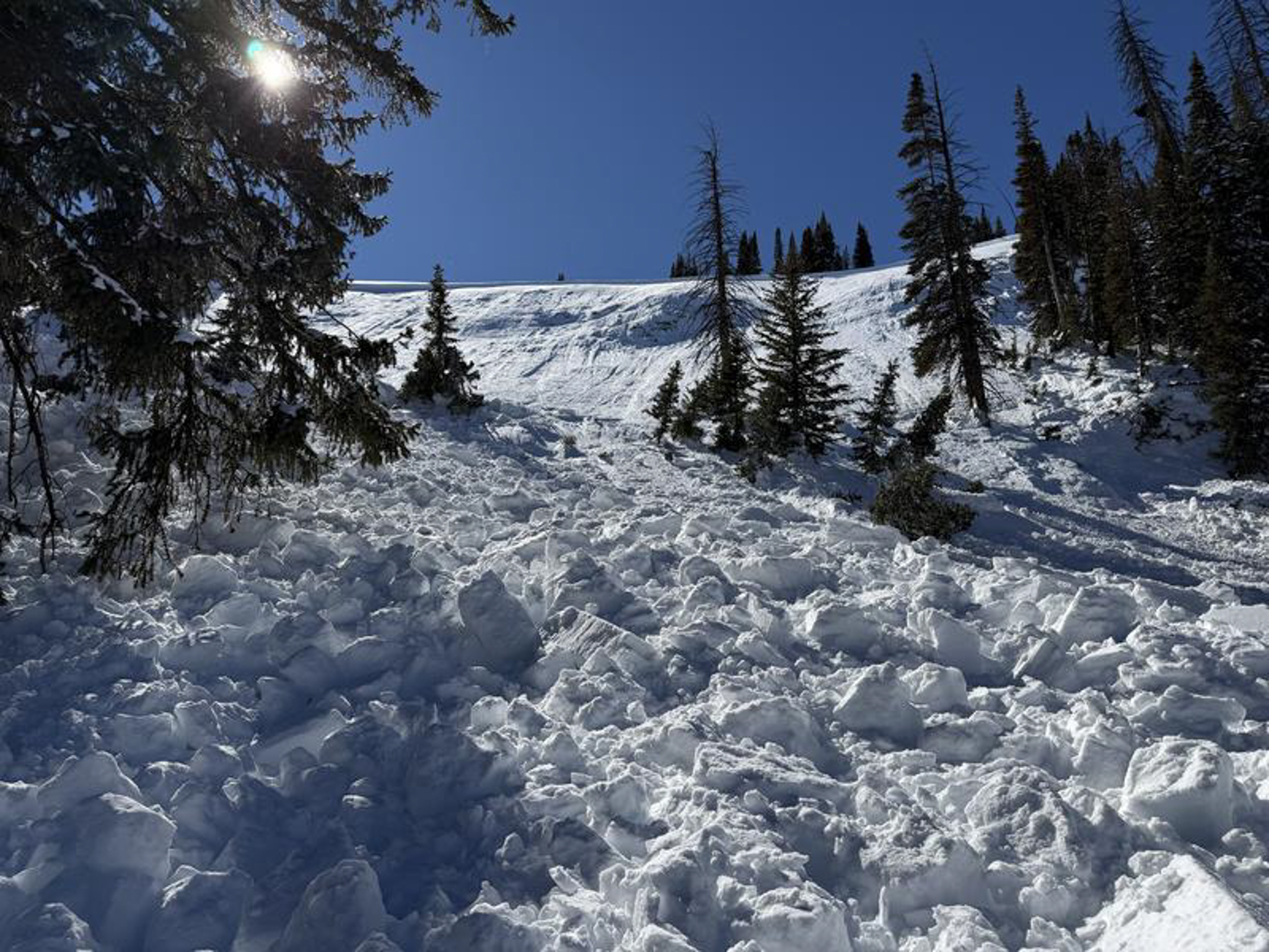 Above is the slide on Duchesne Ridge that produced SUV-size chunks of debris stacking up deep in the runout and trees below. Getting caught up in a slide like this could potentially be game over -- Trees turn to baseball bats, and debris chunks are like boulders coming down on top of you.
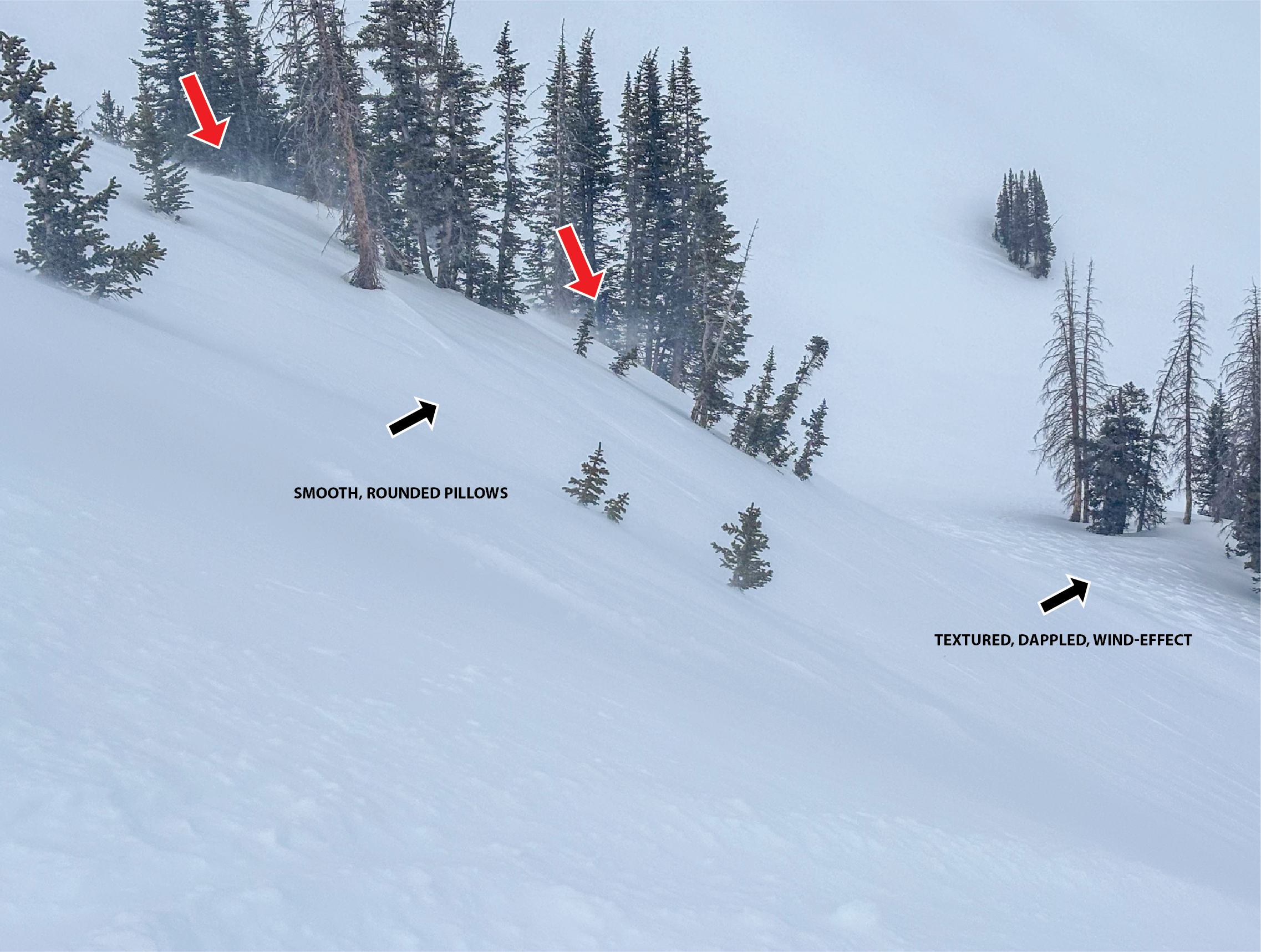 Above, red arrows indicate rolling snow that is loading leeward slopes at mid and upper elevations. The black arrows indicate a few of the things to look for when trying to identify and avoid todays hazard.


