Forecast for the Uintas Area Mountains

Andrew Nassetta
Issued by Andrew Nassetta on
Monday morning, February 23, 2026

CONSIDERABLE avalanche dangers exists in mid and upper elevation polar terrain where it's LIKELY that we can remotely trigger large, tree snapping avalanches failing 1-4' deep into faceted snow and breaking hundreds of feet wide.

This avalanche problem isn't going anywhere, but that is not stopping me from riding today. So I am avoiding all avalanche terrain on the north half of the compass, and steering my rig towards low-angle, polar slopes free of any overhead hazard.

Low
Moderate
Considerable
High
Extreme
Learn how to read the forecast here
Special Avalanche Bulletin

The Utah Avalanche Center is warning of continued dangerous avalanche conditions in the Uinta mountains. This week’s heavy snowfall and strong winds overloaded preexisting weak layers, creating a dangerous conditions. There have already been two tragic avalanche fatalities this week in northern Utah, as well as several close calls and numerous backcountry avalanches reported.

When: In effect from 6am MST this morning to 6am MST Tuesday

Impacts: Dangerous avalanche conditions exist in the backcountry and will persist through at least Monday. Natural avalanches are possible, and people are likely to trigger avalanches on slopes steeper than 30 degrees. Dangerous and deadly avalanches can be triggered remotely (from a distance or from below).

Weather and Snow

Nowcast - 0500 AM temperatures are sharply inverted with single digit temperatures down low in the hollows near trailheads, while keeping consistent in the mid-20's°F near our upper elevation weather stations. Mostly clear skies lead way into another beautiful day across the range.

Forecast - Partly sunny today to kick off the working week, with temperatures climbing to the low 30's°F at the days peak. Winds keep tame today, a bit lighter than yesterday, and blow from the southwest near 15 MPH, gusting into the 20's near the high peaks. Expect increasing thin clouds as the day progresses heading into supper time.

Futurecast - Ahead of our next storm, the track shifts west and we see snow showers begin mid-day Tuesday. Things start wet and wild with potential valley rain, and a rain-line near 7/8k' across the range. Then things pick up steam, cool off slightly, and continue through Wednesday morning. I am guessing 6-10" of accumulation with up to 1" of snow water equivalent.

Travel Conditions - After six weeks of teaser snowfall, finally, the Uinta's got absolutely clobbered and the recent storm is nothing short of colossal. Riding conditions have gone from April-esque to mid-winter in the length of a working week. Low elevations solars are already taking a hit from the sun and heath, while polars permit travel and some light riding -- And of course, get up high and finally, it looks like an average winter.

Low elevations have finally come into play making travel that much easier across the range. Near Strawberry and beyond, our good shot of snow last week has settled out and made road travel in and out of riding zones a real treat.

Recent Avalanches

There is no shortage of activity across the range, and the Uinta community sure got after it this weekend. Multiple natural and human-triggered slides have been observed and reported across the range with a few close-calls along the way.

A solid crew skiing and riding near the Boundary Creek Yurt triggered this sizable, D2 avalanche, that was nearly 800' wide, up to 3' deep, and ran almost its full track. Thanks to Ethan for the great write-up, you can check out the rest of their trip intel from the North Slope, here.

Avalanche Problem #1
Persistent Weak Layer
Type
Location
Likelihood
Size
Description

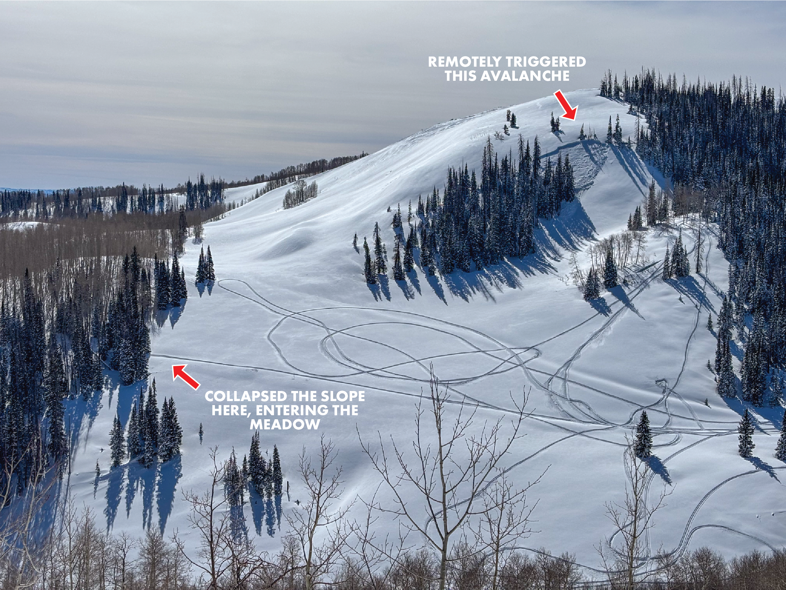
Yesterday, we remotely triggered this avalanche from nearly 1,000' away. Although this is a small avalanche and a benign piece of terrain, it is a great example of how spooky our snowpack currently is and the behavior of our avalanche problems.

On northwest through east aspects at all elevations, our January Drought Layer (JDL) is buried 1-4' deep and well preserved by our most recent set of storms that exited the region this past week. The faceted snow that is buried is extremely weak and has been coming to life with the recently received 2-3' of snow and up to 3" of SWE, in some areas across the range. We can remotely trigger todays persistent slab avalanches that will be large, up to 4' deep and break hundreds of feet wide across slopes, wrapping around features of terrain and piecing together starting zones.

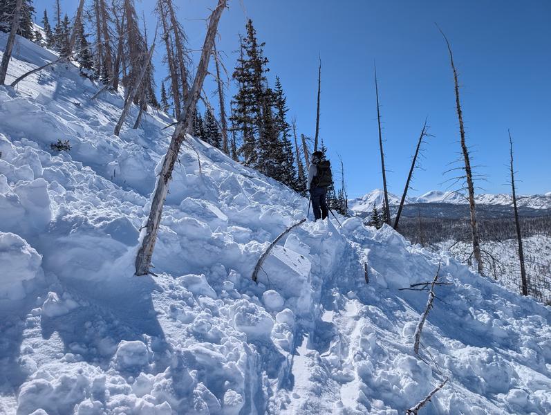
When I think of bullseye terrain where I could trigger a dangerous slide, places like Currant Creek Peak, Heber Mountain, Mill Hollow or Humpy Creek come to mind. Sure, we can trigger the big slope that has an obvious hazard to us as riders, but my greater concern is the benign, more protected slopes, that we usually ride right past or don't give much thought too. Im also thinking about cut-banks, gullies, and small terrain features that we usually don't think twice about playing on, but with our current set-up, are some things I am keeping an eye on.

We continue to see and hear lots of red flags out there -- Large cracks shooting out hundreds of feet in front of our rigs, several booming, audible collapses on the north half of the compass that rumble slopes and shake snow off the trees. Unfortunately, we are going to be dealing with this problem for a while and have to understand that avoidance is the only, and best tool for the job, when dealing with persistent weak layers.

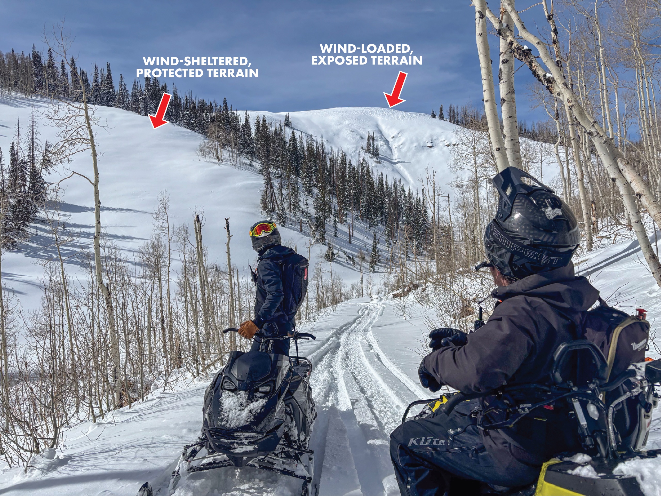
We typically would view the slope on the right as being more intimidating, and scary when it comes to avalanches, but the slope on the left is where my greatest concern lies -- Protected, wind-sheltered terrain is where a majority of our human-triggered avalanches are occurring and our snowpack is most reactive.
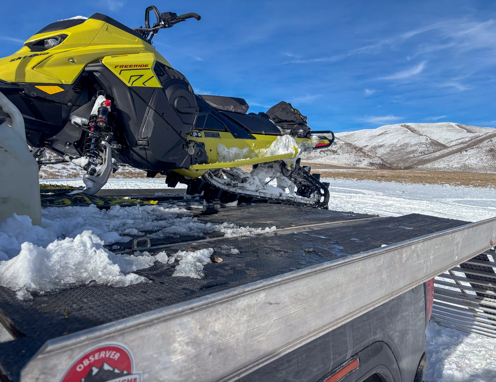
Additional Information

Join the UAC for the first "Stay and Play Avalanche Course" at Bear River Lodge in the Uintas, March 19th-22nd. This course is designed for snowmobilers by snowmobilers, where you will learn avalanche rescue, riding skills, and how to survive in the backcountry. Come enjoy all the luxury offerings at Bear River Lodge and improve your skills along the way.

Our Avalanche Rescue Training Park is set-up and located at the top of Wolf Creek Pass, SR-35, and is waiting for you to come take it for a spin! Open up the control unit, flip a few switches, and dial in your avalanche rescue skills with this roadside attraction!

General Announcements

We have some upcoming classes and events that we'd be stoked to see you at -- Please reach out with any questions and check out below for more details!

We are always looking for snow and avalanche observations or just general riding conditions. Reach out to us with questions, concerns, or if you see anything in your travels! Contact us directly through the info below:

This forecast is from the U.S.D.A. Forest Service, which is solely responsible for its content. This forecast describes general avalanche conditions, and local variations always occur. This forecast was issued on Monday, February 23rd at 0500 and expires 24 hours after it was issued. We'll update this information by 07:00 AM tomorrow.