Forecast for the Uintas Area Mountains

Andrew Nassetta
Issued by Andrew Nassetta on
Sunday morning, February 22, 2026

Today, HIGH avalanche dangers exists on wind-sheltered, northerly facing terrain and large, human-triggered avalanches are VERY LIKELY failing 2-4' deep into faceted snow, and breaking out wide, hundreds of feet across slopes. As riders, we can trigger today's avalanches from a distance, or remotely, meaning we don't have to be directly on the slope to make it slide.

Today is not the day to go big -- I am heading for sunny pow on the south half of the compass, or steering towards over-the head boondocking in low-angle, non-avalanche terrain on the north half of the compass free of any overhead hazard.

Low
Moderate
Considerable
High
Extreme
Learn how to read the forecast here
Weather and Snow

Nowcast - Crisp temperatures and clear skies kick-off the morning to start the week. Moderate winds move snow up high, between 10-20 MPH but gusting into the high 20's and low 30's.

Forecast - For today, another sunny Sunday with clear skies overhead and mild temps will help to round out the weekend. With a high near 30°F, it will feel like a typical winter day at the trailheads, but gain some elevation and find an extra bite to the chill as wind blows from the south 10-15 MPH with gusts into the 20's throughout the day.

Futurecast - We get another batch of sunny weather tomorrow, with increasing clouds in the afternoon and warming temperatures ahead of our next storm system, looking to impact the range on Tuesday night into Wednesday.

Travel Conditions - After six weeks of teaser snowfall, finally, the Uinta's got absolutely clobbered and the recent storm is nothing short of colossal. Travel and riding conditions have gone from spring-like to mid-winter in the length of a working week. Lower elevations, although thin, permit travel and some light riding while upper elevations finally look like an average winter.

Wasatch County SAR Member and Snow Professional, Ty St. Jeor, and our riding party found 5-star riding yesterday across the map. Although things are still thin in some areas and we can still find the guy in the grey suit, we are finally able to have some confidence in dipping a ski and trenching a track -- Man it feels good!

Recent Avalanches

There is no shortage of avalanche activity across the range. Multiple natural and human-triggered slides have been observed and reported across the range with a few close-calls along the way.

Yesterday, in Neeley Basin, avalanche educator and UAC Forecaster emeritus, Pat Lambrose watched a sledder high-mark, trigger, and out run this meaty piece of snow on a north facing slope at 9,800'. Craig compiled some more information on the event, and you can read more, here.

Avalanche Problem #1
Persistent Weak Layer
Type
Location
Likelihood
Size
Description

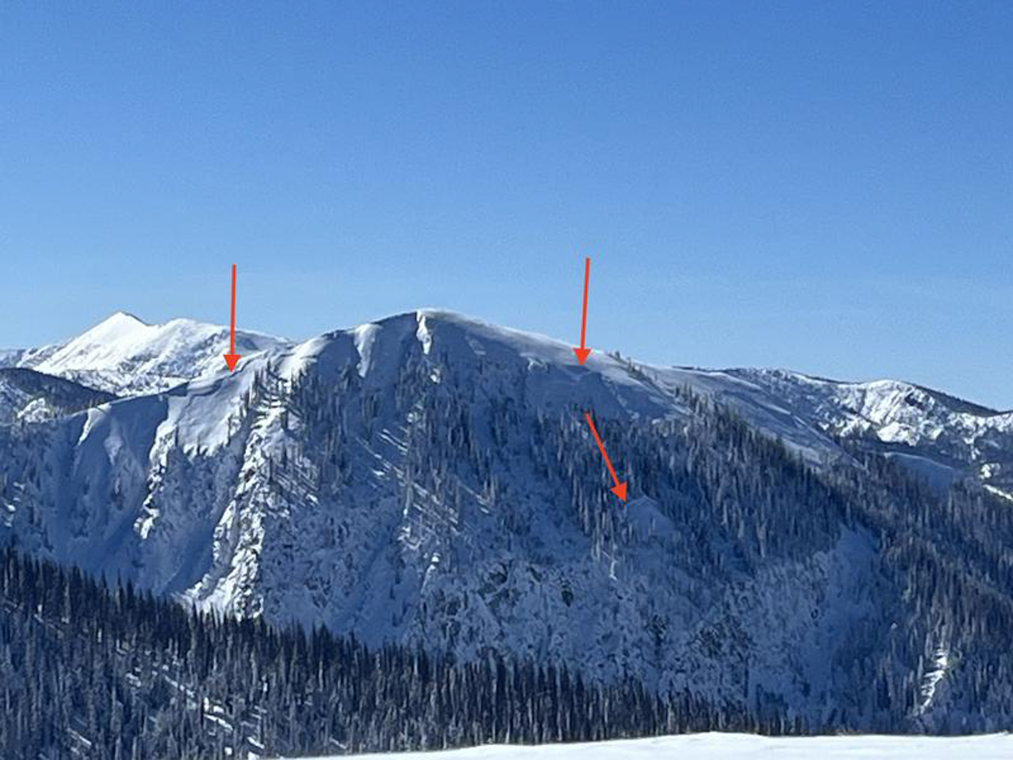
Ted was cruising around the North Slope near Moffit Basin and the Whitney Environs noting multiple large, and destructive persistent slab avalanches from the recent cycle that occurred this week. See more from his travels, here.

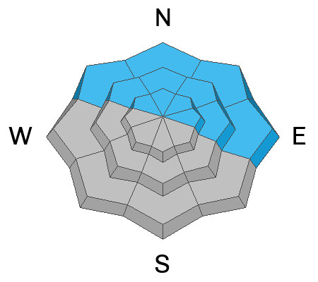
On northwest through east aspects at all elevations, our January Drought Layer (JDL) is buried 1-3' deep and well preserved by our most recent set of storms that exited the region this past week. The faceted snow that is buried is extremely weak and has been coming to life with the recently received 2-3' of snow and up to 3" of SWE, in some areas across the range. We saw a widespread natural avalanche cycle across the range, along with tons of human-triggered slides that have been reported over the past few days. Similar to what we have observed, today's persistent slab avalanches will be large, up to 4' deep and breaking multiple football fields wide across slopes wrapping around features of terrain.

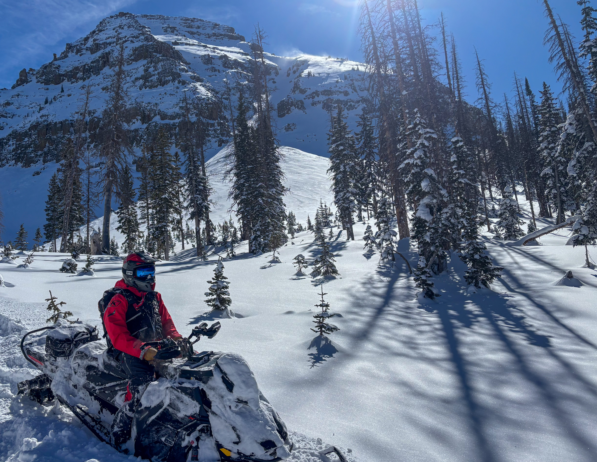
This problem is widespread across all elevations on the north half of the compass -- When I think of bullseye terrain where I could trigger a dangerous slide, places like Currant Creek Peak, Heber Mountain, Mill Hollow or Humpy Creek come to mind. Sure, we can trigger the big slope that has an obvious hazard to us as riders, but my greater concern is the benign slopes, that we usually ride right past or don't give much thought too. Im thinking cut-banks, gullies, and small terrain features that enhance the consequences if caught in even a small avalanche.

Yesterday, we had lots of obvious clues and red flags pointing at this hazard. Large cracks shooting out hundreds of feet in front of our rigs as well as several booming, audible collapses on the north half of the compass. These avalanches are deadly, tree-snapping, don't get to go home to your family slides. Unfortunately, we are going to be dealing with this problem for a while and have to understand that avoidance is the only, and best tool for the job, when dealing with persistent weak layers.

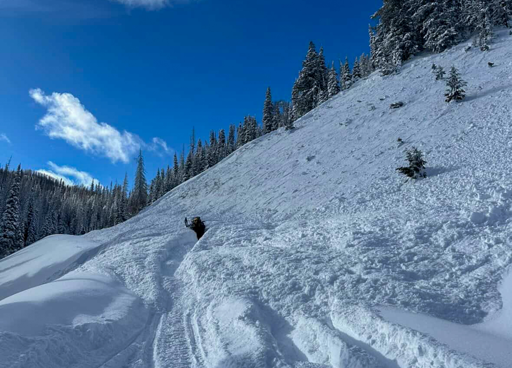
Above are the types of slopes we are concerned about today -- Wind-sheltered, benign, and waiting for a trigger. On Thursday, a savy crew of riders were working their way up Mill Hollow, and while traveling in the flats by the creek on the other side of the drainage, triggered the road cut 2' deep and nearly 750' wide stacking up an impressive amount as seen by the trench carved through the debris -- Thanks for sharing JJ!

Avalanche Problem #2
Wind Drifted Snow
Type
Location
Likelihood
Size
Description

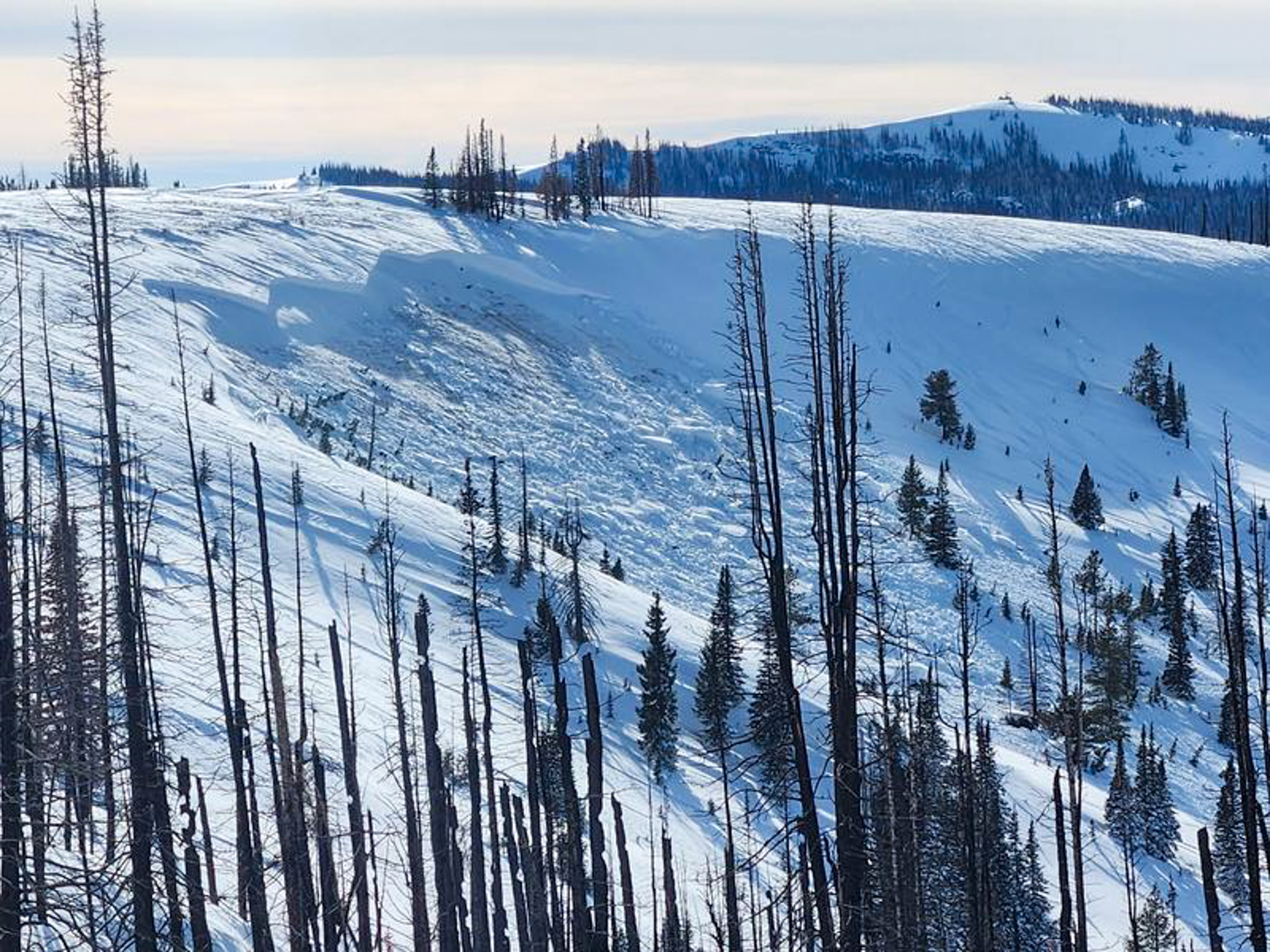
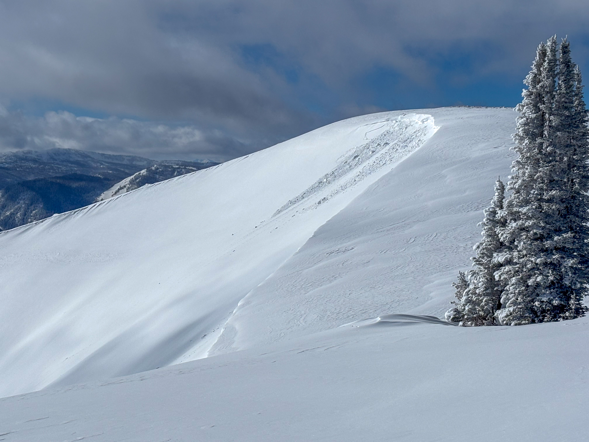
A small, natural wind-drift that failed naturally on a south facing slope at upper elevations this past week. Even a small slide like this could instantly ruin your day in the wrong piece of terrain.

Winds have been all over the map this week and there's no shortage of snow to work with and a majority of aspects are in on the action at mid and upper elevations. Not the biggest, or the baddest, today's drifts will be found on the leeward side of ridges and on specific terrain features like cross loaded gullies and convex rolls. Sitting atop a variety of snow surfaces, once triggered, today's drifts could break deeper into old snow, now buried several feet deep in our snowpack, producing a larger, more dangerous avalanche than we expected.

If the wind is blowing and there is snow to move, always keep on the lookout for freshly drifted snow. Keep watch for and avoid stiff, rounded pillows of snow that look textured and may sound hollow like a drum under our rigs, rides and feet.

Additional Information

Join the UAC for the first "Stay and Play Avalanche Course" at Bear River Lodge in the Uintas, March 19th-22nd. This course is designed for snowmobilers by snowmobilers, where you will learn avalanche rescue, riding skills, and how to survive in the backcountry. Come enjoy all the luxury offerings at Bear River Lodge and improve your skills along the way.

Our Avalanche Rescue Training Park is set-up and located at the top of Wolf Creek Pass, SR-35, and is waiting for you to come take it for a spin! Open up the control unit, flip a few switches, and dial in your avalanche rescue skills with this roadside attraction!

General Announcements

We have some upcoming classes and events that we'd be stoked to see you at -- Please reach out with any questions and check out below for more details!

We are always looking for snow and avalanche observations or just general riding conditions. Reach out to us with questions, concerns, or if you see anything in your travels! Contact us directly through the info below:

This forecast is from the U.S.D.A. Forest Service, which is solely responsible for its content. This forecast describes general avalanche conditions, and local variations always occur. This forecast was issued on Sunday, February 22nd at 0400 and expires 24 hours after it was issued. We'll update this information by 07:00 AM tomorrow