Forecast for the Uintas Area Mountains

Andrew Nassetta
Issued by Andrew Nassetta on
Sunday morning, January 18, 2026

Today, LOW avalanche danger exists across the range and human triggered avalanches are UNLIKELY.

As riders, when the likelihood of triggering avalanches goes down we begin stepping into bigger, and more exposed terrain. With that in mind, remember LOW avalanche danger does not mean no danger. Even an small avalanche in steep, rocky, rowdy terrain could knock you off your rig and result in a nasty outcome.

Low
Moderate
Considerable
High
Extreme
Learn how to read the forecast here
Weather and Snow

Nowcast - A clear and crispy start to the day with stars overhead. 0500 AM temperatures sit cool at trailheads, in the teens, with upper elevations reporting closer to 25 °F. Winds blowing from the northwest are light, around 10 MPH while gusting into the teens.

Forecast - Sunshine and mild temperatures will be the theme, once again. Expect clear skies, a high of 30 °F, and winds to blowing from the northwest around 10-15 MPH.

Futurecast - Enjoy the sun and get after it out there while we can, we wont be seeing any snow until the end of the month unfortunately.

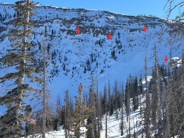
Travel Conditions - Snow depths across the range are 1-4' above 9,000' and supportable. Below that, and on many southerly elevations, the pack is thin. Access is challenging, and the snowpack has lost any integrity and resilience to the elements it once had. In many areas on the north half of the compass the pack has faceted in its top 1', and is quickly becoming unsupportable. On the sunny's, there is a mixed bag of crusts and powder is hard to find. For the best riding, I am shooting for upper elevation, north facing terrain that is not steep or rocky, has good coverage and is well protected from the elements.

Out on sunny, south facing slopes we noticed consistent, but light winds blowing from the northwest. With limited snow available for transport and a variety of surfaces to land on, the wind loading created more of a dappled refresh for riding than any concern for wind-drifted avalanches.

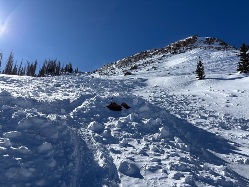
Shady, sheltered, north facing terrain out of the windone was the ticket yesterday, and will continue to be today.

Recent Avalanches

There have been no avalanches reported from across the range in the past 24 hours.

Avalanche Problem #1
Persistent Weak Layer
Type
Location
Likelihood
Size
Description

Above, a large avalanche on Ramona Peak was observed and most likely occured a few weeks ago after our most recent round of storms. The red arrows indicate crow lines in steep, rocky, and shallow terrain.

We have not seen avalanches on persistent weak layers in almost two weeks and aren't showing signs of reactivity. Even though the snowpack is beginning to relax and the likelihood of triggering a deep, dangerous avalanche is decreasing, I am still avoiding slopes like the one in the image above. As always, large cornices are concern me and always have the potential to trigger larger avalanches than expected.

As riders, all we need to do is find a thin portion of the snowpack like around a rock or bush. Here the snowpack is susceptible to our own weight, we can collapse the slope (whumpf), and now we're staring down the barrel of a larger piece of snow than we expected. Although the chance of triggering a big slide are unlikely, I am still avoiding steep, rocky slopes, with a shallow and weak snowpack, as seen in the images above and below.

The scene of a snowmobile triggered avalanche from last week near The Cone at 11,000'. Details, along with a few snowmobile sized holes from the debris pile show that it could have been a close call, but first-hand information is sparse.

General Announcements

We have some upcoming classes and events that we'd be stoked to see you at -- Please reach out with any questions and check out below for more details!

We are always looking for snow and avalanche observations or just general riding conditions. Reach out to us with questions, concerns, or if you see anything in your travels! Contact us directly through the info below:

This forecast is from the U.S.D.A. Forest Service, which is solely responsible for its content. This forecast describes general avalanche conditions, and local variations always occur. This forecast was issued on Sunday, January 18th at 0500 AM and expires 24 hours after it was issued. We'll update this information by 07:00 AM tomorrow.