Forecast for the Provo Area Mountains

Drew Hardesty
Issued by Drew Hardesty on
Friday morning, January 16, 2026

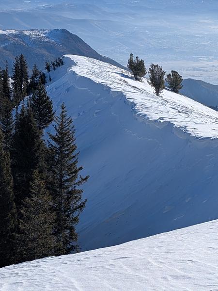
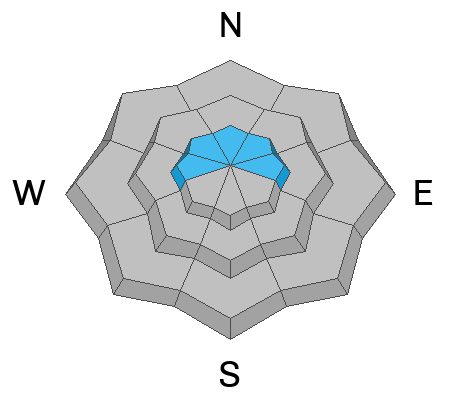
The overall avalanche danger is LOW and the snow is mostly stable. It is unlikely but not impossible to trigger avalanches in isolated terrain. Continue to exercise caution in the upper elevations where pockets of hard and soft slabs of wind blown snow may be triggered around terrain features.

Remember that RISK is inherent in mountain travel.

Low
Moderate
Considerable
High
Extreme
Learn how to read the forecast here
Weather and Snow

Skies are clear with light to moderate winds out of the north. Temperatures are in the mid to upper 20s. Today will be a carbon copy of the day before and the day before that, only with slightly cooler temps and slightly increased winds. Low tide conditions exist in the Provo mountains with just 2-3 feet of base on the polar aspects and half of that - or even bare ground - on the sunny side of the compass. Still, travel is easy with the crusts and dense snow and the views are 5-star.

Recent Avalanches

We didn't hear of any avalanches in the Provo area mountains, but in upper Snake Creek of the Brighton perimeter, a long time backcountry observer noted what looked to have been a recent natural shallow soft slab avalanche in the Caribou Basin (9700’ north aspect). The reporting party thought the avalanche possibly occurred on Wednesday, January 14th...and was the result of heavy wind drifting just to the lee of the ridgeline. (pc: CFrantz)

Avalanche Problem #1
Persistent Weak Layer
Type
Location
Likelihood
Size
Description

There have been hours of discussion, head scratching and contemplation in recent days about the persistent weak layer on the northern aspects at upper elevations as it has gradually gone quiet. We have not seen or heard of avalanche activity involving this layer since the Stairs Gulch event in the central Wasatch last weekend, and prior to that was 10 days ago - also in the central Wasatch . It doesn’t mean that the persistent weak layer is gone, but rather the mild weather and lack of loading has provided a stabilizing trend.

Areas on north aspects, particularly where the snowpack is shallow near rocks and cliffs could still be problematic. Continue to exercise caution in this terrain.

Avalanche Problem #2
Normal Caution
Type
Location
Likelihood
Size
Description

This is not a specific avalanche problem. It is a very inconclusive scenario, without a clear pattern that a user could follow to lower consequences. Any avalanche type is possible. Shallow wet loose avalanches may be expected during the heat of the day and pockets of wind drifted snow may be encountered to the lee of ridgelines and other terrain features. Do not consider the absence of a typical avalanche problem as safe conditions.

Normal caution is still advised.

General Announcements

This information does not apply to developed ski areas or highways where avalanche control is normally done. This forecast is from the U.S.D.A. Forest Service, which is solely responsible for its content. This forecast describes general avalanche conditions and local variations always occur.