Forecast for the Ogden Area Mountains

Brooke Maushund
Issued by Brooke Maushund on
Saturday morning, March 7, 2026

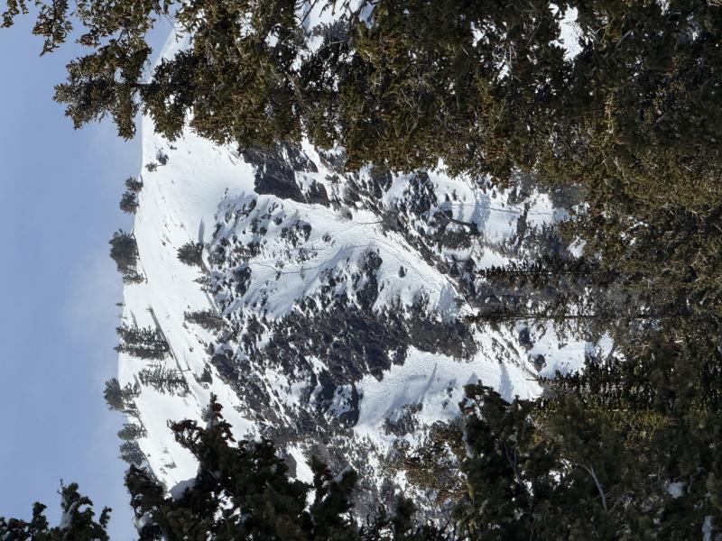
MODERATE avalanche danger exists on most slopes. On mid- and upper-elevation slopes, you can trigger slabs of wind-drifted snow at mid- and upper-elevations large enough to catch and carry you. On the S half of these slopes, expect wet snow avalanches to become increasingly likely throughout the day as the new snow sees sunshine and warming temperatures.

It is still possible to have one of these smaller slides step down to a buried persistent weak layer (PWL) failing 1-3 feet deep that could fully bury you on mid- to upper-elevation slopes facing W-N-E.

Low
Moderate
Considerable
High
Extreme
Learn how to read the forecast here
Special Announcements

All four final avalanche accident reports (Caribou Basin, Butler Basin, Mary Main Bowl, and Ant Knolls) are now published. These reports represent four avalanche fatalities in the five days between February 18th-February 22nd.

Thank you to everyone involved for sharing information. As with all avalanche accidents, we hope to learn something to prevent future accidents. Our deepest condolences go out to the families, friends, rescuers, and everyone affected by these tragic accidents.

Weather and Snow

Yesterday, the storm system largely tapered off into the afternoon. Low hanging clouds—that made Nikki and I ease off the throttle as we rode through the milk bottle at Monte Cristo yesterday—cleared into the evening in the mountains East of Eden, with trace to 2 inches of graupel falling. Shifting winds from the NE to NW blew and decreased to light overnight, as temperatures dropped into the low 20s to mid teens F. Totals for the storm, with some graupel mixed in:

  • Ogden Skyline: 8-10 inches of snow // 0.8-.9 inches of H2O
  • Mountains East of Eden: 6-10 inches snow // 0.4-0.9 inches H2O

Today, we enter a quieter and drier period. Most notably, the sun will come out in long stretches during the day for the first time since new snow fell. Temps will rise into the mid to high 30s F. Winds won't do much in terms of cooling off the snow surface, as they stay at light and variable throughout the day.

Looking ahead, temperatures will continue to rise above seasonal norms into next week after this slightly cooler spell due to the departing storm.

Recent Avalanches

Wind slab and dry loose activity at ski areas yesterday: Ski areas reported small wind slabs at upper elevations yesterday, with dry loose sluffs running far and fast on slick crusts.

See all observations from the Ogden zone HERE.

Avalanche Problem #1
Wet Snow
Type
Location
Likelihood
Size
Description

6-10 inches of new snow will see sustained sunshine and temps close to or above freezing for the first time today. Expect the possibility of wet snow avalanches to increase throughout the day as temperatures rise and the new snow sees more sun.

Roller balls, pin wheels, and sinking in the snow surface more than you were earlier in the day are signs to change aspect or head back to the truck. If the snow is becoming wetter—easier to make a snowball with—than previously, wet snow slides are on the menu. These will be most likely on slopes facing the S half of the compass where snow exists, near rocks, and along cliff bands. Be aware that these can start small before fanning out and gaining a lot of weight and force as they collect more snow moving downhill.

Wet loose activity Taylor Lais and I spotted near Island Peak from Cutler Ridge on Wednesday that likely ran the day prior during the strong sun.

Avalanche Problem #2
Wind Drifted Snow
Type
Location
Likelihood
Size
Description

There were pockets of wind-drifted snow before this storm, and another fresh 6-10 inches fell with wind during it. Drew found small, dense wind slabs when he visited Snowbasin Thursday. Winds stayed at perfect loading speeds through the storm, meaning you can find two types of wind slabs:

  1. New, more reactive slabs will freshly built from the new snow.
  2. Older, more stubborn pockets will be harder to identify as the new snow covers the older, textured snow surfaces.

You will be able to trigger both new and old wind slabs at mid- and upper-elevations on all aspects. These will be most likely at upper elevations, near ridgelines and on exposed mid-slope catchment areas like gullies and convex rolls on slopes facing SE-E-NE. These can be as small as a pocket around your machine's ski, or big enough to wipe a rider off a slope. These may propagate wider than expected and be triggered from a distance if they fail down into the weak faceted snow from January (DJL)—more on that below.

New snow: In areas with higher accumulations, be aware of the possibility of triggering loose, dry sluffs of new snow that may run far and fast on crusts. In protected mid- to low-elevation areas, know that slabs of new snow may develop and possibly propagate widely if deposited on weaker snow or slick old crusts.

Drifts, dunes, and pillows like these from Monte Cristo yesterday are signs the wind has been at work.

Avalanche Problem #3
Persistent Weak Layer
Type
Location
Likelihood
Size
Description

This season's been nothing but irregular, and the Dry January Layer (DJL) is no exception right now. The weak, old snow that sat out during January is still there, and has become damp to wet in some locations with the warmer weather in the recent days. The layer is trending more stubborn since it's first loading event in recent weeks, but wet facets do weird things.

On Cutler Ridge on Wednesday, the wetted DJL to propagated with easy force (ECTP3) on our first test—see the surprising video below—before not being able to get the layer to propagate at all in the next 4 tests we conducted (ECTN). This just shows the irregularity with the snowpack this year, and how high our uncertainty is wtih more loading. This wet, warm, and weird setup is going to be a bit of a puzzle in how exactly it reacts to a sizeable loading event.

As we add more load and stress to this layer with new snow today, know it is still possible to trigger a slab on the PWL on mid- (NW-N-E) and upper elevation (W-N-E)slopes up to 3 feet deep. Any new snow or wind slab avalanches have the potential to step down into this weak, old snow and create a much larger slide than modest new snow totals might make you expect. This possibility is more likely in and along thinner, rocky snowpack areas.

I would approach any steep slope that harbors this layer of facets with caution.

General Announcements

This information does not apply to developed ski areas or highways where avalanche control is normally done. This forecast is from the U.S.D.A. Forest Service, which is solely responsible for its content. This forecast describes general avalanche conditions and local variations always occur.