Forecast for the Ogden Area Mountains

Bo Torrey
Issued by Bo Torrey on
Thursday morning, March 26, 2026

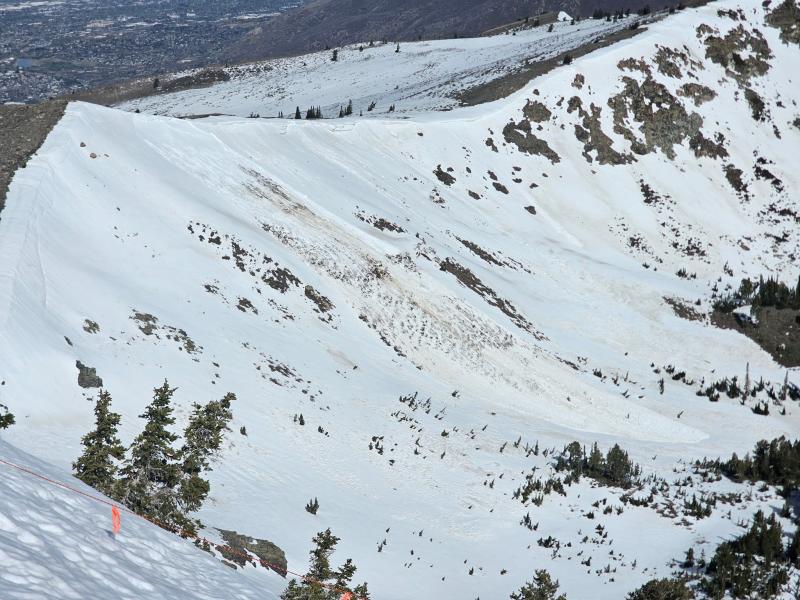
The avalanche danger is MODERATE. As snow surfaces become loose and unsupportable, expect to trigger wet snow avalanches on steep slopes. Large wet-loose and wet slab avalanches have occurred in the last few days, and remain possible today.

(Gray on the danger rose indicates little to no snow.)
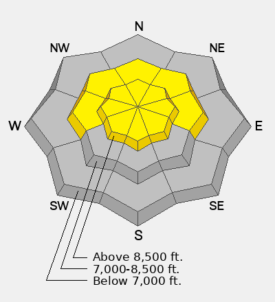
Low
Moderate
Considerable
High
Extreme
Learn how to read the forecast here
Special Announcements

A new version the UAC's mobile app has been released with many new features and performance improvements. Download our app today, available on iPhone and Android. Learn more HERE.

Weather and Snow

Overnight, clouds moved in with a brief period of light rain showers. Overnight low temperatures range from the mid 40s to low 50s °F. Winds blew from the west at 15-25 mph with gusts in the low 30s on Mt. Ogden. Any surface refreeze from overnight won't last long once the sun rises and daytime temperatures warm.

Today, skies will be partly cloudy with mountain temperatures rising into the 50s °F. Winds blow from the west-northwest at 15-25 mph with gusts into the 40s along upper elevation ridges. Later this evening, temperatures begin to drop to near freezing.

Recent Avalanches

On Tuesday, Avalanche control teams noted a large natural wet slab avalanche in the upper Jacobs Creek area along the Ogden skyline south of the Weber River. The avalanche occurred on a steep easterly facing aspect near 9000 feet, and may have been triggered by natural cornice fall.

Avalanche Problem #1
Wet Snow
Type
Location
Likelihood
Size
Description

While temperatures will begin to cool later today, daytime highs still reach into the 50s, and meltwater will continue to move through the snowpack, maintaining conditions for wet slab avalanches to fail. Even after colder temperatures arrive, it will take some time for the meltwater to stop and the snowpack to stabilize.

Wet Loose - This will be the most common concern and the easiest to trigger. As the snow surface becomes soft and slushy, you can trigger wet loose avalanches that start in the surface snow and gouge down into the saturated snowpack. These avalanches start small and can quickly gain volume and speed as they entrain snow.

Wet Slabs - As meltwater moves deeper into the snowpack, it can pool on buried crusts or weak layers, weakening the structure and allowing avalanches to break deeper and wider. These are larger and more destructive avalanches and may occur naturally, possibly failing down around crusts that formed over the holidays in late December.

General Announcements

This information does not apply to developed ski areas or highways where avalanche control is normally done. This forecast is from the U.S.D.A. Forest Service, which is solely responsible for its content. This forecast describes general avalanche conditions and local variations always occur.