Forecast for the Ogden Area Mountains

Issued by Nikki Champion on
Wednesday morning, March 11, 2026
Wednesday morning, March 11, 2026
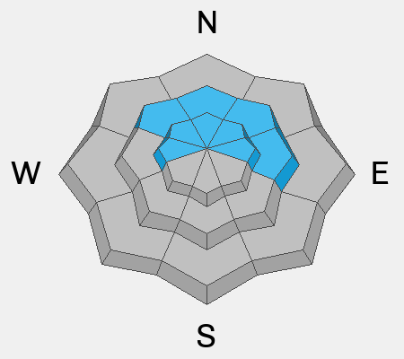
After several days of strong westerly winds, avalanche danger is MODERATE across all upper elevations and on some mid-elevation slopes facing north through northeast, where it’s possible to trigger either a stubborn hard slab or a shallow soft slab of wind-drifted snow.
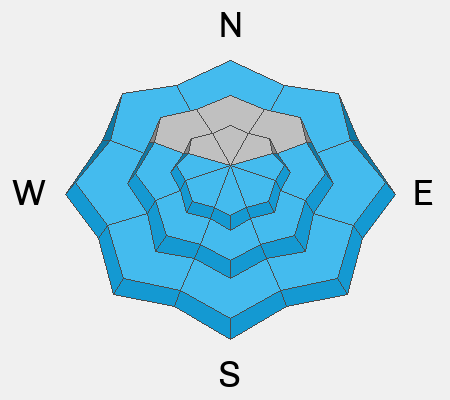
The remaining aspects and elevations have a LOW danger this morning. However, as the strong March sun comes out, wet-snow avalanches may become possible on east, south, and west aspects, as well as on low-elevation northerly slopes, and avalanche danger may rise to MODERATE by the late afternoon. Pay attention to changing conditions; if a slope becomes unsupportable, it’s time to switch aspects.
Low
Moderate
Considerable
High
Extreme
Learn how to read the forecast here