Greatest Rain on Earth?!?: Forecaster Drew Hardesty penned a new essay about high-elevation rain and the warm-snow drought HERE.
Weak Snow: Today's Surface, Tomorrow's Avalanche Problem: Essay by UAC Director Paige Pagnucco HERE.
Currently, the skies are clear. Temperatures are in the upper 20s to low 30s°F. Most sites recorded several hours of below-freezing temperatures, which should provide a longer window for safer and supportable travel on sunny slopes. Overnight, winds blew from the west at 10–15 mph, with gusts into the 20s on Mount Ogden
Today, we'll see increasing cloud cover, with daytime temperatures climbing a few degrees higher than yesterday, into the upper 40s °F. The wind continues to blow from the WSW, at 15-25 mph.
Looking ahead: We will start to see a change in the weather on Monday as a storm moves across northern Utah. We could see a couple of inches, but more substantial accumulation won't begin until Tuesday or Wednesday. There is still a wide range in potential snowfall, but some accumulation is likely, and the weather looks to remain active through late next week and beyond.
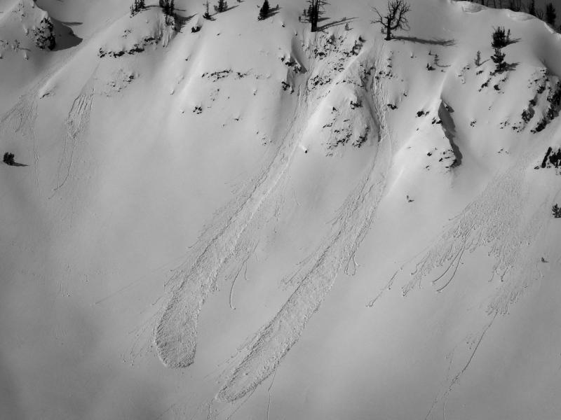
UAC Forecaster, Greg Gagne, was up on Cutler Ridge yesterday. He found stable conditions, but noted weak faceted snow capped by a thin layer of dense snow from the warm temperatures. You can view his excellent observation here.

No avalanches were reported from the backcountry yesterday. You can view recent observations here.