Greatest Rain on Earth?!?: Forecaster Drew Hardesty penned a new essay about high-elevation rain and the warm-snow drought HERE.
Weak Snow: Today's Surface, Tomorrow's Avalanche Problem: Essay by UAC Director Paige Pagnucco HERE.
Currently, the skies are mostly clear. Temperatures are hovering around 32°F at 8000 feet. This will create a shallow refreeze and a brief window for supportable travel on sunny slopes. Overnight, the wind blew from the SW at 10–25 mph, with gusts reaching 30mph on Mt. Ogden.
Today, we'll see mostly sunny skies, with daytime temperatures warming into the mid-40s °F by the afternoon. The wind continues to blow from the SW, at 10-20 mph.
Starting on Monday, we will see a change in the weather as snowfall returns. The initial waves of precipitation, from Monday to Wednesday, don't look like blockbusters, but they may be the first in a series. Stay tuned.
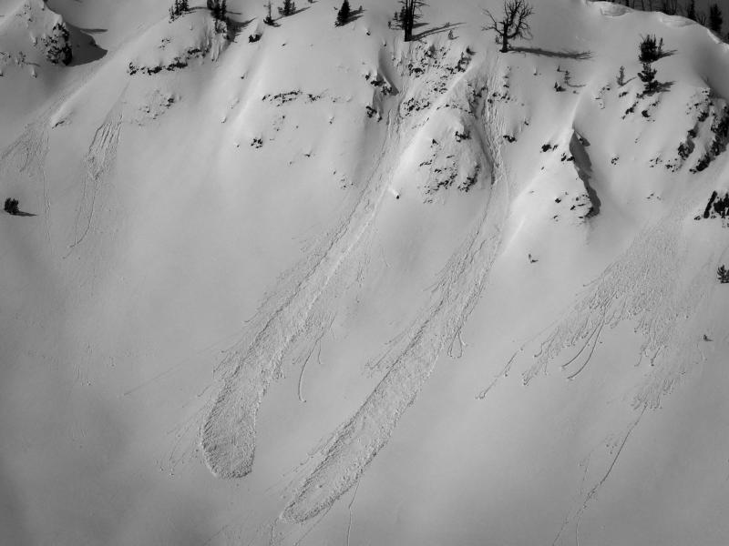
Thursday, a skier triggered a wet-loose avalanche on Bountiful Peak (East-southeast facing slope @ 9000'), pc: Logan Jamison
No avalanches were reported from the backcountry yesterday. You can view recent observations here.