Special Avalanche Bulletin
What
The Utah Avalanche Center is warning of dangerous avalanche conditions throughout the mountains of northern Utah and southeastern Idaho this week where heavy snowfall and strong winds have created a CONSIDERABLE to HIGH avalanche danger. Large and unsurvivable tree snapping avalanches 4-6 feet deep have already occurred, two riders were critically buried in an avalanche in the Brighton backcountry on Friday, and more human-triggered avalanches are expected, with natural avalanches possible.
When
In effect from 3PM MST today to 6am MST Wednesday
Where
For the mountains of Northern Utah including the Wasatch Range...Bear River Range...Uinta Mountains.
Impacts
Dangerous avalanche conditions exist on many slopes. Avalanches are likely to be triggered by anyone traveling on or below slopes steeper than 30 degrees and may be triggered remotely (from a distance) or from below. People stepping out of bounds at a ski area are stepping into the same very dangerous avalanche conditions.
As of 5 am, 24-hour totals (in inches) are roughly 12" snow containing 2" water.
Winds are from the west/southwest and sustained, averaging in the teens and 20's mph (perfect wind speeds for creating fresh wind drifts) with overnight gusts of 30-45 mph along exposed mid and upper-elevation ridgelines Temperatures range through the 20's °F.
For today, expect periods of heavy snowfall this morning and moderate to strong winds, with another 2-4 inches of snow expected. Snowfall rates will be the highest this morning, before tapering to snow showers this afternoon. Temperatures will rise into the upper 20's °F.
After a short break, another storm is expected later Wednesday. This will be a more traditional storm featuring colder temperatures and lower-density snowfall.
We received an excellent observation from Logan Jamison who braved the poor low-elevation conditions to be rewarded by decent travel and riding conditions above 8,000 feet on Cutler Ridge.

Logan Jamison from Cutler Ridge on Sunday
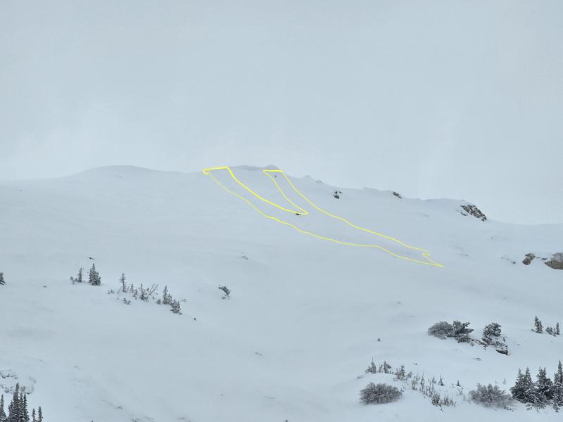
To our south on Sunday in the Salt Lake mountains, a party on the ridgeline above Two Dogs in Days Fork unintentionally released a cornice onto the slope below which triggered an avalanche that initially failed above the Christmas rain crust (CERC) layer, but stepped down to facets and depth hoar at the ground. The slide was on a northeast-facing slope at 10,100 feet and was 4.5 feet deep, 250 feet wide, and ran 700 feet, snapping trees along the way.
Read all backcountry observations here.
Derek DeBruin spotted a sizeable D2 near 9600 'on the South Face of Ben Lomond yesterday. It appears to have run on the slick crust below the new snow. Read his full ob HERE.
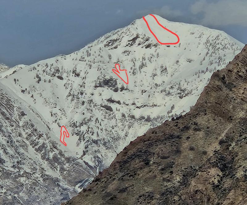
Kaufman also went out for a walk along Cutler Ridge to find a wind slab that released near ridgeline at 9500' on a NE facing slope. You can find his avalanche observation HERE.