Issued by Toby Weed on Friday morning, January 8, 2021
Dangerous avalanche conditions and CONSIDERABLE danger exist on previously drifted upper and mid elevation slopes facing northwest through southeast, and people are likely to trigger avalanches failing on a sugary persistent weak layer near the ground. You'll find safer conditions in sheltered and lower elevation terrain, but avalanches are still possible. Avalanches could be triggered remotely or from a distance.
Cracking and collapsing indicate unstable snow.
Evaluate snow carefully, choose your route cautiously, and make conservative decisions.
Avoid and stay out from under drifted slopes steeper than about 30 degrees.
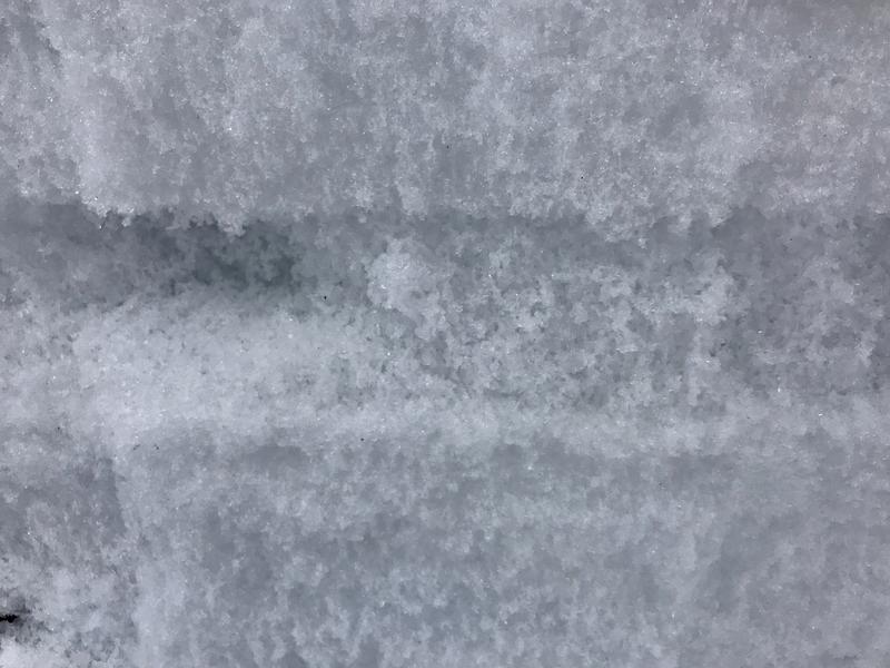
Heavy new snow and drifting from strong westerly winds earlier in the week and especially in the northern part of the Logan Zone overloaded widespread preexisting sugary weak snow, and created dangerous avalanche conditions in the backcountry. The snow pack is generally quite shallow in the Logan Zone and we have a serious problem with widespread very weak sugary snow and a dangerous persistent weak layer near the ground on most slopes. Due to the very shallow snow cover and cold mountain temperatures the faceted snow crystals continue to grow, and on many slopes existing weak layers appear to be getting even weaker.
At upper elevations in the central and northern Bear River Range there is a around three feet of snow, which is only enough to cover the rocks on smooth grassy slopes. Even though I was going slow, watching where I was going, and trying to avoid hitting rocks at upper elevations on Tuesday, I hit one hard and bent an A-arm! In the Logan Peak Area, the Southern Bear River Range, the front side (or western slope), and the Wellsville Mountains, the snow is even shallower and access and travel is more difficult.
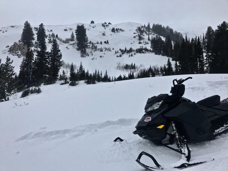
We went for a ride on Tuesday to look at the new snow in the Tony Grove Area, and here are the results of some of out tests:
Expect partly sunny skies, increasing clouds, light south winds, and 8500' temperatures around 27°F. There is a good chance for some snow in the mountains tonight, and 1 to 3 inches of accumulation is expected at upper elevations. High pressure will return Sunday, and remain in place through much of next week.
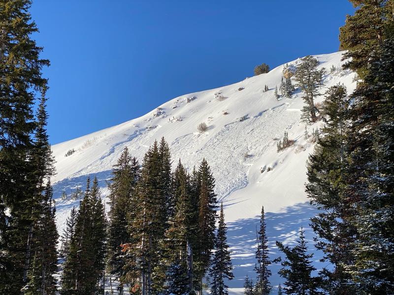
Here's a quick look at the snow and a recent remotely triggered avalanche up in Providence Canyon.
Recent Avalanches
Riders in upper Providence Canyon Wednesday remote triggered a few good sized avalanches from a good distance away in the flats...
A remote triggered avalanche from 1-6 in lower Three Terraces Bowl near the warming hut.
Avalanche Problem #1
Persistent Weak Layer
Type
Location
Likelihood
Size
Description
The buried persistent weak layer problem involving sugary faceted snow is a very dangerous and notoriously tricky avalanche problem, and it is responsible for most fatalities, injuries, and close calls in the Logan Zone.
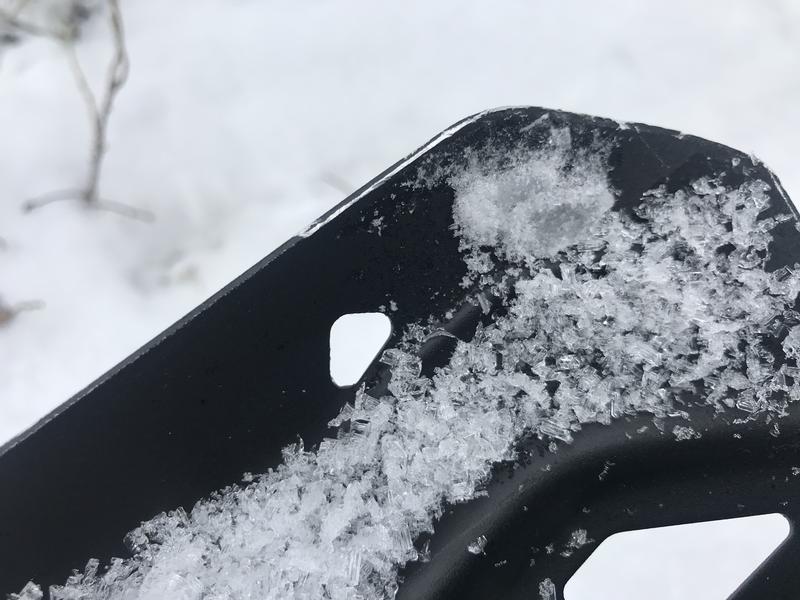
I found these nice large faceted grains or depth hoar in a very weak buried persistent weak layer in Three Terraces in Upper Providence Canyon yesterday.
Avalanches failing on a persistent weak layer can be very sensitive, and they might be triggered remotely, from a distance, or worse from below!
Cracking and collapsing of the snow are a red flag, indicating unstable snow conditions.
Avalanche Problem #2
Wind Drifted Snow
Type
Location
Likelihood
Size
Description
People could trigger 1 to 3-foot-thick slab avalanches of previously drifted snow on steep slopes, especially where drifts formed on slopes with preexisting weak surface snow or buried persistent weak layers. Watch for and avoid stiffer drifted snow at upper and mid elevations near ridge tops and in and around terrain features like gullies, cliff bands, and sub ridges. Avalanches of wind drifted snow could be triggered remotely or from a distance.
Harder wind slabs may allow people to get out on them before releasing.
Additional Information
Check out our new and relevant Blog featuring Paige and Greg discussing Danger Ratings and Persistent Weak Layers....HER
My tip for avoiding avalanches in the backcountry is to keep your slope angles low. Avoid and stay out from under slopes steeper than about 30 degrees. Get a tool to measure slope angle and practice with it in the backcountry. Watch the video HERE.
Paige shows what we are talking about when we mention faceted snow in our forecasts. Watch the video HERE
General Announcements
Thanks to the generous support of our local resorts, Ski Utah, and Backcountry, discount lift tickets are now available. Support the UAC while you ski at the resorts this season. Tickets are available here.
EMAIL ADVISORY. If you would like to get the daily advisory by email you subscribe HERE.
Remember your information can save lives. If you see anything we should know about, please help us out by submitting snow and avalanche observations....HERE. You can also call us at 801-524-5304, email by clickingHERE, or include #utavy in your tweet or Instagram.
I will update this forecast by around 7:30 tomorrow morning.
This forecast is from the USDA Forest Service, which is solely responsible for its content. The forecast describes general avalanche conditions and local variations always occur.