Observation Date
12/5/2024
Observer Name
Gagne
Region
Salt Lake » Little Cottonwood Canyon » Grizzly Gulch
Location Name or Route
Grizzly Gulch/Patsy Marly
Comments
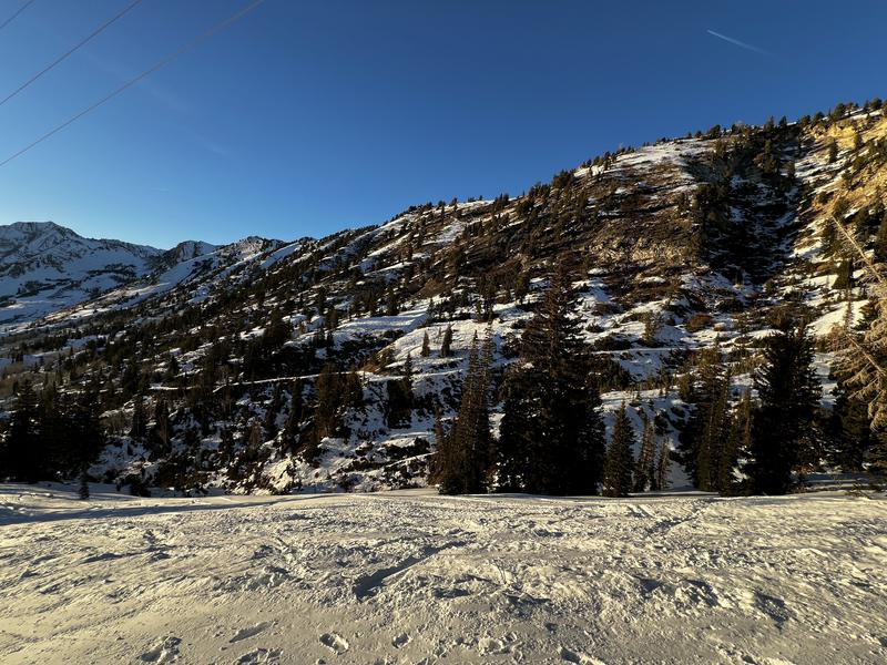
The snowpack is bleak for early December:
- southerly-facing slopes are moth-eaten with patches of bare ground;
- northerly-facing slopes continue to facet throughout the entire snowpack.
I was able to get full propagation (ECTP22) on a NE aspect at 10,000 with a 70 cm (40") snowpack that failed down in the facets near the ground. But for the most part, the snowpack is weakening throughout, especially on NE aspects. (Mark White was also seeing the same in the Wilson Chutes on Wednesday where NE aspects were especially weak.)
The surface is also quite weak, with widespread surface hoar up to 1 cm wide and near-surface facets. I was also seeing radiation recrystallization (RR) on east and west aspects. RR is a thin layer of faceted snow that sits a few mm above a sun crust, and it can be a dangerous weak layer if buried under new snow. All this to say we have a mixture of weak snow on slopes that currently hold snow which will be an issue when it snows again.
Photos of radiation recrystallization crystals and the moth-eaten southerly facing slopes.


Today's Observed Danger Rating
Low
Tomorrows Estimated Danger Rating
Low
Coordinates


