The First Annual Avalanche Awareness Week is December 2-7 We have a week full of fun and educational events planned. Check out the schedule
here.As part of your early season tune-up, consider taking an avalanche class. We have lots of avalanche education classes listed already, from Know Before You Go to Companion Rescue to our Backcountry 101. Click on the Education menu on our webpage for a full list of classes from the UAC and other providers. Check out the Know Before You Go
eLearning program for free, online, avalanche classes.
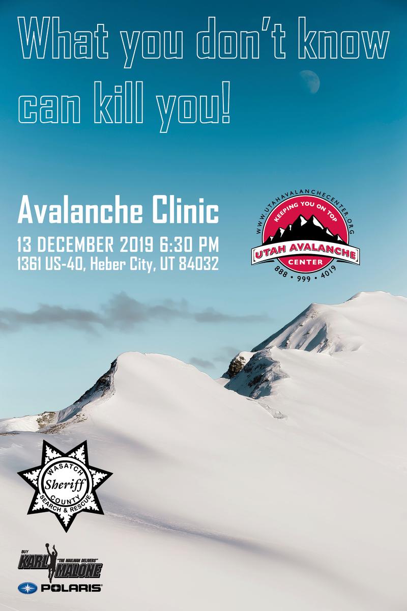
Please join me on Friday Dec. 13th at 6:30 for a free avalanche awareness presentation in partnership with Wasatch County SAR. It's guaranteed to be entertaining, informative, and I'll share safety tips that allow you to rip powder safely and come home to your families at the end of the day.... pretty good deal... huh?
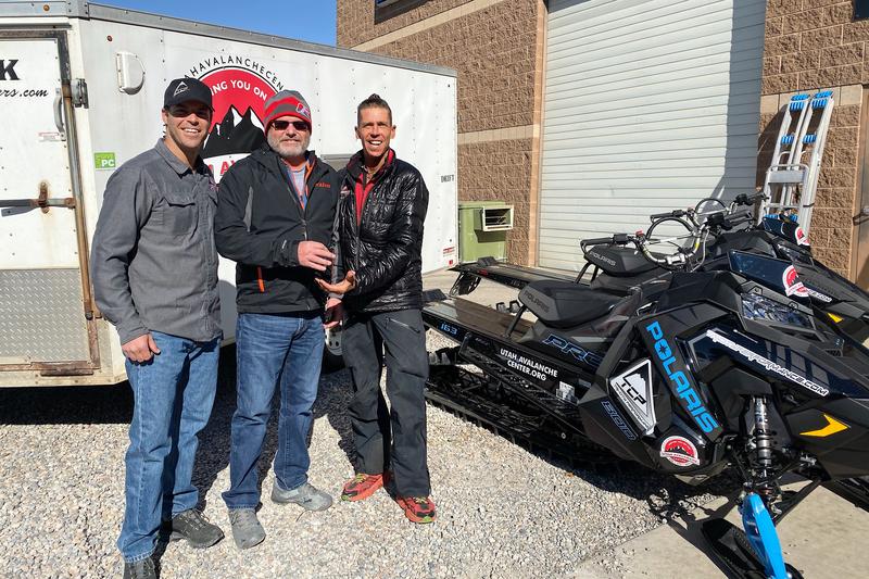
Huge thanks to Mike Poulsen and all the crew at Tri-City in partnership with Polaris for the continued support they offer the UAC. Here, Mike hands the keys of two loaner sleds over to Mark and Craig for the 2019-2020 winter season.
The midweek storm was a bust for us as it took a scenic route, focusing on the southern half of the state. As a result, the Uinta's only stacked up 3-4" of heavy, dense snow along the high peaks.
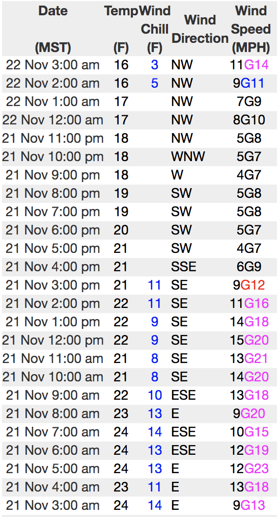
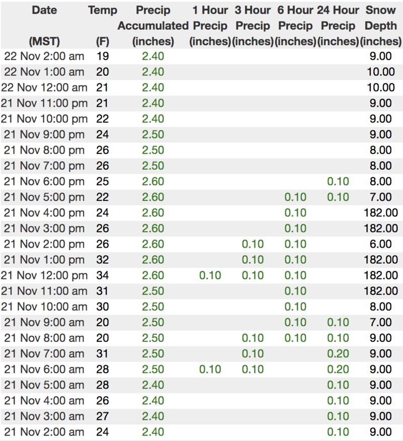
Under mostly cloudy skies, temperatures are in the teens and winds are light and northerly. The bad news is... the snowpack has taken a hard hit the past two weeks, shrinking right before our eyes. The badder news is... there's hardly enough snow to move around on and in the absence of additional snow, our shallow pack loses its strength, transforming into a very weak, sugary mess. This makes for a potentially dangerous setup once winter decides to return from its hiatus.
Above is 24 hour weather data from Windy Peak (10,662') and Chalk Creek (9,169')
Click
here for more real time Uinta winds, temperatures, and snow depth.
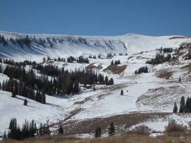
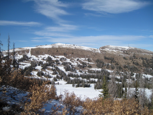
Ted was around Whitney Basin last week and found upper elevation, shady terrain holding snow from the early and mid October storms. While the other half of the compass offers late Autumn trail riding.
It'll be a minute or two before we're riding, but in the mean time here's a few things to remember:
JUST 'CAUSE YOU CAN SEE YOUR RIG PARKED BY THE SIDE OF THE ROAD DOESN'T NECESSARILY MAKE THE SLOPE YOU CHOOSE TO RIDE MORE SAFE
No new avalanche activity to report