Forecast for the Uintas Area Mountains

Craig Gordon
Issued by Craig Gordon on
Thursday morning, March 26, 2026

Heads up... the snowpack hasn't experienced a solid freeze in over a week and I suspect the wheels on the bus are beginning to wobble.

Mid and upper elevation polar terrain facing the north half of the compass offers a deceptively tricky, MODERATE avalanche danger. During the heat of the day, both human-triggered and natural wet snow avalanches are POSSIBLE. Steep, rocky slopes, especially those with a shallow snowpack are most suspect. Once initiated, even a small damp sluff can gouge into weak, faceted snow resulting in a tree splintering, bone snapping avalanche. Getting rolled by a wet slide would absolutely ruin your day.

Grey color on the danger rose indicates little to no snow at lower elevations... apologies to the snowpack. Sorry that you feel that way, the only thing there is to say... every silver lining's got a touch of grey :)

Low
Moderate
Considerable
High
Extreme
Learn how to read the forecast here
Special Announcements

A new version the UAC's mobile app has been released with many new features and performance improvements. Download our app today, available on iPhone and Android. Learn more HERE.

Weather and Snow

Nowcast - A heatwave reprieve is at the doorstep as partly cloudy skies, cooler air, and a stray shower or two slides into the Uinta's this morning. Currently, temperatures register in the low 40's F° while ridgetop winds blow in the 20's and 30's from the west and southwest.

Forecast - Skies clear early in the day as winds switch to the northwest and gust into the 40's near the high peaks. A blast of slightly cooler air will feel refreshing and keep the lid on high temperatures which only climb into the low 50's F°. Overnight lows dip into the upper 20's F° .

Futurecast - A return to unseasonably sultry weather for the weekend, before we shift gears to a cooler, wetter pattern on tap beginning Tuesday afternoon.

Travel Conditions - It ain't for the faint of heart out there right now! Price of admission is high, but believe it or else, Mill Hollow and Wolf Creek Summit offer the best coverage for contiguous snow access. For the brave, there's some soft snow out there, but timing is everything. Sledders, get on it while the snow is softening to keep your ride cool. Human-powered folk, you may get lucky with some supportable, soft turns by playing the timing game earlier in the day. Either way, you can't beat a day when the suns out, whilst yer guns are out and firin' in the mountains!

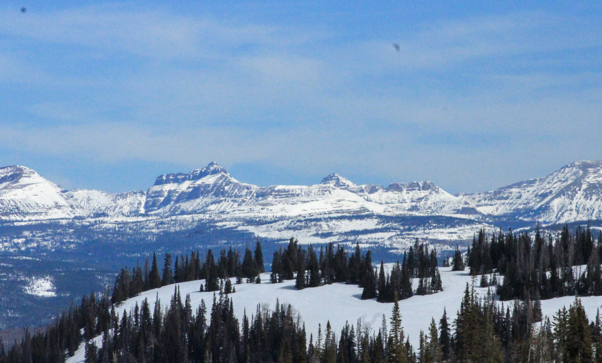
Looking east towards the High Uintas and Central Mountains, there's plenty of snow on polar slopes above 10,000'. Below that... travel, access, and type 2 fun conditions present some serious challenges and oh yeah... lack of coverage.

Traveling around Wolf Creek Tuesday I thought to myself... "pretty surreal, this upper elevation, solar-esque slope should be deep and phat with snow. Instead it's starting to look more like June than March."

Recent Avalanches

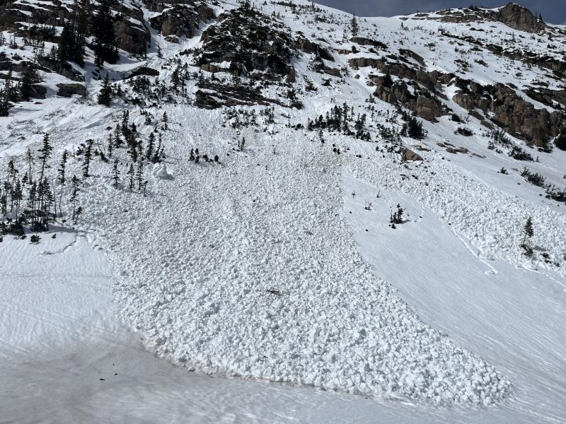
No new avalanche activity reported in the past 24 hours. But on Tuesday, Ted spun a lap around HWY 150 and spotted this couple day old avalanche near Mt. Marsell. Looks like a piece of cornice peeled off the ridge and gouged to weak snow in a shallow, rocky section of the slope.

Recent slides and trip reports from across the range are just a click away... below!

Avalanche Problem #1
Wet Snow
Type
Location
Likelihood
Size
Description

Until temperatures moderate somewhat, expect the usual round of wet sluffs, along with the potential for a slide to break into weak snow (like in the image above), especially in terrain that's steep and rocky or has remained thin all year .

Andy laid the foundation earlier in the week with some rock solid advice and I'm gonna follow his blueprint today by-

  • Avoiding big terrain during the heat of the day, and keeping off of and out from under, large avalanche paths and runouts.
  • Watching for the pack to become punchy and unsupportable under your ride, rig, board, or boards.
  • And finally, if pinwheels, rollerballs, or loose rock starts cascading down from above, it's a sure sign the mountain is feeling the heat and it's time to switch gears on our objectives and snow-centric activities.
General Announcements

We are always looking for snow and avalanche observations or just general riding conditions. Reach out to us with questions, concerns, or if you see anything in your travels! Contact us directly through the info below:

Craig Gordon -- [email protected] -- 801 231 2170

This forecast is from the U.S.D.A. Forest Service, which is solely responsible for its content. This forecast describes general avalanche conditions, and local variations always occur. This forecast was issued on Thursday, March 26, at 04:00 and expires 24 hours after it was issued. We'll update this information by about 7:00 AM tomorrow.