Special Avalanche Bulletin
What-
A Special Avalanche Advisory is in effect for all mountain regions across Utah through Sunday, March 22nd, as avalanche danger is expected to rise.
When-
In effect from 6 AM MST Saturday to 6 AM MST Monday.
Where-
The mountains of Utah and southeastern Idaho.
Impacts-
Record-breaking warm temperatures will rapidly destabilize the snowpack across the state, increasing the likelihood of widespread, spontaneous, destructive wet avalanches. Wet avalanches could occur on all aspects and at all elevations, including places that typically stay colder this time of year. Avoid travel on and below steep slopes, including avalanche runout zones and terrain traps.
After a difficult week in February that included four avalanche fatalities, UAC forecasters will host a community debrief to discuss the conditions surrounding these accidents. We will review the weather and snowpack patterns, share observations from the field, and discuss lessons learned. This event will not be live but include time for questions and discussion, with the goal of learning together as a community. Please submit your questions HERE.
Nowcast - With clear skies overhead and high pressure still in place, March Madness aims for record setting temperatures and tips off center court with overnight lows in the mid and upper 40's F° across the board. Winds from the southwest blow 15-25 mph near the ridges. Riding and turning conditions have taken a hard hit, though smooth solar slopes offer a mid morning corn harvest.
Forecast - One more day of sultry, record breaking heat before high pressure shifts east. Look for mostly sunny skies this morning with high temperatures soaring into the mid 60's F° by about suppertime. Clouds increase and winds from the southwest ramp into the 40's by late in the afternoon.
Futurecast - A dry cold front slated to slide through the region overnight knocks temperatures down slightly to wrap up the weekend. High pressure builds for early next week, delivering another run of unusually warm, summer-like temperatures.
Travel Conditions - North and south side gates are open on HWY-150, plowed from the north to Whitney and from the south to Spring Canyon, and of course SR35 remains open over the pass. Solars are melted out up to 9,000' and many windward slopes are scoured and worked to the dirt.
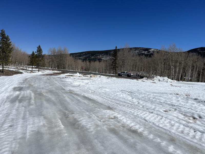
The Whitney turnoff along HWY-150 provides a rugged, yet rideable launchpad for upper elevation access.
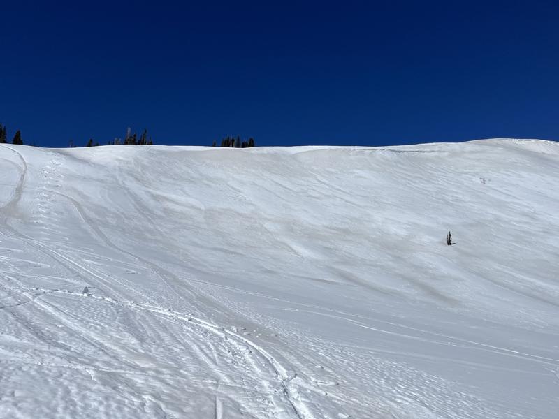
Ted visited Upper Whitney Basin Thursday and reports acceptable riding in upper elevation alpine terrain.
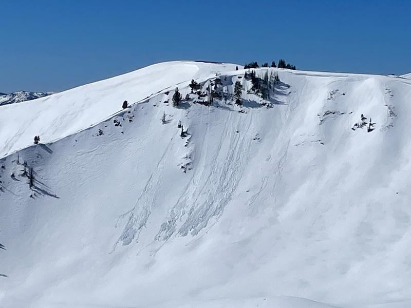
The walls ain't tumblin' down just yet, but a few moist, loose sluffs were observed near the Upper Weber Ridgeline Thursday.
Click below for any recent slides that have been observed, or for travel and condition reports from across the range.