Forecast for the Uintas Area Mountains

Craig Gordon
Issued by Craig Gordon on
Friday morning, March 13, 2020
While the avalanche danger is generally LOW across the range, here are a few considerations-
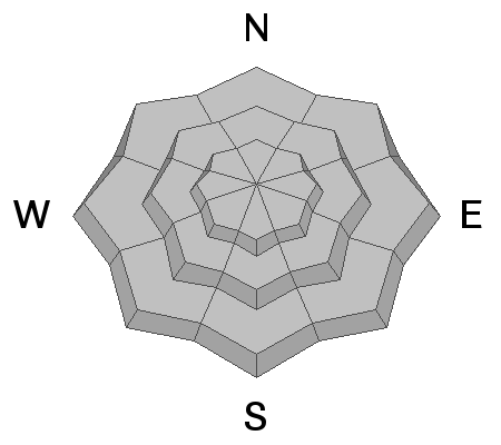
Above treeline, there are isolated places where you could trigger an old wind drift, especially in steep, rocky terrain in the wind zone. And remember... if you're getting into steep, technical terrain, even a small slide can knock you off your ride, slam you into a tree, and throw a curve ball at your day.
Also, snow at lower elevations may become damp, especially late in the day. You're best bet to avoid triggering a wet slide is to simply get off of and out from under steep sun drenched slopes, particularly if they become punchy or unsupportable.
Low
Moderate
Considerable
High
Extreme
Learn how to read the forecast here
Weather and Snow
Currently-
Skies remained clear overnight and temperatures cooled nicely, registering in the low to mid 20's. Yesterday's west and southwest winds blew 30-50 mph along the high ridges for most of the day, but mellowed dramatically right around midnight. Currently it's rather pleasant along the high ridges with light and variable winds blowing just 5-15 mph. It's a mixed bag of snow conditions. Up high you'll find dry, cold snow on north facing terrain, and sunny slopes at mid and low elevations offer a window of solid, supportable corn-like surfaces. In between... it's every man for himself.
Uinta weather network info is found here. Simply click on the Western Uinta tab.
For today-
Look for mostly sunny skies this morning, but as a storm churns away to the south, we can expect increasing mid level clouds becoming thick by late morning. Snow showers are possible by early afternoon. Temperatures rise into the upper 30's and low 40's. Southwest increase slightly and should blow in the 20's and 30's as the day progresses.
Futurecast-
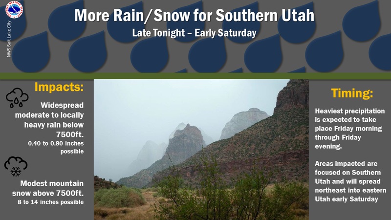
Light snow showers develop overnight with a couple traces of snow expected. The next storm system approaches from the Pacific Northwest mid to late next week.
Recent Avalanches
A few shallow wind drifts along the leeward side of upper elevation ridges and shallow damp sluffs were reported down low, otherwise no significant avalanche activity to report.
To view additional trip reports and recent avalanche activity, simply click here.
Ad
Avalanche Problem #1
Normal Caution
Type
Location
Likelihood
Size
Description
A tale of two avalanche problems to consider.... dry snow and damp snow.
Dry snow-
First.... yesterday's winds created shallow drifts that may still react to our additional weight. While isolated to steep, leeward terrain in the wind zone, remember, if you're tagging steep, technical terrain, be aware that even a small slide could knock you off your feet and boss you around.
Damp snow-
Here's the good news... I think cloud cover and cool temperatures will help put the lid on this problem. However, if the weather forecast doesn't pan out and it's sunnier than expected, remember that wet avalanches are a straight-forward and easy avalanche problem to avoid. As daytime temperatures climb and the snow get damp, manky, or unsupportable, simply get off and out from under steep, sun-baked slopes. In addition, you'll want to avoid terrain traps like gullies and road cuts where wet, cement-like snow can stack up very deeply.
Additional Information
If you want pow... head south!
General Announcements
The information in this forecast expires in 24 hours, but will be updated by 7:00 AM Saturday Mar. 14th.
This forecast is updated daily by 7:00 AM.
In the mean-time, if you see or trigger an avalanche or just wanna let me know what you're seeing you can reach me directly at 801-231-2170
This is a great time of year to schedule one of our free avy awareness presentations.
You can email me directly [email protected]
The information in this forecast is from the US Forest Service which is solely responsible for its content.