Nowcast - Mild temperatures kick off the morning in the 20's°F across the board. Light winds blowing from the west around 15 MPH gusting into the 20's are paired with clear skies and bright stars as the first of the morning light begins to steal the show.
Forecast - For today, blue skies and warm temperatures will be the theme, with a high near 35 at 9,000'. Winds blow from the west, similar to yesterday, staying light in the teens with a few gusts into the 20's at upper elevations.
Futurecast - Clouds roll into the region tomorrow morning and snow develops Monday afternoon into Tuesday. I am hopeful we will see around 4-8" of snow with .25-.5" of SWE, and will keep you in the know as we learn more.
Travel Conditions - Access has taken a hard hit over the past few days from warm temperatures and increasingly strong sunshine, but gain some elevation and you'll see the Uinta's are performing closer to average this season than meets the eye. Snow depths vary from 1-4' across the range above 9,000' with a mostly right-side up snowpack. In general, protected polars continue to weaken but are riding well thanks to our Christmas Eve rain crust keeping us off the ground and are the go-to source for cold snow.
Cold, protected, polar slopes continue to provide the best riding across the range but remember, todays powder is tomorrows weak layer -- Or rather, Tuesdays weak layer!
 Moderate slope angles, sheltered terrain characteristics, and a bit of stoke have kept coming back for the same old recycled powder since our last storm in early January.
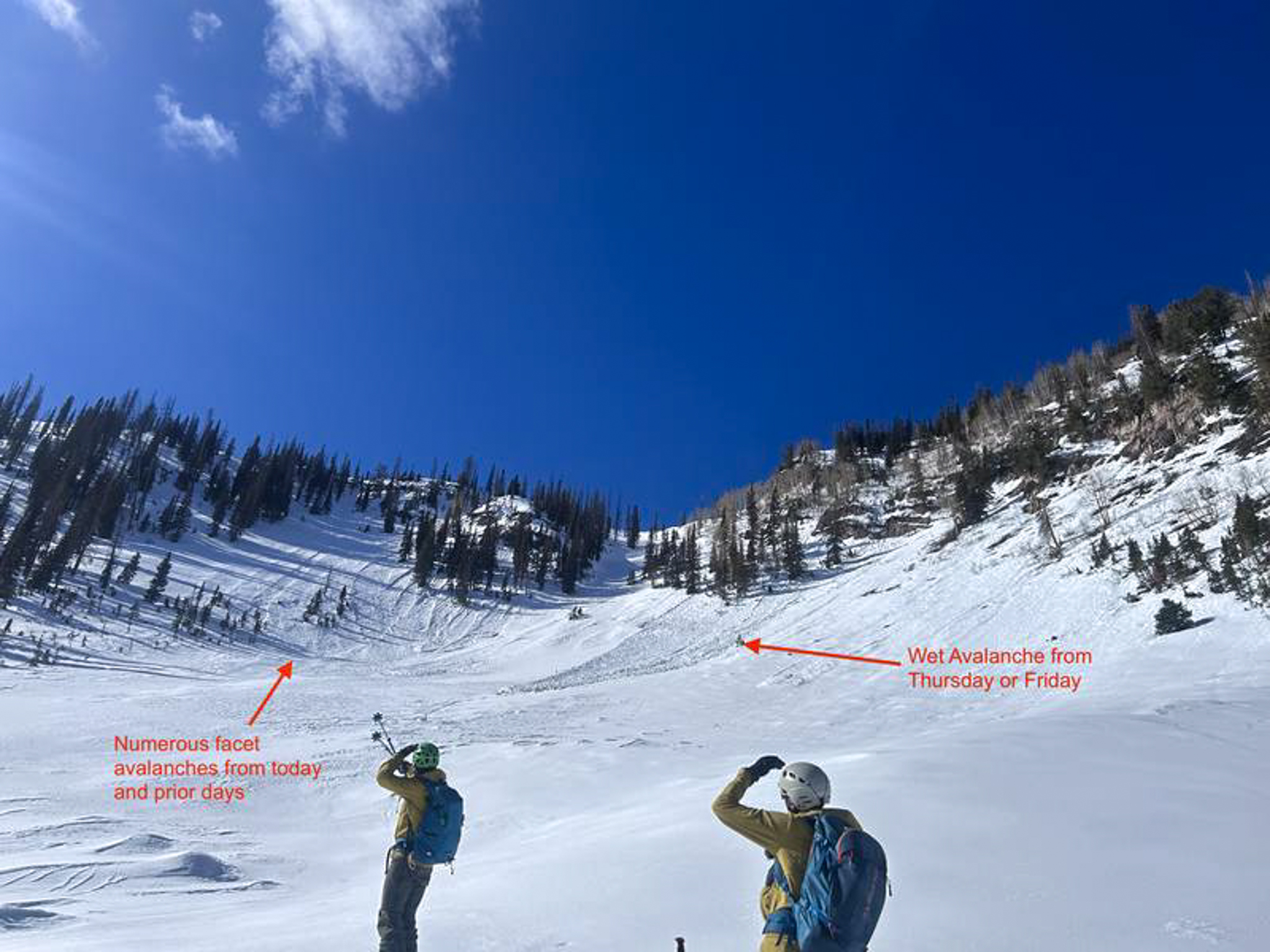
Summit County SAR member Big Al and his riding crew were in the Upper Moffit basin and observed lots of wet and dry loose snow avalanches around the compass throughout their travels. 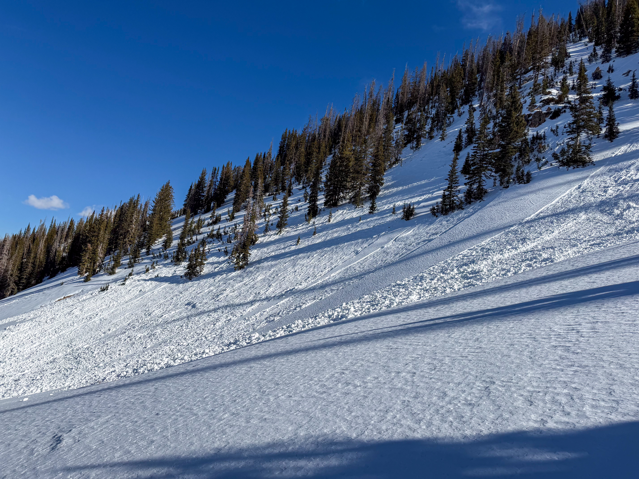 Loose snow avalanches are widespread at mid and upper elevations, and observed across the range on steep, sustained slopes.


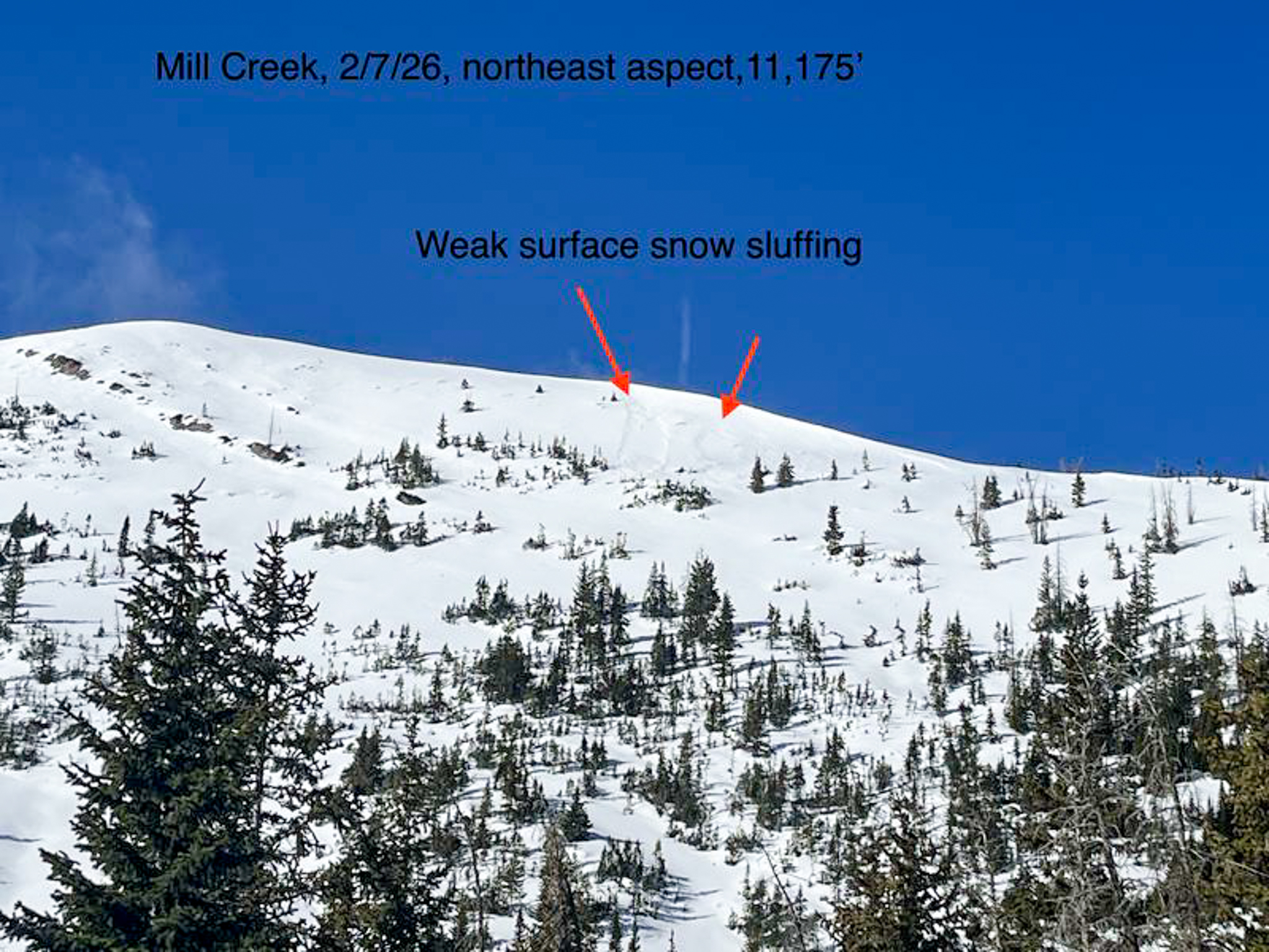 Ted was on the North Slope near Mill Creek, and noted similar loose snow avalanching at upper elevations, in the windzone. See more from Ted's stellar and well written trip reports, found


