Forecast for the Uintas Area Mountains

Craig Gordon
Issued by Craig Gordon on
Sunday morning, February 2, 2020
Heads up... with a powerful winter storm on tap, the avalanche danger will rise significantly overnight
In the wind zone at and above treeline, steep, wind drifted slopes offer MODERATE avalanche danger and human triggered avalanches are POSSIBLE. Lose a little elevation and you lose most of that problem.
While more the exception than the rule, human triggered avalanches breaking into deeper, buried weak layers remains a distinct possibility. Usual suspects include- steep, rocky, upper elevation terrain, especially slopes exhibiting a thin, shallow snowpack. Remember- any slide that breaks to old snow will immediately ruin your day.
Wind sheltered, low and mid elevation slopes with no steep terrain above or adjacent to where you're riding offers LOW avalanche danger and human triggered avalanches are UNLIKELY.
Low
Moderate
Considerable
High
Extreme
Learn how to read the forecast here
Special Announcements
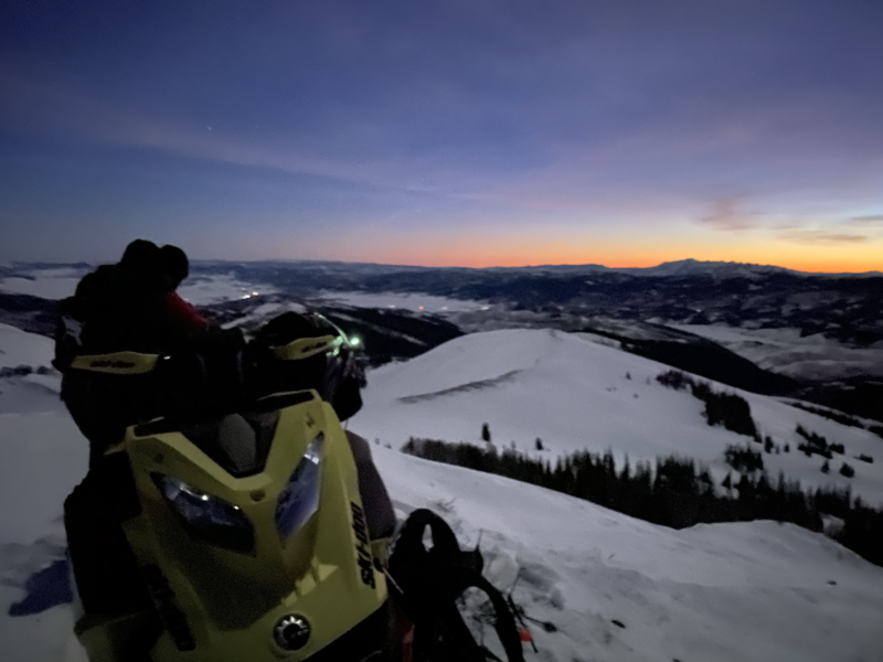
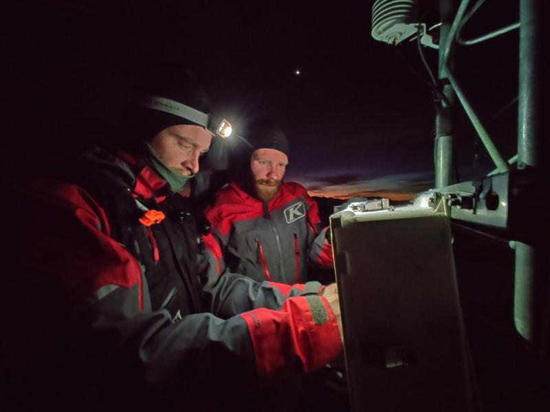
Are these guys studs or what? After busting out an avy class, Tyler St. Jeor and his crew help maintain the Uinta weather station network with an evening ride to Currant Creek Peak to install a new battery and keep things rolling in anticipation to the big storm headed our way. These guys give a lot of themselves and are dedicated to helping keep our community safe... thanks for doing what y'all do!
January 24 - February 6
Are you looking to improve your avalanche skills? We are offering a Motorized Backcountry 101: Introduction to Avalanches class on February 6 & 8 out of The Edge Powersports and Thousand Peaks Ranch in the Western Uintas. Click HERE for more details.
Weather and Snow
Currently-
High, thin clouds rolled into the region overnight, enabling temperatures to remain rather mild and in the mid to upper 20's. Southwest winds began ramping up around midnight and currently blow 35-50 mph along the high ridges. Riding and turning conditions are gonna be a bit hit or miss today, but with total settled snow depths averaging over five feet, the range is white, the coverage remarkable, and your options pretty limitless.
Uinta weather network info is found here. Simply click on the Western Uinta tab.
For today and tonight-
It'll be downright balmy with southerly winds quickly ramping up this morning and clouds thickening, all ahead of a powerful winter storm. Expect very mild temperatures today with highs soaring into the mid 40's. Winds blast into the 60's and 70's along the high peaks. Snow develops late tonight, becoming heavy at times after midnight. We can expect 8"-10" by about sunrise
You know it's gonna be a solid storm when our good friend Brian McInerney, hydrologist at the NWS, produces one of his award winning weather briefing videos. (*awards are pending committee review :)
Recent Avalanches
No significant avalanche activity to report.
To view additional trip reports and recent avalanche activity, simply click here.
Ad
Avalanche Problem #1
Persistent Weak Layer
Type
Location
Likelihood
Size
Description
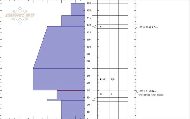
Above, an image of snow structure on a north facing slope in upper Whitney Basin that avalanched earlier this season. These are the type of slopes that may light up with Monday's storm.
Heads up-
Today's warm temperatures may help to reactivate buried weak layers in our snowpack that have been dormant for several weeks.
In most terrain the snowpack is deep, it's gaining strength, and it's happy in its own skin. However, steep, rocky, upper elevation terrain and slopes that avalanched near the ground earlier in the season remain suspect. So, while so much of our terrain is good to go, if you're travels take you to steep, technical slopes today, especially those with a thin, shallow snowpack, think about your exit strategy and the consider the consequences of triggering a slide that has the potential to break deeper and wider than you might expect. Or... with all the good riding out there and miles of terrain to choose from, simply avoid slopes with these characteristics.
Avalanche Problem #2
Wind Drifted Snow
Type
Location
Likelihood
Size
Description
While there's not an abundance of snow available to blow around, I bet todays wind, whips up a batch of shallow drifts sensitive to our additional weight. Found mostly on the leeward side of upper elevation ridges, I wouldn't be too surprised to find a fresh drift or two cross-loaded in and around terrain features like chutes or gullies. More the exception than the rule, a rogue wind slab could break deeper and wider than you might expect, creating a slide that quickly gets out of hand. Your best bet for avoidance is to simply steer clear of any fat, rounded piece of snow, especially if it sounds hollow like a drum.
Additional Information
Thanks to the generous support of our Utah ski resorts and Ski Utah, we have discount lift tickets available. All proceeds support the UAC. Get your tickets HERE.
Get one of these cool t-shirts to support the UAC and other avalanche centers across the U.S. INFO
General Announcements
The information in this forecast expires in 24 hours, but will be updated by 7:00 AM Monday Feb. 3rd.
This forecast is updated daily by 7:00 AM.
In the mean-time, if you see or trigger an avalanche or just wanna let me know what you're seeing you can reach me directly at 801-231-2170
This is a great time of year to schedule one of our free avy awareness presentations.
You can email me directly [email protected]
The information in this forecast is from the US Forest Service which is solely responsible for its content.