Nowcast - Skies are cloudy in the wake of yesterday's storm which delivered an evenly distributed trace of snow across the range, though favored terrain on the North Slope might've overachieved, stacking up a couple traces. In either case, winds are light, as temperatures claw their way out of the low teens °F. No matter how you cut it... snow conditions are variable and travel is rugged.
Forecast - Expect mostly cloudy skies and a trailing wave of moisture that delivers a dusting of snow before suppertime. A midday break in the action allows temperatures to climb into the low 30's °F. Winds whisper from the southwest this morning, but ramp into the 30's and 40's by about sunset, opening the door to a good looking shot of snow slated to arrive later tonight. In fact, a Winter Weather Advisory is in effect for the Uinta zone.
Futurecast - The meat of the storm rolls in late tonight, kicking in early Wednesday. I'm thinking our best shot of snow materializes during the day, delivering 10-12" of snow with an inch of SWE. It's a right side up storm with dense, heavy snow getting the party started. Lower density snow, lingering morning snow showers, and cold temperatures are slated for Thursday as clearing skies round out the workweek. Expect a lull in the action for the weekend followed by an active pattern for early next week... looks promising and we'll keep ya posted.
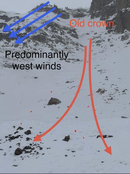
Travel Conditions - Access has taken a hard hit over the past few days from warm temperatures and increasingly strong sunshine. Snow depths vary quite a bit, but get above 9,000' and swing over to the north half of the compass and you'll find a mostly right-side up snowpack averaging 1-4' deep. In general, protected polars are riding in the glass half full category, while above treeline the snow surface has been worked by the elements and yeah... we are long overdue for a fresh coat of white paint.
 What a difference a few days make. This weekend I found shallow cream and stellar riding in mid-elevation, mellow, wind sheltered terrain. This is the exact terrain that is going to get spooky as soon as we start to stack up some snow, water, and wind.

Yesterday... Andy, Liam, and Juniper (the dog) installed a beacon training park near Wolf Creek Summit. It's super straight-forward and intuitive, and all the instructions are at the control center. Next time you see Liam or Andy, hit 'em up with a high-five for all the hard work. Truth be known... Juniper was only onboard because she thought the crew kept saying "bacon training park." So in lieu of a high-five, a back scratch or an Andy approved meat treat acknowledging Juniper's moral support will probably suffice :)
No new activity was reported from the backcountry, yesterday.