Forecast for the Uintas Area Mountains

Craig Gordon
Issued by Craig Gordon on
Saturday morning, December 15, 2018
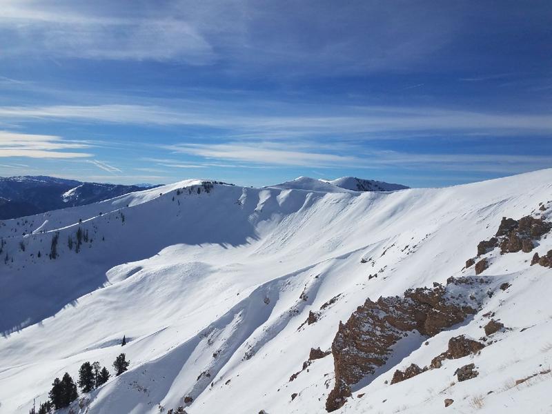
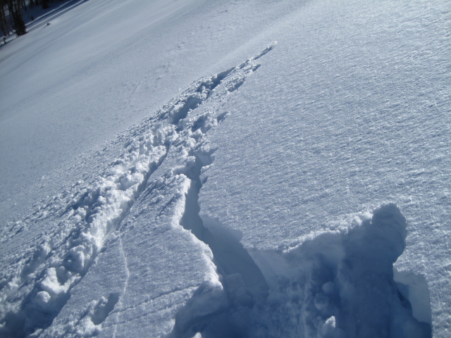
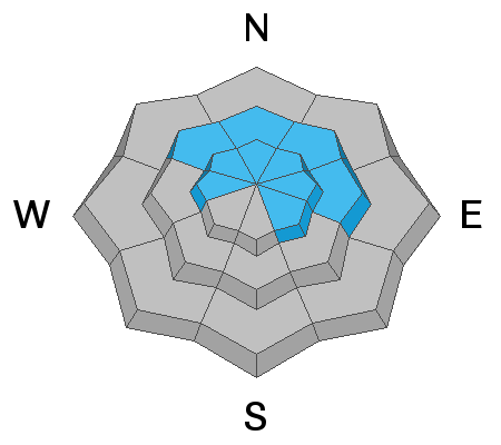
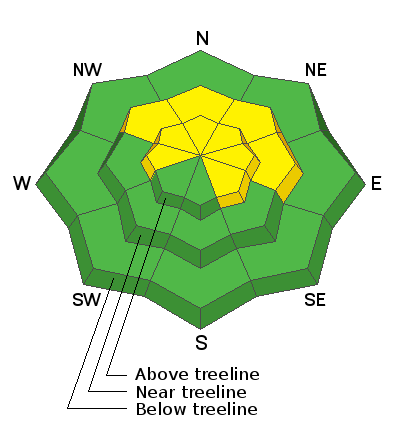
In the wind zone, in mid and upper elevation terrain at and above treeline, the avalanche danger is MODERATE. Human triggered avalanches are possible in steep, wind drifted terrain, especially on slopes facing the north half of the compass and particularly on those with an easterly component to their aspect. In addition, while becoming harder to initiate, human triggered avalanches breaking into deeper, buried weak layers is a distinct possibility, particularly on any steep slope harboring old snow near the ground. Remember- triggering a slide that breaks to old snow will immediately ruin your day.
Lose a little elevation or swing around to slopes with no old snow near the ground and the avalanche danger drops dramatically.
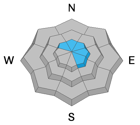
Low
Moderate
Considerable
High
Extreme
Learn how to read the forecast here
Special Announcements
Check out the new free online avalanche course series developed by the Utah Avalanche Center. This is a great way to refresh your skills or prepare you for a Backcountry 101 or Level 1 class.
Weather and Snow
High clouds streaming into the region late yesterday are starting to thin out somewhat this morning. Of course, as the valley gunk starts to build, it'll be a beautiful day in the mountains. Temperatures cooled slightly overnight and currently sit in the teens and low 20's. Southerly winds bumped into the mid and upper 30's right around sunset and are still humming along the high peaks. Wednesday's strong west and southwest winds transformed a lot of our big, exposed terrain into a lunar landscape. But, if you lose some elevation and head to wind sheltered, mid elevation terrain, you'll be rewarded with soft, creamy snow.
We are working to get the entire Uinta weather network back online, but got Windy Peak up and running last week. Above is recent hourly data from Trial Lake (9,945') along with wind data from Windy Peak (10,662'). To view more regional weather stations click here.
Plowing is done on Mirror Lake Highway, but Wolf Creek Pass is still open. The steep slopes surrounding the pass are getting hammered... ridden hard and without incident. However, just 'cause you can see your rig parked near Wolf Creek, doesn't mean the terrain you're choosing to ride is good to go. Remember- if you are getting out and about, be prepared for your own self rescue. Wear and know how to use an avalanche beacon, shovel, and probe.
White, winter pavement brings you to some amazing sights on the eastern front.
The majestic peaks near the Mirror Lake Highway are lookin' mighty white these days.
Recent Avalanches
Thursday, Bob Merrill reported a few fresh wind drifts which released naturally in the big, east facing bowls in upper Weber Canyon. Otherwise, no significant new avalanche activity to report from the eastern front.
This seasons snowpack and avalanche observations, along with trip reports are found here.
Ad
Avalanche Problem #1
Wind Drifted Snow
Type
Location
Likelihood
Size
Description
Last night's southerly winds probably found enough loose snow to blow around and form fresh drifts that'll react to our additional weight. Found mostly on the leeward side of upper elevation ridges, I wouldn't be too surprised to discover pockets of wind drifted snow, cross-loaded in terrain features like chutes and gullies. In any case, don't let your guard down. Be on the lookout for and avoid any fat, rounded piece of snow especially if it sounds hollow like a drum.
Obviously the winds have been blowing at the upper elevations, stripping the snow and transporting it to the leeward side of ridges.
Shooting cracks like in the image above, are huge clues to unstable snow.
Avalanche Problem #2
Persistent Weak Layer
Type
Location
Likelihood
Size
Description
The pack feels pretty comfortable in its own skin and the midweek storm did little to overload any deeper buried weak layers... and that's good news. However, the Uinta's are a big range and there's lots of variables when it comes to snowpack depth and strength. Remember- "persistent weak layers" in the snowpack are a headache because they remain problem children for long periods of time. And all we need to do is find one weakness, maybe around a bush or rock that we can't see buried underneath the snow, collapse the pack, and now we're staring down the barrel of a scary avalanche. The usual suspect terrain comes to mind. Steep, rocky slopes with a shallow snowpack. So the way I'm avoiding this scenario is by simply avoiding the terrain where this setup exists.... mid and upper elevation, north facing slopes that harbored snow prior to the big Thanksgiving storm. There's a lot of terrain to ride today and not have to deal with unmanageable avalanche conditions, IF you chose slopes that had NO old snow prior to the big Thanksgiving storm.
JG was in the Wolf Creek environs yesterday and his beautifully detailed pit profile above reveals a fairly robust snowpack on the south half of the range.
Meanwhile on the east side of the range, Ted found a typical thin snowpack and commented, "A quick snow pit shows about two feet of snow with the early season sugary snow near the ground easy to locate. There is a little body or structure to the snow pack, so its not quite riding on the ground which is pretty typical out here."
Additional Information
A weak storm system clears out of the region this morning, leaving plenty of sunshine and temperatures warming into the 30's for the afternoon. Southerly winds gusting into the 40's and 50's gradually relax as the day wares on. Overnight lows dip into the teens. Warm and sunny conditions are on tap for Sunday, and then the next storm system arrives Monday, though it looks like a non-event as the storm splits overhead. No big pattern changes in sight.
General Announcements
The information in this advisory expires 24 hours after the date and time posted, but will be updated by 7:00 AM Sunday December 16th, 2018.
If you're getting out and about, please let me know what you're seeing especially if you see or trigger and avalanche. I can be reached at [email protected] or 801-231-2170
It's also a good time to set up one of our very popular avalanche awareness classes. Reach out to me and I'll make it happen.
This information does not apply to developed ski areas or highways where avalanche control is normally done. This advisory is from the U.S.D.A. Forest Service, which is solely responsible for its content. This advisory describes general avalanche conditions and local variations always occur.