Forecast for the Uintas Area Mountains

Andrew Nassetta
Issued by Andrew Nassetta on
Monday morning, January 5, 2026

New snow and strong winds create CONSIDERABLE avalanche danger on upper elevation, northerly facing slopes where human triggered avalanches are LIKELY failing 1-4 feet deep into old snow and breaking up to a football field wide. Once initiated, even a small avalanche can step-down, breaking deeper into the snow pack and triggering a larger, unmanageable slide.

Depending on how much snow we get today, pockets of HIGH avalanche danger could develop at upper elevations. With that in mind, I am avoiding avalanche terrain on the northerly aspects and steering my rig towards quality riding on low-angle, south-facing slopes where our persistent weak layer does not exist.

Low
Moderate
Considerable
High
Extreme
Learn how to read the forecast here
Weather and Snow

Nowcast - Since yesterday afternoon into the early hours this morning around 0500, winter is wintering. Favoring the north slope, we have picked up between 5"- 12" of snow with about 1" of snow water equivalent. Winds have not let up, and averaged 25 MPH from the south and southwest overnight with gusts into the 50's and 60's at upper elevations. Temperatures remain in the 20's°F across the board with windchill dipping into the single digits.

Forecast - Through the breakfast hour, expect to stack up another 4"-6" of snow by mid-day, followed by an afternoon break in the action. Temperatures stay mild through the day in the 20's while winds continue to rip from the south with gusts up to 40 MPH range.

Futurecast - Spotty snow showers persist through the week with a somewhat active pattern and a look for accumulating snowfall Wednesday into Thursday. After that, we dry out, heading into the middle of the month.

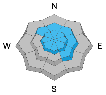
Travel Conditions - Since yesterday, riding quality and travel conditions have improved across the range with supportable snow depths ranging from 3-5'. Unfortunately, the pack is still extremely thin at most low elevations, and I'd head for riding up high above 9,000'. Fortunately, the Christmas Eve raincrust keeps us off the ground, while last night's storm helps to cover up lingering rocks, stumps, and bumps that have not been put away for the winter. Upper elevation slopes on the north half of the compass continue to hold the deepest and best snow, while sunny, solar aspects will have a shallower, feel-the-bottom vibe to them today.

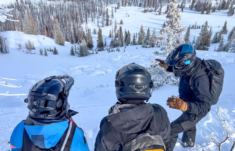
On the South Slope, riding conditions were supportable, creamy, and pleasantly surprising! We tagged mid-elevation, wind-sheltered terrain and had quality turning all day long without any avalanche terrain in sight.

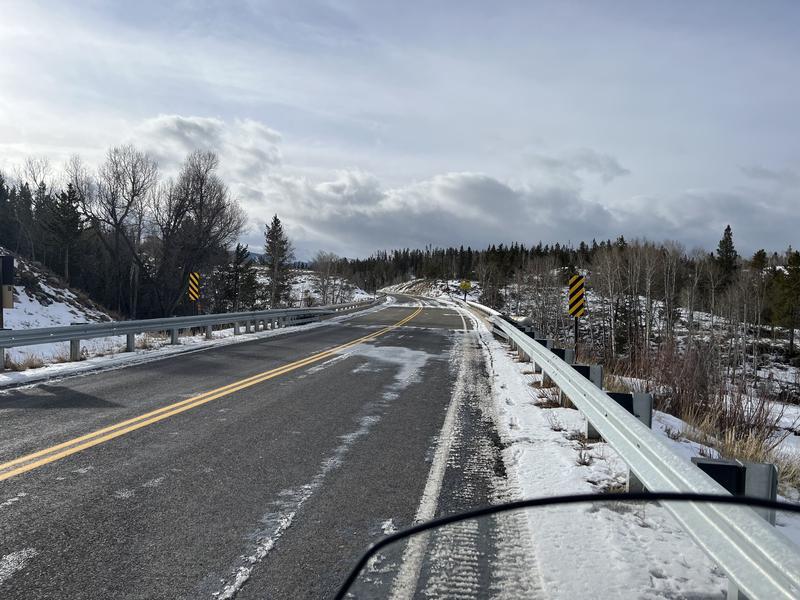
Meanwhile, Ted was on the North Slope and noted thin cover on HW 150 access coming from Bear River services, where the gate is closed.

Recent Avalanches

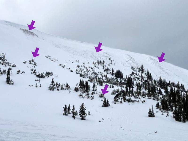
No new avalanche activity has been reported in the past 24 hours, but check out some travel observations and old avalanches by clicking on the button below.

Avalanche Problem #1
Persistent Weak Layer
Type
Location
Likelihood
Size
Description

When we discuss thin spots and trigger points, the arrows in the photo above depict exactly that. The arrows highlight places where we are most likely to trigger a persistent slab avalanche (via Ted S.)

New snow and wind stress our persistent weak layers now buried 2-4' beneath the snow surface. Throughout today, this new load will wake things up and put its strength to the test. How much weight, or load, will our snowpack structure be able to support? Since I am uncertain, I am on the lookout for red flags and obvious warning signs like recent avalanches, cracking, or collapsing -- All telltale signs that you are entering the dragon's den, and you might wanna rethink your next move. This snowpack setup is just waiting for a trigger like us to come in and kick the legs out from under it.

Persistent slabs are tricky, unmanageable avalanches. Instead, avoidance is the go-to tool. It's easy to get fooled because we can put 100 sled tracks on a slope without any consequence, but all the 101st rider needs to do is find a shallow point in the snowpack around a bush or a rock where you can collapse the weak layer and trigger the avalanche.

Above, Chad and Al discuss the set-up they see out in the Mirror Lake Corridor near Reids Peak where a strong, dense slab sits above weak, early season, faceted snow that continues to show signs of life.

Avalanche Problem #2
Wind Drifted Snow
Type
Location
Likelihood
Size
Description

There is plenty of fresh snow out there to move, and winds blowing between 20 and 40 MPH gusting into the 50's and 60's have done just that. Over the past couple days, winds blowing from the southwest have loaded leeward slopes on northwest through southeast aspects and created dense, fresh drifts up to 2' deep. My greatest concern is where fresh drifts sit atop old, faceted snow near the ground, and once triggered, will turn a relatively small and manageable avalanche into a deep, and potentially life-threatening slide.

Im avoiding fat, rounded pillows on specific terrain features like convex rolls, chutes, gully walls, and cut banks that look textured or may sound hollow like a drum under my ride. Cornices are beginning to gain meat and will be touchy today. Give them plenty of room, and remember that cornices can easily trigger large avalanches too.

Additional Information

There is no better time to take any avalanche course than now! Whether you sled, ski, board or snow angel, we have a class for you. Reach out to us to get into an avalanche course that fits you best, or get your riding crew together and lets set-up a private day on snow!

Students in a Sled Backcountry 101 coursed working on their pit craftmanship and learning how to properly perform an ECT test and how to communicate those results.

There is no better way to learn about avalanches than investigating avalanches! Students from a recent course take a look at an old human triggered avalanches and try to put the pieces together to understand what happened.

General Announcements

We have some upcoming classes and events that we'd be stoked to see you at -- Please reach out with any questions and check out below for more details!

We are always looking for snow and avalanche observations or just general riding conditions. Reach out to us with questions, concerns, or if you see anything in your travels! Contact us directly through the info below:

This forecast is from the U.S.D.A. Forest Service, which is solely responsible for its content. This forecast describes general avalanche conditions, and local variations always occur. This forecast was issued on Monday, January 5th at 0500 AM and expires 24 hours after it was issued. We'll update this information by 07:00 AM tomorrow.