Forecast for the Skyline Area Mountains

Brett Kobernik
Issued by Brett Kobernik on
Monday morning, March 2, 2026

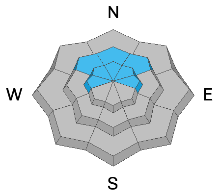
The majority of the terrain on the Skyline has a MODERATE avalanche danger today.

A CONSIDERABLE avalanche danger remains on steep slopes above 8500' that face northwest, north, northeast and east.

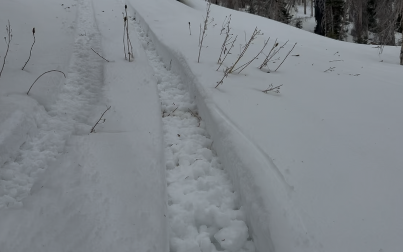
Human-triggered avalanches are not all that likely, although if you trigger one, it could be sizeable. It is difficult to determine which slopes will release and which won't. That is what makes this a dangerous situation.

Low
Moderate
Considerable
High
Extreme
Learn how to read the forecast here
Weather and Snow

General Conditions: Temperatures remain warm. Highs were into the 40s on Sunday and only cooled into the low to mid 30s overnight. The wind has been light from the southwest. Riding conditions are poor. Mid elevations are wet, sloppy and almost unrideable because skis and machines are punching through the unconsolidated mess. Higher elevations are better but only on the more northerly facing terrain.

Photo below: Kobernik - snowbike track sinking deep into wet mush at 9000'.

Photo below: Chris Magerl sinks deep into unconsolidated wet snow at 8900', DETAILED OBSERVATION HERE

Mountain Weather: We'll have partly cloudy skies today with continued warm weather. Temperatures will get into the 40s again. Wind from the southwest is going to pick up as the day goes on. It'll probably feel breezy this afternoon. A small storm system moves through tonight, bringing slightly cooler temperatures and the chance for a few inches of snow. Another storm system is shaping up for later in the week that looks a little more promising for snow.
Avalanche Problem #1
Persistent Weak Layer
Type
Location
Likelihood
Size
Description

The snow from our large storm last week has gained a lot of strength. It is supportable to skis and machines in the higher terrain. However, the weak faceted snow that is just underneath has not gained much strength. Snowpit tests produce stubborn but poor results with full failure and propagation through the weak layer.

What this means is that the snowpack is not as sensitive now, but it still has the potential to produce avalanches that break into the old faceted snow. Many steep slopes will stay in place if you get onto them. Some will not. It is almost impossible to tell which slopes will slide and which ones won't.

General Announcements
This forecast is from the U.S.D.A. Forest Service, which is solely responsible for its content. This forecast describes general avalanche conditions and local variations always occur.