General Conditions: Riding conditions remained decent on Monday. Overall, the snowpack is still shallow and I feel like I'm "on guard" all day long because I feel like I could hit something within the shallow snow at anytime. I am riding slowly and cautiously. It is not like a normal winter at this time where I am usually just letting it rip. Many places are still punchy and your track or skis will punch through the new snow into the old weak sugary facets. Temperatures hit 40°F on Monday and stayed warm overnight, only dropping to around freezing. You'll find sun crusts on all the sunny-facing slopes. Wind from the southwest has increased and is in the moderate speed range.
Mountain Weather: A storm is moving into northern Utah this morning. Unfortunately, it is not going to dig far enough south to do much for the Skyline. We may pick up a few inches of snow tonight into Wednesday. 2 to 4 inches of dense snow is possible. Temperatures are going to remain very warm today and Wednesday with highs into the 30s. The rain/snow line will be up around 8500 feet or higher. Clouds thicken up today and start to clear out again on Wednesday night. Wind from the west looks like it's going to remain breezy today and Wednesday.
I'm sorry to report that yet another person was killed in an avalanche on Sunday. A snow biker was caught and buried in a large avalanche in Snake Creek in Wasatch County. His partners could not pick up a signal from his avalanche beacon. It turned out his beacon was in his pocket but was turned off. We will have a full detailed report later this week. PRELIMINARY REPORT HERE
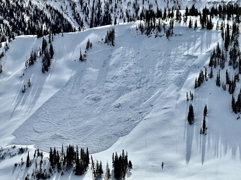
Closer to home on the Skyline, I remotely triggered a sizeable avalanche in Seeley Canyon on Monday afternoon. MORE DETAILS HERE