All four final avalanche accident reports (Caribou Basin, Butler Basin, Lake Mary Chutes, and Ant Knolls) have now been published. These are reports of four avalanche fatalities in five days spanning February 18th-February 22nd. You can find them all HERE.
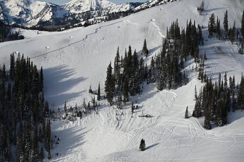
Photo: WCSAR
Thank you to everyone involved for sharing information. As with all avalanche accidents, we hope to learn something to prevent future accidents. Our deepest condolences go out to the families, friends, rescuers, and everyone affected by these tragic accidents.
Avalanche Trivia is back at Hopkins Brewing on March 8th, starting at 7 PM! Bring your friends and test them on their knowledge, while giving back to the UAC. See details HERE.
Overnight, a strong cold front moved in. Temperatures dropped, snow began to fall, and winds shifted to the west-northwest.
This morning, light snow is falling. Temperatures are in the teens to low 20s °F. Winds are blowing out of the west-northwest 10-15 mph with gusts in the 20s along the 9000 ft. ridges, and 20-30 mph with gusts into the 40s along the 11000 ft. ridges.
Today, snow continues this morning before tapering and becoming more showery. Later this afternoon, another wave of moisture moves in, and snowfall intensifies. We could see another 2-8 inches of low-density snowfall accumulate by sunset. Temperatures remain cold, with daytime highs in the mid 20s °F and wind chills in the single digits. Winds blow from the west-northwest 15-25 mph with gusts into the 30s.
Snow and water numbers as of 6:00 AM
- Park City Ridge: 1-3 inches with 0.1-0.2 inches of SWE
- Big Cottonwood Canyon: 3 inches with 0.2 inches of SWE
- Little Cottonwood Canyon: 4-6 inches with 0.3-0.4 inches of SWE
Yesterday, a skier descending a south-facing slope in Little Cottonwood Canyon triggered and was caught and carried in a wet slab avalanche. They were able to self-arrest before being carried into the Flagstaff gully. View the observation HERE.
Further down the road, a skier triggered a wet loose avalanche that entrained significant snow as it ran down slope more than 1000 vertical feet in to Mt. Superior apron.
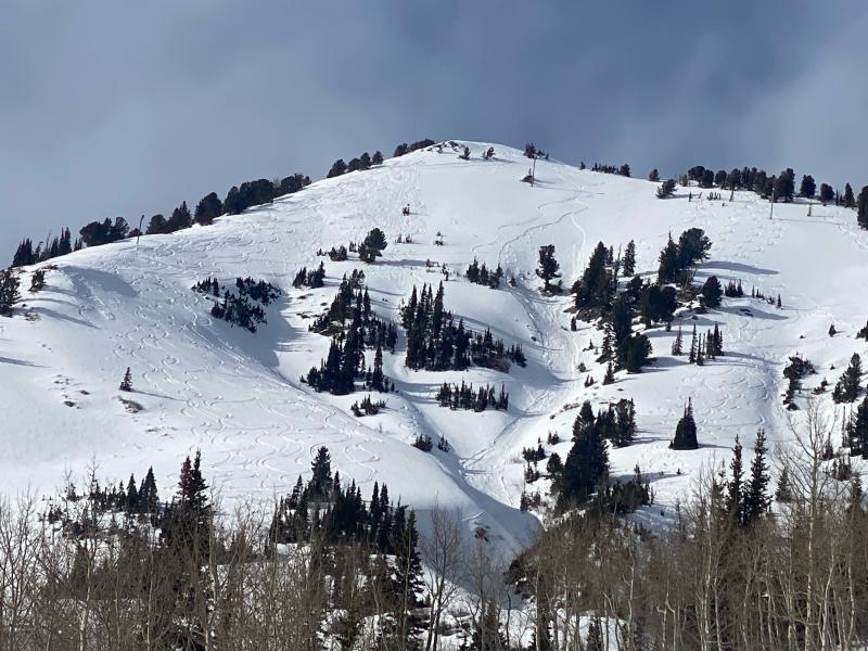
While wet snow avalanches are unlikely today, remember that the strong spring sun can rapidly transform cold, low-density snow into a heavy, wet mess.


