Forecast for the Salt Lake Area Mountains

Nikki Champion
Issued by Nikki Champion on
Wednesday morning, March 11, 2026

After several days of strong westerly winds, avalanche danger is MODERATE across all upper elevations and on mid-elevation slopes facing northwest through east, where it’s possible to trigger either a hard slab or a shallow soft slab of wind-drifted snow. Watch for sensitive slabs 6 to 12 inches deep, possibly deeper in upper-elevation alpine terrain.

The remaining aspects and elevations have a LOW danger this morning. However, as the strong March sun comes out, wet-snow avalanches may become possible on east, south, and west aspects, as well as on low-elevation northerly slopes, and avalanche danger may rise to MODERATE by the late afternoon. Pay attention to changing conditions; if a slope becomes unsupportable, it’s time to switch aspects.

Low
Moderate
Considerable
High
Extreme
Learn how to read the forecast here
Weather and Snow

This morning, there are a few clouds in the sky, and temperatures have dropped significantly compared to yesterday, currently sitting in the single digits along the highest peaks and in the low 20s °F at trailheads. Every weather station went through a solid refreeze last night, some for up to 12 hours. Westerly winds remained elevated, gusting 30 to 50 mph, with 11,000 foot gusts above 90 mph.

Today, expect mostly clear skies. There is a small chance of showers early this morning, but no measurable snow is expected. Temperatures will warm into the mid 30s to 40s °F. Westerly winds will remain elevated throughout the day, though there is a slight decreasing trend beginning, gusting 25 to 35 mph along exposed mid and upper elevation ridges, with 11,000 foot gusts in the 60s mph.

After a brief cool down, temperatures will start warming again later this week. A weak system may brush the area this weekend, but it looks mostly dry with just a slight chance of a little snow and some increased west to northwest winds, followed by another stretch of warm, dry weather.

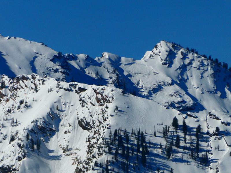
Although there was plenty of sun this weekend, there could still be some preserved cold, dry snow on upper elevation shaded terrain.

Due to the cool temperatures, expect a stout crust this morning on all aspects where the snow surface was damp yesterday. This begins to introduce "slide for life conditions." If you are traveling up a solar aspect this morning, where the surface is now frozen, make sure you have appropriate gear and the knowledge to stop a fall if one occurs. This could include crampons and an ice axe.

Recent Avalanches

A glide avalanche was observed in Bonkers on a north-facing slope at 9,800'. The slide failed on the ground interface, taking out the entire depth of the snowpack, and was approximately 5' deep, 60' wide, and ran about 500 vertical feet. This avalanche likely occurred on 3/9. The debris covered several downhill ski tracks and the skin track. Otherwise no new observations from the backcountry.

Avalanche Problem #1
Wind Drifted Snow
Type
Location
Likelihood
Size
Description

Westerly winds have been cranking the past few days, with overnight gusts above 90 mph. These strong winds have formed both soft and hard slabs of wind-drifted snow on upper and some exposed mid-elevation slopes. While these slabs are most prominent on leeward slopes, strong winds can load any aspect due to cross-loading from swirling and shifting wind directions.

With winds remaining elevated today, these soft and hard slabs will only continue to grow. Fresh slabs of wind drifted snow may be sensitive and 6 to 12 inches deep, possibly deeper in upper elevation alpine terrain. Watch for pillow-shaped deposits and avoid them. Signs of instability, such as shooting cracks, collapsing, and overhanging cornices, are clear indicators of wind-drifted snow and unstable terrain.

At the upper elevations, where winds have been gusting for days and slabs are becoming stiff, stubborn, and more supportable, they may allow travel farther onto the slope before signs of instability appear.

Avalanche Problem #2
Persistent Weak Layer
Type
Location
Likelihood
Size
Description

The Dry January Layer (DJL) of faceted snow is 2-4 feet deep and buried by a strong slab and supportable crusts, with the last reported human-triggered avalanche failing on the DJL on February 26. As we continue to move further away from our last loading event, triggering an avalanche failing on the DJL is unlikely, and this problem is moving toward dormancy.

The most suspect terrain for triggering a deep, hard slab avalanche failing on the DJL is on steep, rocky, northerly aspects at upper elevations, where the snowpack is thinner. This includes "repeater slopes" that avalanched during the mid-February cycle. Outlier terrain where the snowpack has remained generally thin throughout the season is also suspect.

Stairs Gulch avalanche – natural on the PWL, 3/6

Avalanche Problem #3
Wet Snow
Type
Location
Likelihood
Size
Description

Temperatures are cooler this morning, but with the strong March Sun, when the sun does come out for a prolonged period, avalanche danger could rise to MODERATE on solar aspects and lower-elevation north-facing terrain.

Watch for wet rollerballs and soggy snow as signs that the snow surface is taking on heat, and switch to a different aspect.

General Announcements

This information does not apply to developed ski areas or highways where avalanche control is normally done. This forecast is from the U.S.D.A. Forest Service, which is solely responsible for its content. This forecast describes general avalanche conditions and local variations always occur.