Forecast for the Provo Area Mountains

Trent Meisenheimer
Issued by Trent Meisenheimer on
Saturday morning, March 7, 2026

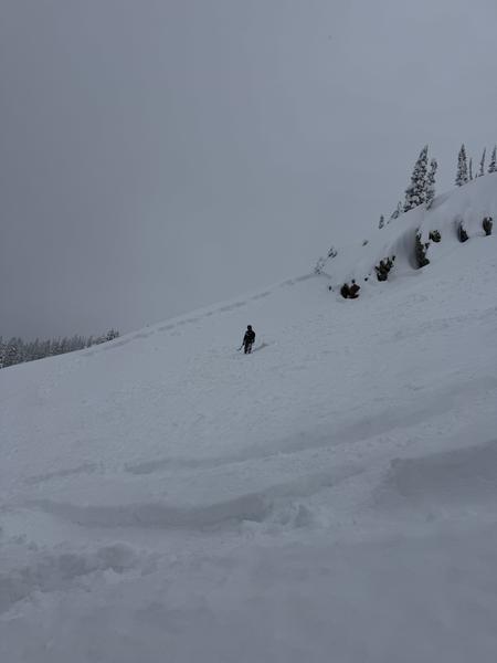
This morning, the avalanche danger is MODERATE for new snow soft slabs and dry-loose avalanches on all aspects. There is also a MODERATE danger of triggering a persistent weak-layer avalanche 2 to 5 feet deep that fails on the Dry January Layer of faceted snow.

With strong sunshine and cold snow, expect the snow surface on steep southerly aspects to become damp and wet by mid-morning. In these areas, the avalanche danger could quickly rise to CONSIDERABLE on steep sunlit slopes, where loose wet avalanches may become a significant problem and large enough to bury a person.

*This danger rating applies to areas that received more than 6 inches of new snow.

Low
Moderate
Considerable
High
Extreme
Learn how to read the forecast here
Special Announcements

Avalanche Trivia is back at Hopkins Brewing on March 8th, starting at 7 PM! Bring your friends and test them on their knowledge, while giving back to the UAC. See details HERE

Weather and Snow

Most of the Provo Range was largely skipped by this storm, with areas south of Tibble Fork Road picking up only a trace to 6 inches of snow (0.04–0.23" SWE). Farther north, snowfall increased significantly. Storm totals across much of the central Wasatch reached 1–3 feet (0.91–2.31" SWE), with Upper Little Cottonwood taking the lion’s share at 33" containing 1.91 inches of water. Toward Box Elder Peak and the Wasatch Back, totals were likely similar.

Clear skies greet the mountains this morning with cold temperatures ranging from 10°F to 20°F. North winds remain light along the upper elevation ridgelines, blowing 5–15 mph.

Today will bring plenty of sunshine as the storm continues to move out of the region. North winds will continue along the upper elevation ridgelines at 5–15 mph, with gusts into the 20s. This afternoon, expect skies to become partly cloudy as lingering moisture moves through the area.

Recent Avalanches

No observations or avalanches were reported in the Provo area. However, yesterday, many riders in the Cottonwoods reported dry-loose avalanches running on the slick crusts. One notable avalanche from Georges Bowl (pic below) was a new snow soft slab roughly 12" deep and up to 100' wide. The skier was caught in the slide but reported it wasn’t large enough to knock them over. Be sure to check out all observations HERE.

Avalanche Problem #1
Wet Snow
Type
Location
Likelihood
Size
Description

As the strong March sun hits the cold snow, expect a rapid transition from dry powder to damp and wet conditions. In steep solar terrain, wet-loose avalanches could entrain a surprising amount of snow and run fast and far on the slick crusts beneath. Once the snow surface becomes damp and you start seeing rollerballs or pinwheels, it’s time to move off steep south-facing slopes. There is some uncertainty here since 700 mb (10,000') temperatures remain cold, but the March sun is strong.

Also keep an eye out for a greenhouse effect later this afternoon as thin, high clouds move in, which could make the snow surface damp on all aspects—not just the sunny slopes.

*This avalanche problem will be less of a problem in areas that did not receive more than 6 inches of new snow.

Avalanche Problem #2
New Snow
Type
Location
Likelihood
Size
Description

New Snow: Roughly 1-3 feet of low-density snow sits over slick crusts on many aspects from our rain event last week. As a result, dry-loose avalanches (sluffs) are running fast and far and could be large enough to bury a rider. We can also expect new snow soft-slab avalanches that fail within the storm snow due to density changes or a poor bond at the old/new snow interface. Use test slopes, slope cuts, and shovel tilt tests to see how the new snow is behaving.

Wind Drifted Snow: In upper-elevation terrain, look for smooth, rounded pillows of wind-drifted snow on the lee sides of ridges, sub-ridges, and other terrain features. These drifts often appear chalky, hollow, or textured compared to the surrounding snow.

*This avalanche problem will be less of a problem in areas that did not receive more than 6 inches of new snow.

Avalanche Problem #3
Persistent Weak Layer
Type
Location
Likelihood
Size
Description

The Dry January Layer (DJL) of facets is buried 2–4 feet deep beneath a hard slab of settled snow and crusts. Activity on this layer has been quiet since February 26th, and tests suggest it’s becoming stubborn to trigger. However, if it fails, it could still produce a large and dangerous avalanche. Steep, shallow, rocky upper elevation slopes facing W–N–E remain the most likely trigger points. Avalanches in the new snow could also step down into this deeper weak layer. Human-triggered avalanches remain possible.

UAC Forecaster. Trent Meisenheimer summarizes the current snowpack structure. This video is from Wednesday, March 4, before the storm.

General Announcements

This information does not apply to developed ski areas or highways where avalanche control is normally done. This forecast is from the U.S.D.A. Forest Service, which is solely responsible for its content. This forecast describes general avalanche conditions and local variations always occur.