Forecast for the Provo Area Mountains

Bo Torrey
Issued by Bo Torrey on
Thursday morning, March 5, 2026

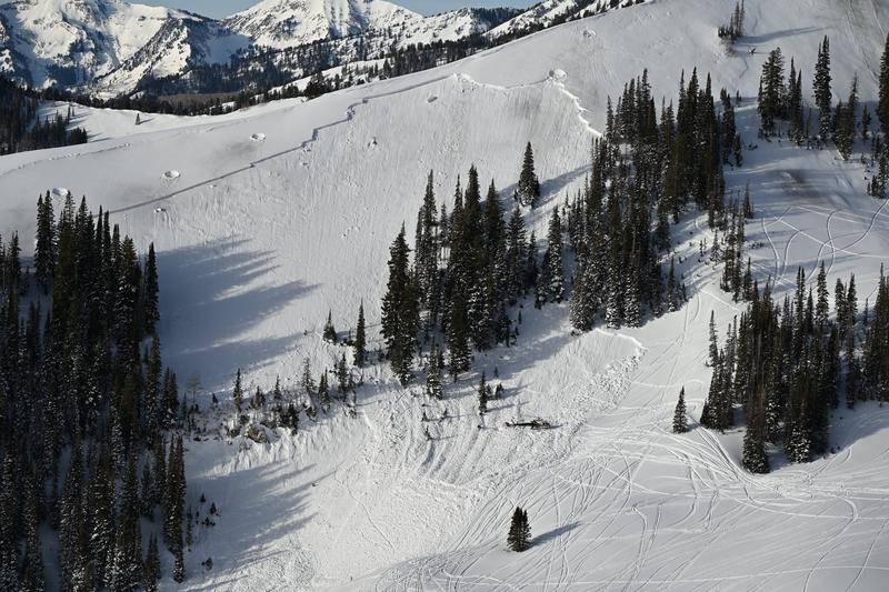
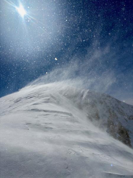
A MODERATE avalanche danger exists on mid- and upper-elevation slopes where fresh snow and strong winds are creating sensitive slabs. While the January weak layer is increasingly difficult to trigger, any resulting avalanche would be unsurvivable. Choose conservative terrain and avoid steep, wind-loaded slopes.

Expect the low-density storm snow to produce loose-dry avalanches. Sensitive soft slabs may develop late this afternoon if we see periods of intense precipitation.

Low
Moderate
Considerable
High
Extreme
Learn how to read the forecast here
Special Announcements

All four final avalanche accident reports (Caribou Basin, Butler Basin, Lake Mary Chutes, and Ant Knolls) have now been published. These are reports of four avalanche fatalities in five days, spanning February 18th to February 22nd. You can find them all HERE.

Photo: WCSAR

Thank you to everyone involved for sharing information. As with all avalanche accidents, we hope to learn something to prevent future accidents. Our deepest condolences go out to the families, friends, rescuers, and everyone affected by these tragic accidents.

Weather and Snow

Overnight, a cold front moved in. Temperatures dropped, snow began to fall, and winds shifted to the west.

This morning, light snow is falling. Temperatures are in the 20s °F. Winds are blowing out of the west-southwest 10-15 mph with gusts in the 30s along the high ridges.

Today, light snow continues this morning before tapering and becoming showery. Later this afternoon, another wave of moisture moves in. We could see another 2-4 inches of low-density snowfall accumulate by sunset. Temperatures remain cold, with daytime highs in the mid 20s °F. Winds blow from the west 15-25 mph with gusts into the 30s.

Snow and Water totals as of 6:00 AM

  • Provo Mountains: 1-2 inches of snow with 0.02-.1 inch of SWE.
Recent Avalanches

No avalanches were reported from Provo yesterday. UAC Forecaster, Trent Meisenheimer, and UAC Board member TJ Kolanko were out near Mill Canyon Peak. View their excellent observation and summary of the snowpack HERE.

Mill Canyon Peak avalanched wall to wall during the February 17-20 cycle. An more recent avalanche crown is seen, low in the trees, bottom right of the photo. Photo: Meisenheimer

Avalanche Problem #1
Wind Drifted Snow
Type
Location
Likelihood
Size
Description

Fresh snow and strong winds blowing from the west-northwest are creating sensitive, soft slabs at mid and upper-elevations. Slopes facing NE-E-S will be the most likely places to trigger fresh drifts, but look for and avoid any cross-loaded terrain features. Yesterday, strong winds blowing from the south created stiff drifts that are now buried and hidden beneath today's fresh snow. These booby-trap slabs are most likely to exist on upper elevation slopes facing NW-N-E and may be triggered further down slope and break above you.

Backcountry observers noted surface hoar and near-surface facets formed above a crust on north-facing aspects. This may lead to sensitive conditions, with avalanches that break wider-than-expected, and the potential to be triggered from a distance.

Any avalanche triggered on mid and upper elevation terrain has the potential to step down to a persistent weak layer, resulting in a very large, deadly, hard-slab avalanche.

Strong ridgetop winds yesterday in the upper White Pine drainage. Photo: Kelly

Avalanche Problem #2
Persistent Weak Layer
Type
Location
Likelihood
Size
Description

The DJL (Dry January Layer) of facets is buried 2–4 feet deep beneath a hard slab of settled snow and crusts. Avalanche activity on this layer has gone quiet since February 26th. In my last few days of fieldwork, the layer remained soft and weak but began showing signs of strengthening. Snowpack tests continue to show that the layer is very difficult to initiate; however, once a failure occurs, it still propagates across the column.

This is a low-probability, high-consequence scenario. While it may be difficult to trigger this avalanche, the resulting slide would be very large and likely unsurvivable. Uncertainty regarding this problem is growing as strong winds and snow begin to add stress to this layer.

For now, I recommend avoiding steep, rocky, upper-elevation slopes facing W-N-E where this problem is most likely to be triggered.

General Announcements

This information does not apply to developed ski areas or highways where avalanche control is normally done. This forecast is from the U.S.D.A. Forest Service, which is solely responsible for its content. This forecast describes general avalanche conditions and local variations always occur.