Two varieties of wet snow avalanches are currently at play:
Wet Loose avalanches are possible on all aspects where sustained snow exists. These avalanches will be long-running and can gouge down into the snowpack. With a superficial refreeze last night and continued unseasonably warm temperatures today, snow surfaces will become unsupportable, especially on solar slopes out of the wind zone. Based on recent field work, the time window for supportable snow is almost nonexistent, and by mid-morning, when the eggshell of a surface freeze softens, expect waist-deep bootpacking and trench-tracked skiing. When snow can no longer support a footstep, a ski, or a track - it’s time to consider heading home.

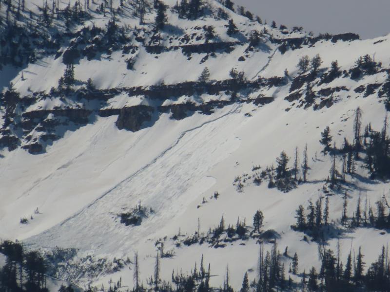
Natural Wet Loose avalanches on Cascade Peak (UDOT)
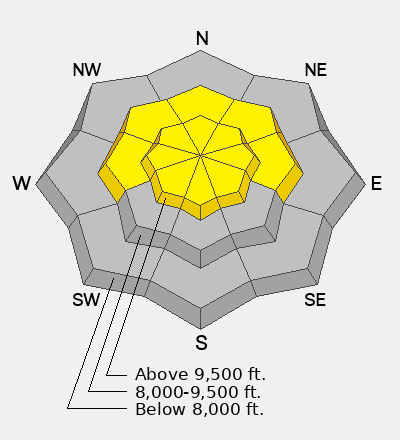
Wet Slab avalanches are also possible on the north half of the compass. The historic heatwave has had 10 days to move meltwater down through the snowpack. Weak snow and crusts that formed early in the season have been producing natural avalanches daily, and some are gouging down to the ground as glide avalanches. Though slightly cooler temperatures and higher winds may keep surfaces firm up high, problem layers deep in our water-saturated snowpack are unlikely to feel much of a change today.
Photo taken by UDOT avalanche forecasters showing recent wet slab activity in the Provo mountains.
Wet snow avalanches can carry a lot of force. As tragic as the skiing and riding are right now, it would be an even worse time to be caught in a slide. In other words, the juice has never been so not worth the squeeze.