Greatest Rain on Earth?!?: Forecaster Drew Hardesty penned a new essay about high-elevation rain and the warm-snow drought HERE.
Weak Snow: Today's Surface, Tomorrow's Avalanche Problem: Essay by UAC Director Paige Pagnucco HERE.
Currently, the skies are mostly clear. Temperatures are warm, with freezing levels around 9000 feet. This will create a shallow refreeze and a brief window of supportable travel on sunny slopes. Overnight, the wind blew from the SW at 5–15 mph, with gusts reaching into the 20's.
Today, we'll see mostly sunny skies, with daytime temperatures warming into the mid-40s °F. The wind continues to blow from the SW, at 10-20 mph.
Starting on Monday, we will see a change in the weather as snowfall returns. The initial waves of precipitation, from Monday to Wednesday, don't look like blockbusters, but they may be the first in a series. Stay tuned.
Conditions remain thin with difficult travel at the low and mid-elevations. I traveled up Box Elder via Tibble Fork on Thursday. You can view my report here.
No avalanches were reported from the backcountry yesterday. You can view recent observations here.
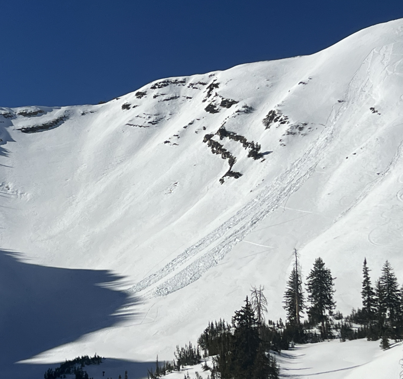
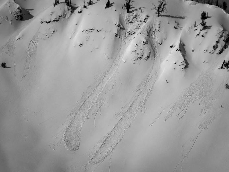
On Thursday, both natural and skier-triggered wet-loose avalanches were reported. These slides were triggered on steep, sunny slopes. Although small, the heavy and wet debris can make it difficult to escape if you're caught.