Forecast for the Ogden Area Mountains

Issued by Bo Torrey on
Thursday morning, March 19, 2026
Thursday morning, March 19, 2026
The avalanche danger is MODERATE and will quickly rise to CONSIDERABLE as daytime temperatures warm. Historic warm temperatures are sending large amounts of meltwater through the snowpack, which can destabilize layers and result in large, destructive natural avalanches.
Avoid travel on and below steep slopes, including avalanche runout zones and terrain traps.
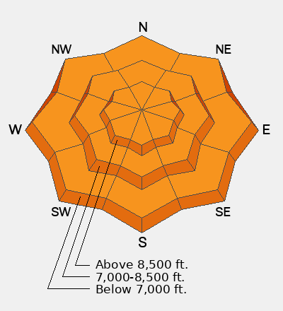
Low
Moderate
Considerable
High
Extreme
Learn how to read the forecast here