Forecast for the Ogden Area Mountains

Nikki Champion
Issued by Nikki Champion on
Sunday morning, March 1, 2026

Avalanche danger is MODERATE on all upper-elevation slopes and on mid-elevation slopes facing northwest through north to east. Avalanches may be large and destructive, breaking on a buried persistent weak layer 1 to 3+ feet deep and potentially hundreds of feet wide. Upper-elevation, thinner snow areas are most suspect.

As temperatures rise, wet snow avalanches may become possible, and danger could increase to MODERATE on lower-elevation and sun-exposed slopes throughout the day. Avoid steep terrain during the warmest part of the day and monitor conditions closely.

Evaluate snow and terrain carefully.

Low
Moderate
Considerable
High
Extreme
Learn how to read the forecast here
Special Announcements

The report for the Mary Main Bowl accident has been published. Thank you to everyone involved for sharing information. As with all avalanche accidents, we hope to learn something to prevent future accidents. Our deepest heartfelt condolences go out to the family, friends, rescuers, and everyone affected by this tragic accident.

A new blog is posted Riding the Ski Lift With My Daughter. This piece was written to us by longtime friend and backcountry skier John Climaco.

Weather and Snow

This morning, skies are generally overcast, and overnight temperatures dropped below 30 °F at only a few weather stations above 9000 feet. The remaining stations did not experience a true overnight refreeze. South to southeasterly winds are blowing at 5 to 10 mph, with gusts around 15 mph along mid-elevation ridges, and 10 to 20 mph with gusts into the 30s along the highest ridges.

Today, skies will be mostly cloudy with a chance of rain. Temperatures will rise into the upper 40s °F. Moderate south to southwest winds will continue, especially at upper elevations, with sustained speeds of 15 to 25 mph and gusts into the 30 mph range.

Looking ahead, a wetter storm moves in on Monday. Ahead of the cold front it will stay warm with southwest winds, keeping snow levels high around 8500 feet. The front passes Monday afternoon, winds shift northwest, and snow levels drop to about 6500 feet by Tuesday morning, so expect heavy, dense snow first, followed by lighter snow. Forecast models disagree on how long moisture will linger into Tuesday, which is why snowfall totals remain uncertain.

Recent Avalanches

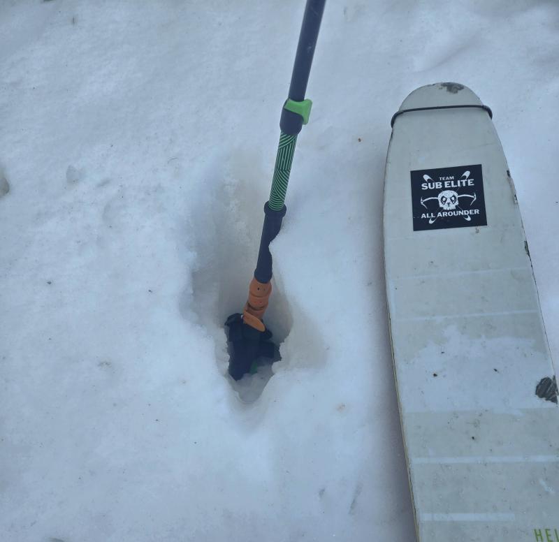
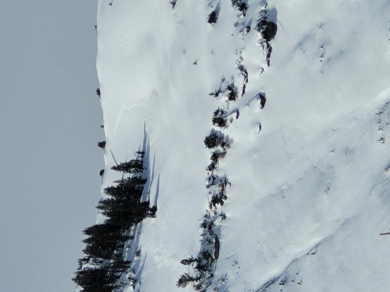
There were no reported avalanches in the Ogden backcountry yesterday, but multiple observations have come in of avalanches that occurred earlier in the week, likely during periods of rain and heavier precipitation. Find all the recent Ogden avalanches HERE.

Example of a D2 Wet Slab that occurred near the Ben Lomond Headwall - E - 9200 (C. Vigil)

Though the number of avalanches reported has slowed down, we can't forget that four people have been killed in separate avalanche accidents in the past ten days.

  • Wednesday 2/18 Ant Knolls, Wasatch Back Fatality — Snowmobiler. Final report HERE.
  • Thursday 2/19 Rock Garden, BCC (Brighton Backcountry) Fatality — 11-year-old skier. Preliminary report HERE.
  • Saturday 2/21 Butler Basin, BCC - Fatality — Backcountry skier. Preliminary report HERE.
  • Sunday 2/22 Caribou Basin, Wasatch Back Fatality — Snowbiker. Preliminary report HERE.

All of these accidents involved slab avalanches 2 to 3 feet thick and up to 500 feet wide, failing on weak faceted snow, our January Dry Layer (JDL).

Avalanche Problem #1
Persistent Weak Layer
Type
Location
Likelihood
Size
Description

The DJL (Dry January Layer) is now buried 1 to 3 feet beneath the surface and has been responsible for four avalanche fatalities, several accidents, and more than 60 reported avalanches.

Over the past few days, fewer obvious signs of instability have appeared during backcountry travel and in snowpits, suggesting the snowpack is gradually gaining strength. In many areas, the Ogden mountains received rain all the way to the summits, creating many crust interfaces, and the facets appear to have absorbed most of the stress during both loading events, likely requiring another large load to see activity increase again. That said, we are only a few days past the last significant loading event, and uncertainty remains, especially given the poor snowpack structure and spatial variability across the range.

The most suspect areas are higher-elevation, thinner snowpack zones where the facets do not seem as wet and as many complex crust interfaces do not exist. Continue to pay attention, evaluate snow and terrain carefully, and travel conservatively in the backcountry.

Semi-supportable crust at the surface - N aspect - near 9000' from my field day yesterday near Snowbasin

Avalanche Problem #2
Wet Snow
Type
Location
Likelihood
Size
Description

Previous rain on snow and warm temperatures have created a saturated, unsupportable snowpack at mid and low elevations.

As daytime temperatures rise and the surface crust softens, wet snow avalanches may be triggered.

A photo from Derek's observation from Ben Lomond showing a "moose foot pen", demonstrating how saturated the snowpack is at many elevations.

Avalanche Problem #3
Wind Drifted Snow
Type
Location
Likelihood
Size
Description

Sustained strong westerly winds continue to create thick, stiff slabs and large cornices along upper-elevation ridges. These slabs may be difficult to trigger but could break above you and carry into lower-angle slopes.

Watch for signs of wind-drifted snow, such as round, pillow-shaped drifts, and avoid those slopes.

General Announcements

This information does not apply to developed ski areas or highways where avalanche control is normally done. This forecast is from the U.S.D.A. Forest Service, which is solely responsible for its content. This forecast describes general avalanche conditions and local variations always occur.