Forecast for the Moab Area Mountains

Eric Trenbeath
Issued by Eric Trenbeath on
Tuesday morning, January 27, 2026

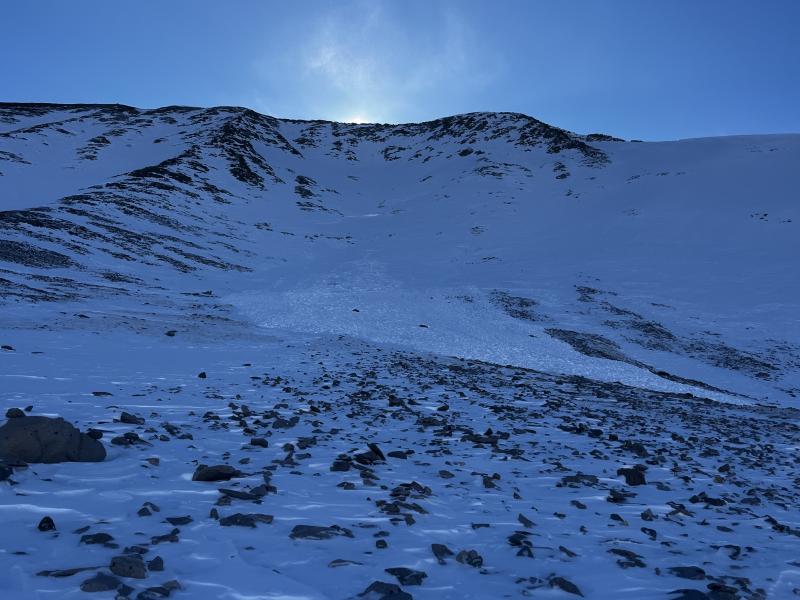
A MODERATE avalanche danger exists on steep slopes near and above treeline that face W-N-E and on SE aspects above treeline. Human triggered avalanches failing on a persistent weak layer are possible. The danger is most acute on steep wind drifted slopes at and above treeline that face N-NE-E. In these areas, dangerous hard slab avalanches stepping down deeper into the snowpack are possible. Avoiding slopes steeper than 30 degrees is the only way to avoid the problem.

Isolated, unstable slabs of wind drifted snow may still be found in the high country. Avoid steep slopes with recent deposits of wind drifted snow. Triggered wind slabs have the potential to step down into buried persistent weak layers causing a deeper and much more dangerous avalanche.

Most south facing slopes have generally LOW danger.

Low
Moderate
Considerable
High
Extreme
Learn how to read the forecast here
Special Announcements

Geyser Pass Road Conditions: Grand County will be plowing this morning and the road will be closed while work is in progress. Expect an opening likely between 11:00 and 12:00.

Grooming: Trails have seen a lot of traffic and are not freshly groomed.

We are looking to reschedule our Moab Backcountry 101 Class to February 20, 21 in the hopes that we will have more snow. Click here for information and registration. Moab and Monticello locals can use the discount code MOAB-LOCAL for a 10% discount.

Weather and Snow

24 Hour Snow: 0" 72 Hour Snow: 0" Season Total Snow: 44" Depth at Gold Basin: 29"

Winds on Pre-Laurel Peak: NW 10-15 Temp: 14°F

Weather

A fast moving shortwave passing by to the north is responsible for cloudy skies this morning. Look for gradual clearing today with mostly light winds blowing from the west northwest. High temperatures will be in the upper 20's at 10,000 feet. Another system clips by to the north on Wednesday bringing partly sunny skies but things remain dry for us through the week.

General Conditions

In spite of our bout with northwest winds on Sunday, soft snow can still be found on sheltered slopes near and below treeline on all aspects. Brian Hays was up in Gold Basin yesterday and he found good turning on a southerly aspect. He also reported finding isolated slabs of wind drifted snow along upper elevation ridge crests and overall poor snowpack structure. Read his observation here. I took a trip up around the wind ravaged landscape at the base of Mount Mellenthin where I found breakable wind crust, sastrugi, and exposed talus as well as this avalanche. Surprisingly, however, as soon as I dropped into slightly more sheltered terrain, the snow instantly became soft. Our recent 8-10 inches of low density snow has not formed a cohesive slab outside of wind affected areas and beneath it, the snowpack is entirely faceted through to the ground. More on this weak structure below.

A picture is worth a thousand words. Some wind affect is visible in the high country but not near the extent to what I found up around Mount Mellenthin. There is evidence in the photo that the avalanche reported on Mount Tukno on Sunday, started much higher. The lookers right high shoulder is the perfect fetch for wind deposited snow from northwest winds. The avalanche appears to have initiated there as flanks are visible. Brian Hays photo.

See more recent observations here.

Snowpack and Weather Data

Gold Basin SNOTEL site (10,000')
SNOTEL site near Geyser Pass Winter Trailhead (9600')
Wind Station on Pre-Laurel Peak (11,400')
NWS forecast for the La Sal Mountains.
Recent Avalanches
In my travels under the north face of Mount Mellenthin yesterday, I ran across this natural, hard slab release that likely ran during the wind event on Sunday before drifting back in. Take note of the overall lack of snowcover on this massive face and how the debris covers exposed talus. With our current snowpack, it doesn't take a lot of cover or connectivity to produce a dangerous avalanche.
Several other avalanches were reported on Sunday. Click here for the complete avalanche database.
Avalanche Problem #1
Persistent Weak Layer
Type
Location
Likelihood
Size
Description

Our current snowpack is rife with persistent weak layers and in many areas, it's faceted through to the ground. The most prominent weak layers of concern are 1) a layer of near surface facets beneath the most recent storm snow, and 2) faceted snow beneath the Christmas Rain Crust (CRC). Weak snow alone does not constitute a problem, however, we need to have a slab on top of the weak layer. You are most likely to find a slab over top of a weak layer in wind affected terrain near and above treeline on slopes facing N-NE-E. Outlying areas may include slopes facing W, NW, and SE. Slabs triggered in the upper portion of the snowpack have the potential to step down beneath the CRC causing a deeper and much more dangerous avalanche. Without obvious signs of instability, these dangerous avalanches are difficult to predict and the only sure way to avoid them is to avoid slopes steeper than 30 degrees. For more on this structure, see the video below.

Avalanche Problem #2
Wind Drifted Snow
Type
Location
Likelihood
Size
Description

Sustained strong winds from the northwest have blown and drifted snow on to slopes facing the east half of the compass. Most of these have stabilized but remain on the lookout for recent drifts on the leeward sides of ridge crests and terrain features in exposed terrain. Fresh drifts are often recognizable by their smooth, rounded appearance and they may sound or feel hollow underneath. The most dangerous slopes will be those facing N-NE-E. In these areas, human triggered wind slab avalanches may step down to a buried persistent weak layer causing a deeper and much more dangerous avalanche.

Additional Information
General Announcements
This forecast is from the U.S.D.A. Forest Service, which is solely responsible for its content. This forecast describes general avalanche conditions and local variations always occur.