Forecast for the Moab Area Mountains

Eric Trenbeath
Issued by Eric Trenbeath on
Saturday morning, January 24, 2026

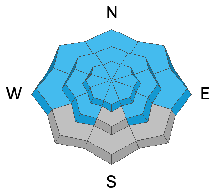
New snow and wind have elevated the avalanche danger to CONSIDERABLE on steep slopes near and above tree line that face N-NE-E. In these areas, human triggered avalanches involving soft slabs of recent and wind drifted snow are likely. In some cases, triggered slabs within the new snow may step down into a buried persistent weak layer causing a deeper and much more dangerous avalanche. This is also possible on slopes facing NW. Slopes steeper than 30 degrees should be avoided in these areas.

A MODERATE danger can be found on most all other aspects and elevations that have more than about 8-10 inches of new snow. Look for signs of instability such as cracking in the snow surface and avoid areas that have smooth, rounded deposits of wind drifted snow. Loose snow avalanches running on either slick hard surfaces or loose, weak facets may also be possible. Utilize test slopes to see how the new snow is behaving before committing to steeper terrain.

Low
Moderate
Considerable
High
Extreme
Learn how to read the forecast here
Special Announcements

Geyser Pass Road Conditions: The road will not be plowed. Expect several inches of new snow with an underlying surface of ice up high. 8 inches has fallen at the parking lot. 4x4 required.

Grooming: LUNA will be up grooming trails this morning.

We are looking to reschedule our Moab Backcountry 101 Class to February 20, 21 in the hopes that we will have more snow. Click here for information and registration. Moab and Monticello locals can use the discount code MOAB-LOCAL for a 10% discount.

Weather and Snow

24 Hour Snow: 8" 72 Hour Snow: 8" Season Total Snow: 44" Depth at Gold Basin: 30"

Winds on Pre-Laurel Peak: NW 10-15 Temp: 15°F

Weather

The storm continues to churn it's way through Southern Colorado. A lingering chance for snow remains for the La Sals, but winds have shifted to the northwest which generally signifies the end for us. We should see gradual clearing today with winds shifting to more westerly. They'll blow in the 10-15 mph range with gusts as high as 30 mph along ridge tops. High temperatures at 10,000 feet will creep into the upper teens. Under clear skies, temperatures will crater into the single digits tonight. Sunday looks cold, clear, and beautiful.

General Conditions

It sure was great to be out in a snow storm yesterday. Light to moderate snow fell most of the afternoon and by 4:00 PM we had 4-6 inches of new snow. Snowfall continued until around midnight bringing us up to 8 inches in Gold Basin and possibly as much as a foot up high. Needless to say, this will improve conditions greatly but it's still low tide out there. Winds blowing from the southwest weren't too out of hand but they blew enough to move snow around at upper elevations, particularly during a three hour period mid-storm when they blew in the 20-30 mph range along ridge tops.

The new snow has fallen on a variety of surfaces from slick and hard, to weak and faceted, and everything in between and I don't expect it will bond particularly well to any of them. In addition, the underlying snowpack is loose, weak, and faceted. For more on that, read my observation.

See recent observations here.

Snowpack and Weather Data

Gold Basin SNOTEL site (10,000')
SNOTEL site near Geyser Pass Winter Trailhead (9600')
Wind Station on Pre-Laurel Peak (11,400')
NWS forecast for the La Sal Mountains.
Recent Avalanches
Click here for the complete avalanche database.
Avalanche Problem #1
New Snow
Type
Location
Likelihood
Size
Description

Avalanches involving the new snow will be possible on nearly all aspects and elevations today with the exception of southerly aspects that were nearly bare prior to the storm. The danger will be most acute on steep slopes near and above tree line that face N-NE-E. In these areas, preferential wind loading has likely drifted snow into sensitive soft slabs a foot or more deep. Human triggered avalanches within the new snow in these areas also have the potential to step down into a buried persistent weak layer causing a deeper and much more dangerous avalanche. Avoid slopes steeper than 30 degrees that face N-NE-E.

On all other aspects pay attention to how the new snow is behaving before committing to steeper terrain. Look for signs of "slabiness" such as blocks of snow between your skis or cracking in the snow surface, and avoid areas with recent deposits of wind drifted snow. In areas where there is no slab, you may still be able to trigger loose snow avalanches on very steep terrain. Utilize test slopes or make "slope cuts" before you commit. Practice safe travel techniques such as skiing or riding slopes one at a time and move to a safe location at the bottom.

Avalanche Problem #2
Persistent Weak Layer
Type
Location
Likelihood
Size
Description

Poor snowpack structure and a persistent weak layer problem exists on slopes near and above tree line that face NW-N-NE-E. In these areas, stiff slabs of wind drifted snow overly a weak and faceted snowpack with the primary layer of concern sitting just beneath the Christmas Rain Crust (CRC). The odds of triggering a large avalanche failing on this weak layer have decreased since the large, snowmobile triggered avalanche on January 9, but they haven't gone away completely. The recent addition of new and wind drifted snow has kept the possibility alive, if not bumped it back up. The only safe strategy at this time is to avoid slopes steeper than 30 degrees in these areas.

Additional Information
General Announcements
This forecast is from the U.S.D.A. Forest Service, which is solely responsible for its content. This forecast describes general avalanche conditions and local variations always occur.