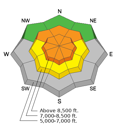
There is very little snow left below about 7000 feet in elevation, but in higher elevations, avalanche conditions are complex, with several avalanche problems. People are likely to trigger wind slab avalanches today on recently drifted northwest through southeast-facing slopes at upper elevations, natural loose wet avalanches are possible in sunny terrain, and there's still a good chance of dangerous hard slab avalanches that propagate widely, failing on a widespread, persistent weak layer buried up to three feet deep.
Monday's storm overproduced; about a foot of very wet new snow accumulated on upper-elevation slopes, and Moderate winds drifted the new snow right into avalanche starting zones at upper elevations. The storm continued to build a strengthening slab layer overloading slopes with poor snow structure and fragile, buried persistent weak layers. Yesterday in the Central Bear River Range, we observed numerous natural loose wet avalanches on sunny slopes entraining the wet new snow, and some of these were pretty big. We found nice powder riding, even in the afternoon, on north-facing slopes. In sunny meadows, the surfy snow made for fun riding, and we stayed off and well out from under the steep hills (slopes steeper than 30 degrees).
The UAC Card Canyon weather station at 8700 feet reports 26°F with 62 inches of total snow. The Tony Grove Snotel, located at 8400 feet, reports 10 inches of heavy new snow from Monday and Monday night, containing 1.7 inches of SWE (snow water equivalent). It's 28°F, and there's 74 inches of total snow. At 9700 feet on Logan Peak, winds are blowing from the south-southwest at 25 to 30 mph. It's 22°F on Paris Peak at 9500 feet, and the wind, from the south-southwest, is blowing 18 to 22 mph.
It will be mostly sunny in the mountains today, with a high temperature near 40°F at 8500 feet. Expect increasing clouds and winds out of the south-southwest as the next storm system moves into the area, with snow possible in the evening. The National Weather Service has issued a Winter Storm Watch for our area, beginning late tonight and extending through Friday afternoon. This time, it looks like the central Utah mountains will do better, and accumulations in the Bear River Range will be fairly light, with 3 to 7 inches of accumulation possible by Thursday. Snow is also likely on Friday, with a couple more inches possible.
In the Wasatch Mountains, avalanches have killed four people recently in separate accidents. We've released our final report on last Sunday's tragic Caribou Basin Accident (2-22-26). Our heartfelt condolences go out to the affected family, friends, rescuers, and community members. Thank you to everyone involved for sharing information.
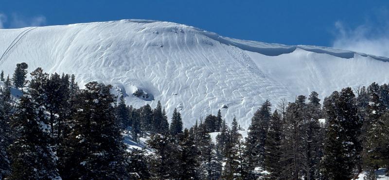
*Over the weekend in the Logan Zone, riders triggered large and dangerous hard slab avalanches. These hard slab avalanches of previously wind-drifted snow are exactly the type of avalanche you could trigger today:
- An observer's crew came across and searched a freshly triggered avalanche on Friday, February 27, near the Naomi Trail on an east-facing slope around 8900'.
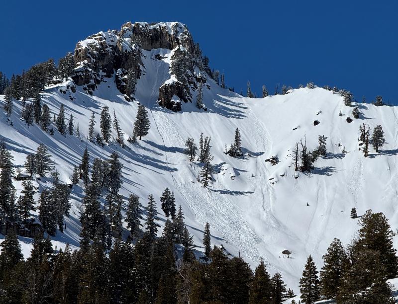
- On Sunday, March 1, a rider was caught and carried, and their sled rolled by a 3-foot deep and 50-foot wide hard slab avalanche under a cliff band on a north-facing slope at around 8700 feet in elevation. The video below includes both avalanches
Huge thanks to the riders that shared information, photos, and videos. This information may well save lives.... For all observations and avalanche activity in the Logan Zone, go HERE.