Forecast for the Logan Area Mountains

McKinley Talty
Issued by McKinley Talty on
Tuesday morning, March 17, 2026

The avalanche danger is MODERATE. Warming temperatures will elevate avalanche conditions on sunny slopes, and small wet avalanches are possible. Avoid terrain traps such as gullies and cliffs, where even a small avalanche can have serious consequences.

Low
Moderate
Considerable
High
Extreme
Learn how to read the forecast here
Special Announcements

Spring Campaign and Spring Auction - Each spring, we ask for your continued financial support to fund our forecasting and education programs. We hope you will consider supporting our mission by checking out our campaign and auction, live and available HERE.

Weather and Snow

Last night's poor refreeze and gusty winds may keep mid and upper-elevation northwest through northeast facing slopes cool, but warming temperatures could still lead to saturation. Northwest winds will continue to blow at 30-35 mph today, while daytime temperatures are expected to be 15°F warmer than yesterday, reaching the mid 50s°F at trailheads this afternoon. Avalanche danger will increase through the week as temperatures continue to rise.

Today, loose wet avalanches are possible on slopes exposed to the sun. Active "roller-balls" indicate the snowpack is losing strength and are a clear sign to move to shadier or lower-angle terrain. Additionally, sinking into the snow above your ankles indicates the upper snowpack is quickly losing strength, and is another clue to move to shadier slopes. Snow has completely melted off most low-elevation slopes in the Logan zone, and trailhead coverage will take a significant hit this week.

The UAC Card Canyon weather station at 8700 feet reports 33°F and 56.5 inches of total snow. It's 38°F at the Tony Grove Snotel at 8400', with 67 inches of total snow. At 9700 feet on Logan Peak, winds are blowing from the northwest at 30 mph, gusting to 40 mph. On Paris Peak at 9500 feet, winds are blowing from the west-southwest at 30 mph, with gusts up to 45 mph, and it's 28°F.

Clear skies this morning will transition to partly cloudy conditions this afternoon. Northwest winds will continue to blow at 35 mph, gusting to 45 mph, helping to limit melt-off in upper-elevation terrain. Trailhead temperatures will climb to the mid 50s°F this afternoon, while temperatures at 10,000 feet will rise to around 40°F. Tonight, temperatures will remain above freezing, and the avalanche danger will continue to increase day by day through the week.

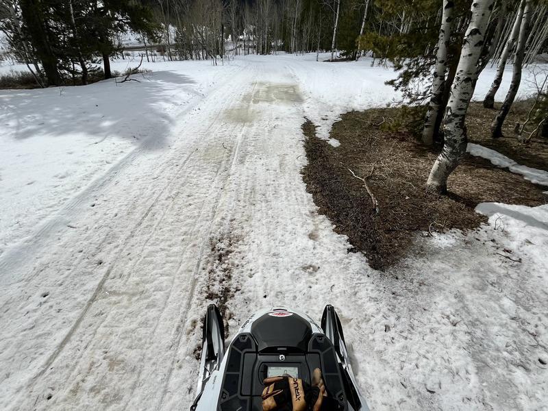
Trailhead coverage is melting quickly and may be absent of snow by the end of the week.

Recent Avalanches

No new avalanches were reported in the Logan area mountains.

Find observations from the Logan zone and from across the state HERE.

Avalanche Problem #1
Wet Snow
Type
Location
Likelihood
Size
Description

Today's warm temperatures will increase the danger of wet avalanches. While last night's winds may have helped refreeze some snow surfaces, the snow will soften up much more quickly today than it did yesterday. Wet avalanches are possible on steep slopes and will only become more prevalent through the week. Roller balls and pinwheels are definite signs of rising danger.

  • Small, loose wet avalanches will begin to occur today and will grow in size as the snowpack continues to warm up. While today's avalanches may not be big enough to bury you, they will be strong enough to push you over rocks/cliffs or into trees.
  • Pay attention to terrain traps below you, such as gullies or cliffs, where even a small avalanche can have consequences.
  • If you're sinking into the snow above your ankles, or you're seeing active roller balls, head to shadier or lower-angle terrain.
Additional Information
  • Travel with a partner, and cross or ride slopes steeper than 30 degrees one at a time while the rest of your group watches from a safe spot.
  • Ensure that everyone in the group has avalanche rescue equipment (a transceiver, probe, and shovel) and knows how to use it.

-----------------------------------------------------------------------------------------------------------------------------------------------------------------

For all questions on forecasts, education, Know Before You Go, events, online purchases, or fundraising, call 801-365-5522.

Did you know the UAC hosts a podcast? Episode 2 of Season IX is just out - AI, Machine Learning, and the Value of Expert Intuition at the Utah Avalanche Center.

Are you interested in learning more about avalanches? Visit our education page for details on all our classes.

For more information, visit the UAC weather page here: UAC Weather Page For Logan-specific weather, go here: Logan Mountain Weather

-Remember, the information you provide could save lives, especially if you see or trigger an avalanche. To report an avalanche or submit an observation from the backcountry, go HERE

-Receive forecast region-specific text message alerts to receive messages about changing avalanche conditions, watches, and warnings. Sign up and update your preferences HERE

This forecast is from the U.S.D.A. Forest Service, which is solely responsible for its content. This forecast describes general avalanche conditions and local variations always occur.

General Announcements
This information does not apply to developed ski areas or highways where avalanche control is normally done. This forecast is from the U.S.D.A. Forest Service, which is solely responsible for its content. This forecast describes general avalanche conditions and local variations always occur.