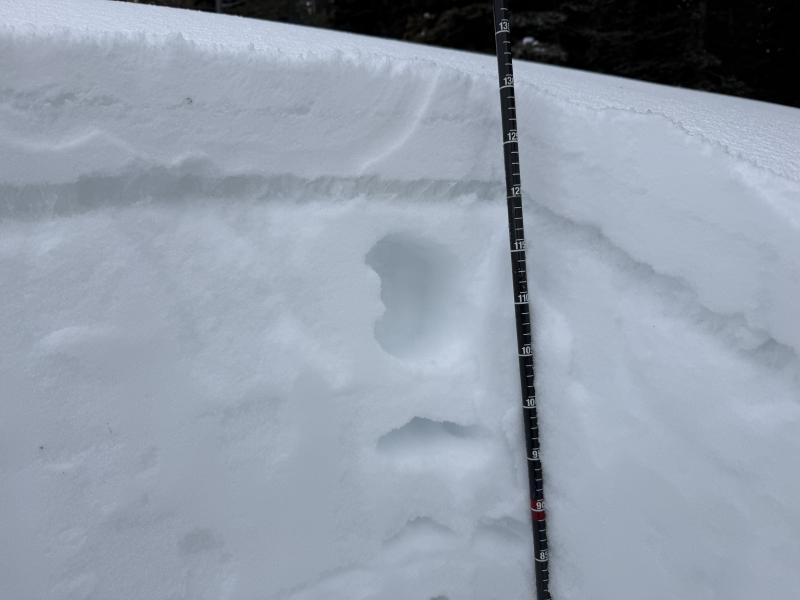
Heightened avalanche conditions are found in drifted terrain at upper elevations and on mid-elevation slopes facing northwest through east that are steeper than 30 degrees. Terrain below about 7000 feet has only very shallow snow cover, with muddy trails and sunny slopes facing southeast through west completely bare of snow. We've been "nickel and dimed" so far this week, with only a few inches of new snow up high, but a few inches really improved the riding and refreshed the winter mountain views. After a dry few weeks, the snow on the ground is quite variable, with plenty of old tracks, wind, and sun crusts of differing thickness, sastrugi, and hard wind drifts in exposed terrain, areas with shallowly buried, cornflake-like surface hoar, and soft and fairly deep, recrystallized powder (or faceted surface snow) in sheltered northerly terrain. Here is a new video about different types of weak snow that develop during periods of benign weather and can become persistent weak layers when buried by future snows.
The wind diminished significantly after yesterday's frontal passage, and it is more like a light breeze this morning on the summit of Logan Peak (9700 feet). It's currently blowing 10 to 17 mph from the west. At 8700 feet, 3 inches of new snow accumulated at the UAC Card Canyon weather station, where it's 28°F, and there's 44 inches of total snow. The Tony Grove Snotel, located at 8400 feet, reports four inches of new snow from yesterday's storm. It's 30°F, and there's 55 inches of total snow. It's 24°F on Paris Peak at 9500 feet, and the wind sensor appears to be rimed, reading 0 mph as of 0200.
Rain in the valley this morning means a bit more snow falling in the mountains, and radar shows a decent band of precipitation tracking over the Bear River Range. The National Weather Service has continued a Winter Weather Advisory for the Logan Zone through this evening. Snow is likely in the Bear River Range today, with up to 3 inches of accumulation possible up high. Expect high temperatures at 8500' around 33°F and light winds from the west. Tomorrow, skies will be mostly sunny in the mountains, with a high temperature of around 32°F and a moderate breeze from the west. The weather looks fairly tame for the weekend, with clouds building on Sunday before the next round of storminess moves over the area on Monday. It looks like an active week ahead, with periods of heavy snow beginning on Monday night and continuing through at least the first half of the week.
There was some natural wet activity last week, but no avalanches were reported locally since then. For all observations and avalanche activity in the Logan zone, go HERE